
“Blizzards, we had fog — we had to sleep in the helicopter, on the sea ice one night, because we couldn’t fly anywhere,” Markus Dyck, senior polar bear biologist with the GN, told Nunatsiaq News Sept. 5.”
Fog was the theme of polar bear research this summer in Queen Maud Gulf, otherwise known as the M’Clintock Channel polar bear subpopulation region.
The ice has been heavy in that region as well, according to a the National Snow and Ice Data Center (NSIDC) and reported yesterday in another story (“Heavy pack ice in NW Passage ice creates tough conditions this year: Pack ice clogs Queen Maud Gulf“).
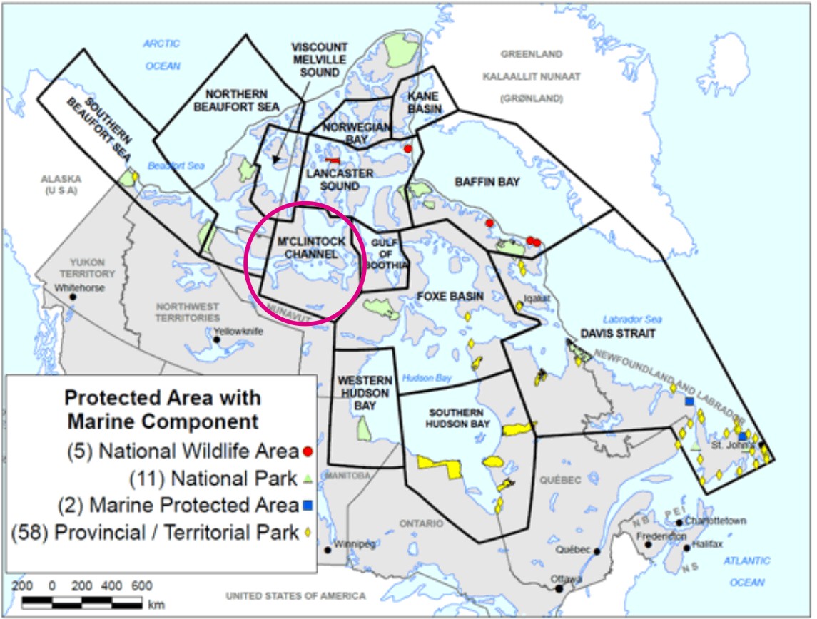
For maps showing where M’Clintock Channel and Queen Maud Gulf actually are, see the maps — and more quotes — below.
From the M’Clintock polar bear survey story (NunatsiaqOnline September 9 2014):
“The first part of a survey to estimate Nunavut’s M’Clintock Channel polar bear sub-population wrapped up earlier this summer — but not without some adventure and lots of bad weather.
So, now it’s up to the Nunavut Management Review Board to decide what the quota for 2014 should be for the M’Clintock Channel, which separates the Prince of Wales Island and Victoria Island in Nunavut’s Kitikmeot region.
During the 2014 season, the Government of Nunavut’s survey team experienced some terrible weather.
“Blizzards, we had fog — we had to sleep in the helicopter, on the sea ice one night, because we couldn’t fly anywhere,” Markus Dyck, senior polar bear biologist with the GN, told Nunatsiaq News Sept. 5.
Dyck said he had planned to start the population survey in mid-April but the helicopter, which was stationed up in the High Arctic, couldn’t fly down until early May because of bad weather.
“The helicopter tried and tried and tried [to fly south],” Dyck said. “Usually after an hour, they had to turn around because it was too foggy, or there was freezing rain, or a blizzard.”
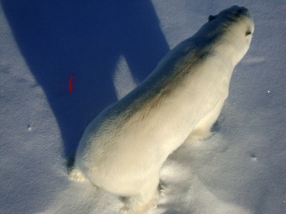
Still, Dyck, who had expected some bad weather when he planned the survey, was able to cover 75 per cent of the survey area. With the help of guides from local hunting and trapping organizations from a number of Kitikmeot communities, the surveyors encountered over 150 polar bears.
A relatively new non-invasive method of tagging polar bears was used, called biopsy darting. This method, first used in 2011, uses a low-flying helicopter. When a polar bear is spotted, the helicopter shoots dart, which quickly falls out.
“The dart hits the [polar] bear in the bum, bounces out, and what you have is a tiny piece of skin which is the size of a lentil,” Dyck said.
Surveyors collected skin and tissue samples of 134 bears, Dyck said.
Researchers are currently analyzing these samples to identify and log individual bears.
“Before, you had to identify individual bears by using ear tags or tattoos,” Dyck said.
As for the M’Clintock Channel, the size of its polar bear population has been under debate recently.
…
… Dyck said until the biopsy darting survey is done —planned for two more seasons — nobody really knows how many bears are in the M’Clintock population.
“The first real estimate…doesn’t happen until after the second field season,” Dyck said.
Environment Canada’s current estimate of 284 polar bears of the M’Clintock population is based on a survey done between 1998 and 2000, he added.” [my bold]
Read the whole story here.
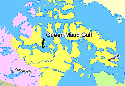
Note that the “M’Clintock Channel” polar bear subpopulation region (see previous posts here and here for some background) encompasses Queen Maud Gulf (map below, from Wikipedia), which was also in the news regarding its heavy ice conditions this summer.
From that story:
“Icebreakers and cruise ships travelling through the Northwest Passage encountered rough sailing conditions this past week: heavy ice closed the Queen Maud Gulf between the northern coast of the mainland and the southeastern corner of Victoria Island in Nunavut.
While the rate of ice loss during August in the Arctic Ocean overall in 2014 was near average, the Northwest Passage continued to be clogged with ice and was unlikely to open, the National Snow and Ice Data Centre said in its most recent Arctic ice report.
That’s because weather patterns are pushing more chunks of polar pack ice into the Northwest Passage than in 2007, 2008, 2010 and 2011.
But this, as of the end of August 2014, ice-clogged areas in the passage were tracking above the 1981 to 2010 average, said the Colorado-based NSIDC, which bases its reports on satellite information.
The heavy ice conditions come as no surprise to crew and passengers on board the Austral.
The French-owned mega-yacht with 132 cabins, on a 22-day, $16,000-minimum per person-plus voyage from Kangerlussuaq, Greenland to Anadyr, Russia, was stopped in its tracks last week in the Queen Maud Gulf.
The yacht was due into Cambridge Bay on Sept. 6.
But the leader of the cruise wrote Cambridge Bay’s cruise ship organizer Vicki Aitaok Sept. 5 that the ship had to cancel its visit.
“We have a big problem for our stop in Cambridge Bay!
The captain of the ice breaker Pierre Radisson (who open the ice for us), just advise us that he don’t want to continue the convoy during the night.
That means that now we are stopped in middle of the Queen Maud Gulf in middle of sea ice,” read the email posted by Aitaok on Cambridge Bay’s Facebook news page early Sept. 6. [my bold]
Read the rest of the sea ice story here.


You must be logged in to post a comment.