
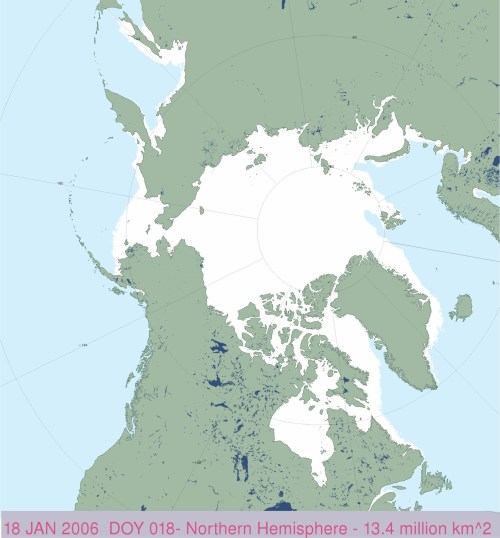
Sea ice charts for 18 January from NSIDC Masie show exactly as much sea ice in 2017 as there was back in 2006 – 13.4 mkm2.

Masie image below from 2006 (enlarged and cropped from archived version and label re-inserted) shows the distribution of ice was slightly different than this year (less in Baffin Bay/Davis Strait/Labrador Sea, more in the Barents and Bering Seas):
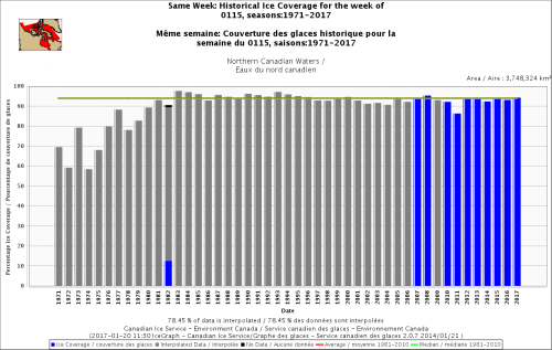
Considering only Canada (where 2/3 of the world’s polar bears live), Canadian Ice Service comparative graphs going back to 1971 show average amounts of ice existed the week of 15 January 2017, but considerably more than the estimates for the 1970s (odd that we never hear about that):
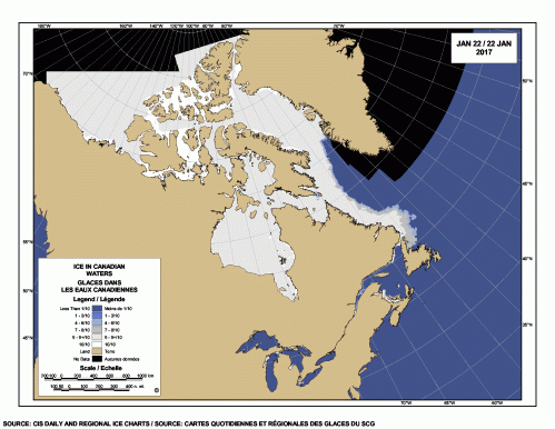
The CIS charts show the wide swath of ice off Labarador that’s slowly descending toward Newfoundland:

And the ice cover today (22 January 2017):
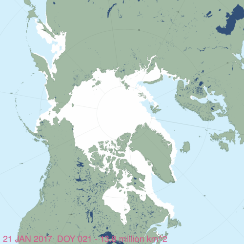
And Masie for 21 January 2017:


You must be logged in to post a comment.