
US National Snow and Ice Data Center says the Arctic maximum extent for this winter peaked at 14.88 mkm2 on 25 February, but in fact this amount of ice coverage lasted for at least two weeks (22 February – 8 March), with very slight variation. Just a little something they all left out of their announcements, for some reason.

Here are the NSIDC maps I saved to my own archive:


NSIDC scientists calculate an average to two decimal places in order to arrive at a single peak date.
However, that doesn’t negate the fact that sea ice covered between 14.8 and 15.0 mkm2 of the Arctic for at least two weeks until the 7th or 8th of March, and that’s what is biologically significant. Keep in mind that for long-term comparative (climatological) purposes, the average extent for the entire month of March is used (see graph below), not the peak extent, and we won’t know that until early April.

From the NSIDC report (22 March 2022):
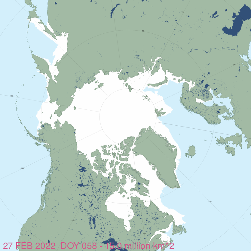
On February 25, 2022, Arctic sea ice likely reached its maximum extent for the year, at 14.88 million square kilometers (5.75 million square miles), the tenth lowest extent in the satellite record. [See their Table 1, below] This year’s maximum extent is 770,000 square kilometers (297,000 square miles) below the 1981 to 2010 average maximum of 15.65 million square kilometers (6.04 million square miles) and 470,000 square kilometers (182,000 square miles) above the lowest maximum of 14.41 million square kilometers (5.56 million square miles) set on March 7, 2017. Prior to 2019, the four lowest maximum extents occurred from 2015 to 2018.
The date of the maximum this year, February 25, was fifteen days earlier than the 1981 to 2010 average date of March 12. Only two years had an earlier maximum, 1987 and 1996, both on February 24. This year is the second earliest date on the satellite record, tying with 2015, which also reached its maximum extent on February 25.
The ice growth season ended with near average sea ice extent in the Bering Sea, above average in Baffin Bay and off the coast of south-eastern Greenland, and below average in the Barents Sea with a narrow open-water wedge north of Novaya Zemlya. Extent was well below average in the Gulf of St. Lawrence and the Sea of Okhotsk.
Since the maximum on February 25, extent has dropped about 390,000 square kilometers (151,000 square miles), with losses primarily in the Sea of Okhotsk and the Barents Sea. These losses have been offset by gains in the Bering Sea, Baffin Bay, and the Labrador Sea.

Postscript: at 20 March, ice extent had only dropped to 14.7 mkm2 (see below).


You must be logged in to post a comment.