
Is that ice I see forming along the shore of Hudson Bay, just in time for Hallowe’en? Not enough to resume hunting but a sign that freeze-up can’t be too far off. See the ice map below and this photo posted at PolarBearAlley confirming the presence of slushy ice on the shore near Churchill.
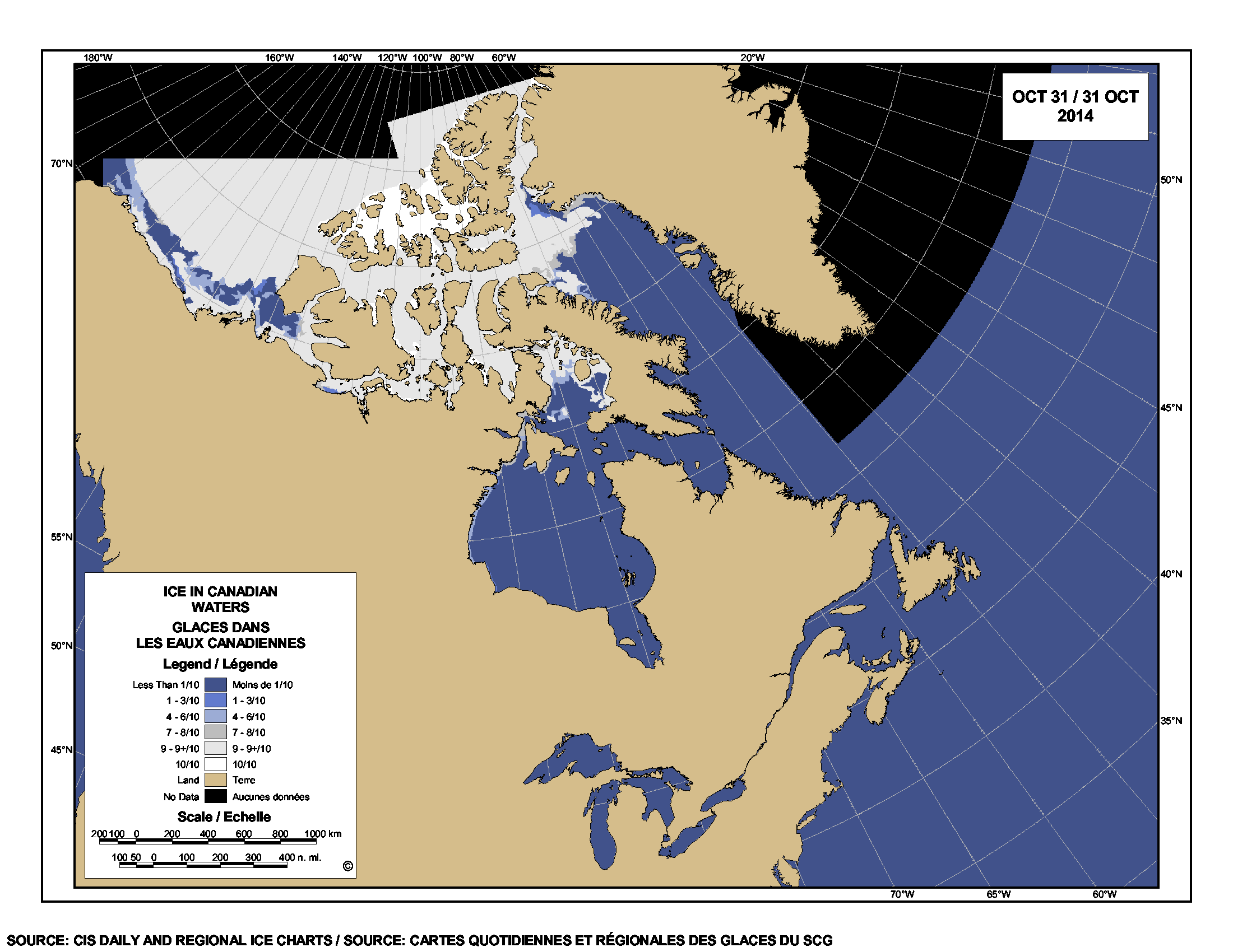
[Map above from Canadian Ice Service updated daily, click to enlarge]
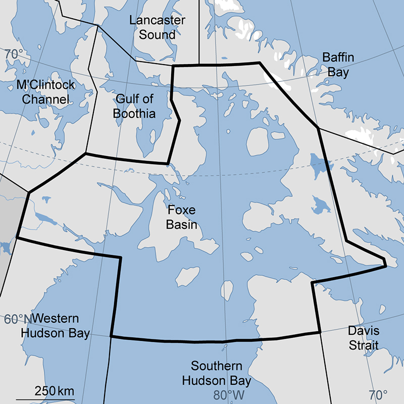
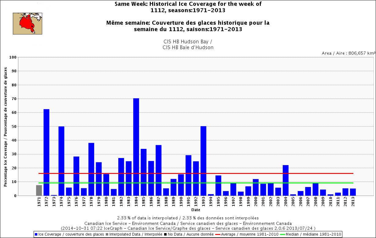
Dead-on average ice cover in Foxe Basin this week, as it was back in 1980, see below. But look at how variable the ice has been, for the same date, since 1968! Click on graphs below to enlarge.
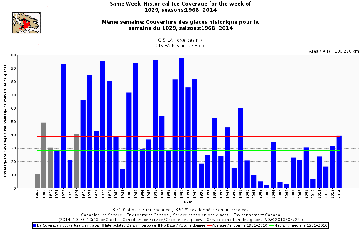
What does this suggest about what’s to come? Back in 1980, by November 12 (just two weeks later), the ice in Foxe Basin was above average.
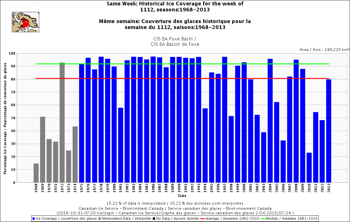
Can that tell us anything about when we can expect freeze-up this year on Hudson Bay to the south? Back in 1980, by November 12, the ice on Hudson Bay was also about average. But more importantly, by November 12, the ice cover was well above the 10% level now acknowledged as the point when most bears leave the shore.
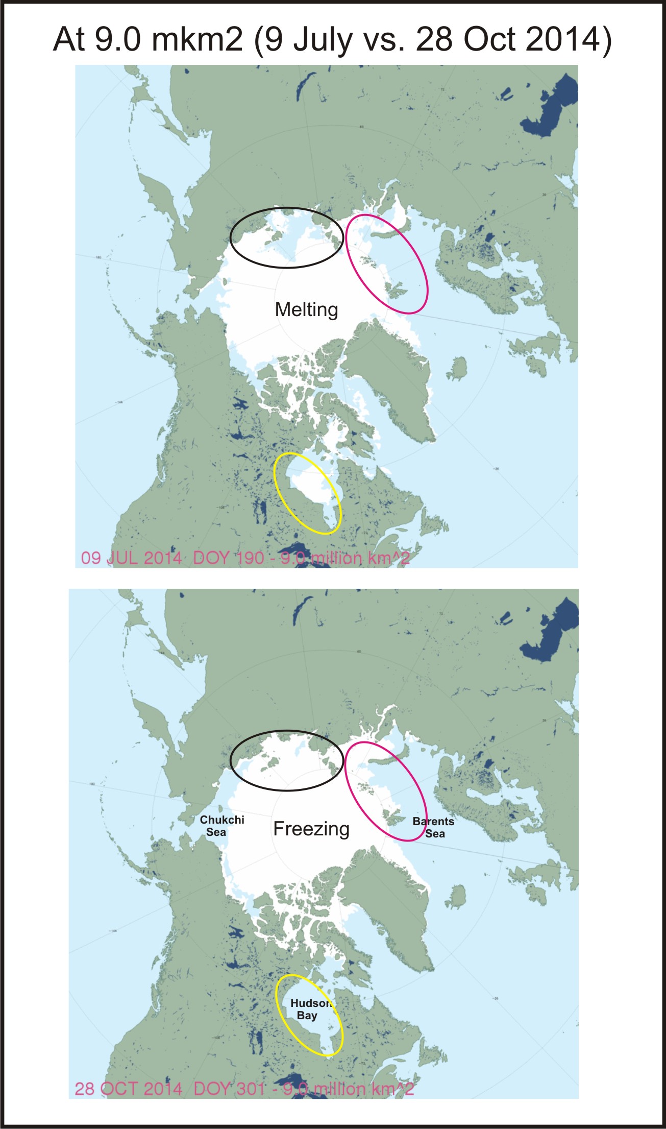
Elsewhere in the Arctic, courtesy NSIDC’s MASIE ice maps (my labels added), ice cover is now over 9 million square km and the freeze-up pattern still different than it was at the same coverage when it was melting in early July: bears will be hunting soon in most areas, if they are not already.


You must be logged in to post a comment.