Tag Archives: ice maps

Hudson Bay update – lots of sea ice well positioned for polar bears to get ashore

There is slightly less ice this year in Hudson Bay than last year but it is hugging tight against the western shore, which means polar bears in Western and Southern Hudson Bay will be able to stay out on the ice (if they want to) until August.

Sea ice extent Canada 2016 July 15_CIS

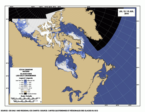
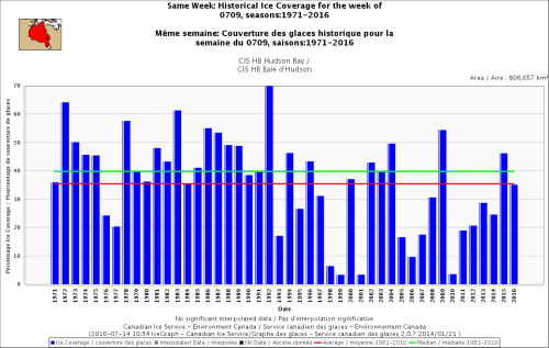
The latest weekly ice graph from the Canadian Ice Service (for 9 July) below shows average ice coverage this year (and more than there was in 1976 and 1977):

Hudson Bay same week 9 July 1971-2016

[By the way, the IUCN Polar Bear Specialist Group website is still “under construction” allowing them to avoid mentioning the less-than-dire conclusions contained in the 2015 IUCN Red List assessment]

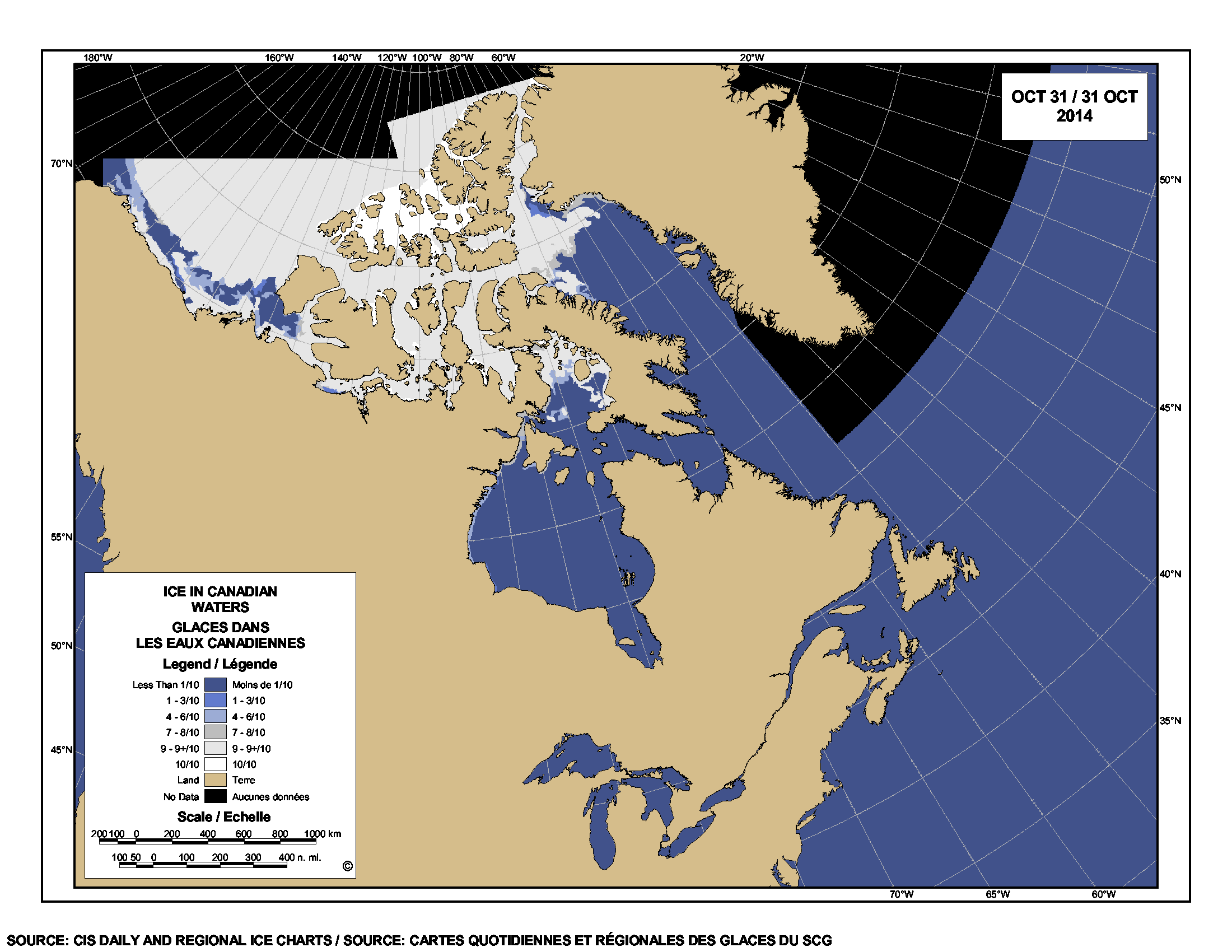
More ice maps below, comparing previous years.

Continue reading

Tracking polar bears in the Southern Beaufort, with a sea ice surprise – April 2015 map

USGS biologists were clearly busy this spring putting more satellite radio collars and glue-on tags on Southern Beaufort Sea polar bears but there’s some surprising information in their April 2015 tracking map about current sea ice conditions.

From the 2013-2014 issue of  “Polar Bear News” (USFWS).

From the 2013-2014 issue of “Polar Bear News” (USFWS).

What’s interesting is that the sea ice maps they use show less dark spots that might be open water this year than were present last year in late April. Oddly, this phenomenon has one prominent biologist worried about “challenging” polar bear habitat developing this year – without mentioning last year at all.

The USGS track map for April 2015 is copied below.1
Continue reading

Polar bear habitat update: what a difference a year makes to sea ice coverage in Canada!

There is far more ice — and far more concentrated ice — in Canada this year than on this day last year. That’s good news for most polar bear populations.

[And, it turns out, more ice total this year on this date than there has been since 2001!]

Polar bears off Churchill_2000-11-20_wikipedia

I’ve made a composite 2014/2013 ice map for 4 November that tells the story (courtesy daily Canadian Ice Service sea ice maps).
Continue reading

Polar bear habitat update – Sea ice starting to form on Hudson Bay

Is that ice I see forming along the shore of Hudson Bay, just in time for Hallowe’en? Not enough to resume hunting but a sign that freeze-up can’t be too far off. See the ice map below and this photo posted at PolarBearAlley confirming the presence of slushy ice on the shore near Churchill.

Sea ice extent Canada 2014 Oct 31 CIS

[Map above from Canadian Ice Service updated daily, click to enlarge]

Continue reading