
There may not be ice for Western Hudson Bay polar bears to walk on yet but there is still more ice forming along the northwest shore of the bay than last year at this time or even the year before. The Canadian Ice Service (CIS) map for 5 November shows this early formation.
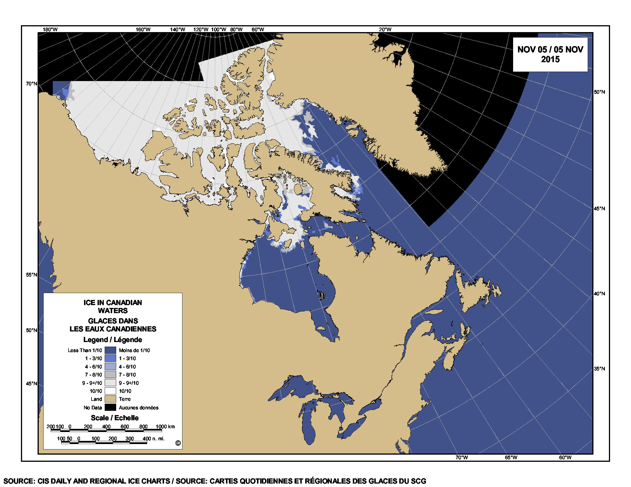
What’s present is mostly grey ice defined by CIS as:
“Young ice 10-15 cm thick, less elastic than nilas [a kind of new ice] and breaks on swell. It usually rafts under pressure.”
Polar bears generally need ice about 30 cm thick to support their weight, which could take a day or two – or a week or two, depending on the weather in northwestern Hudson Bay. For Churchill, along the central coast of western Hudson Bay, ice thick enough for walking will not likely be far behind, given the long-range forecast of freezing weather. In recent years, most Churchill polar bears have left the ice by around 20 November. More maps and graphs for this week below.
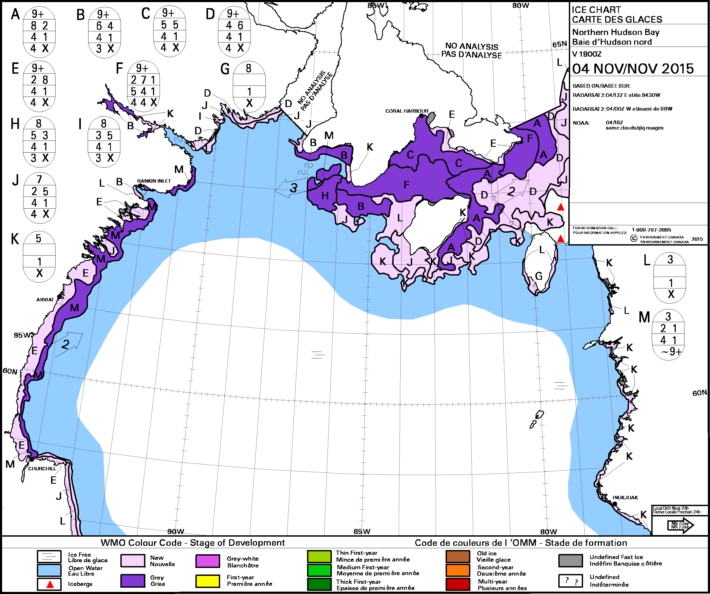
CIS stage of development map for northern Hudson Bay for 4 November 2015, showing grey and new ice development north of Churchill:
Last year’s map at 5 November:

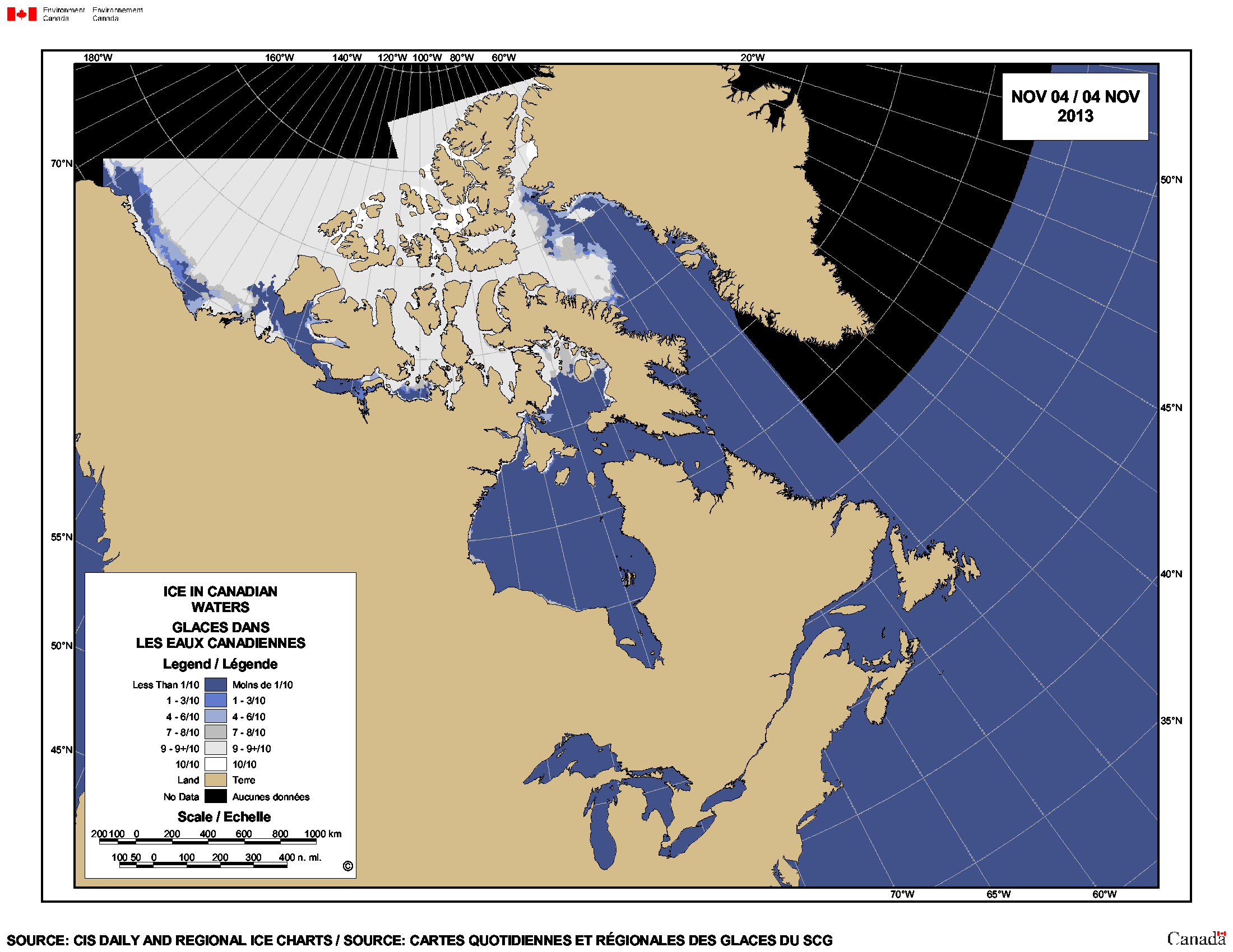
Map for 4 November 2013 (the only one I have on hand):
Map for 12 November 2012 (the only one I have on hand) shows what the next few days may bring this year in Western Hudson Bay if winds don’t blow the ice out into the bay:

Photos of Churchill polar bears waiting for the ice, taken during a helicopter tour here.
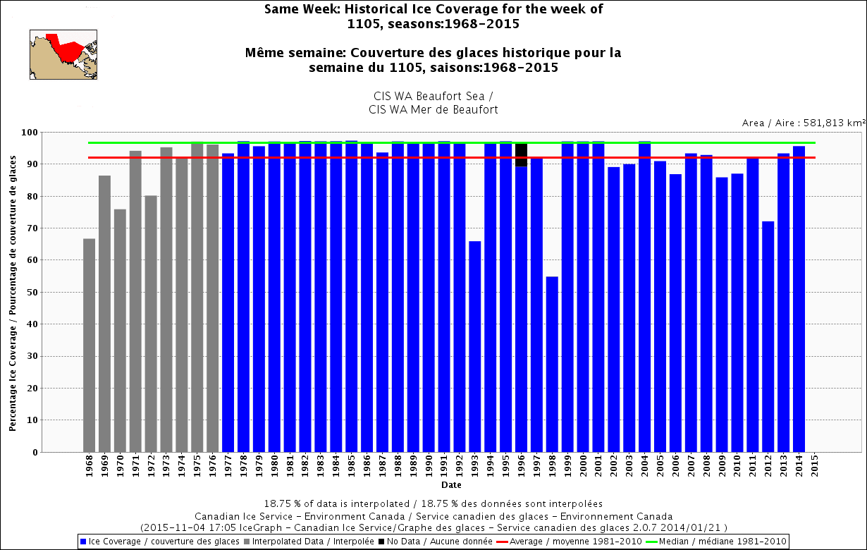
Below are comparative sea ice graphs for the week of 5 November for various Canadian regions with polar bear populations, showing freeze-up well ahead of previous years.
Hudson Bay, 1971-2015:

Davis Strait, 1968-2015:

Foxe Basin, 1968-2015:

Beaufort Sea, 1968-2015:
The global ice map from NSIDC Masie for 4 November 2015 does not yet show this new ice formation in Hudson Bay but shows Foxe Basin almost filled with ice, with 9.3 mkm2 of ice worldwide at what is not yet mid-fall in the Arctic. Chukchi Sea ice is still far north of Wrangel Island (more on that later) and Barents Sea ice has not reached the Svalbard Archipelago:


You must be logged in to post a comment.