
Never mind that the sea ice maximum this year came almost a month later than last year (and close to latest since 1979) – and was lower by only .02 – the US National Sea Ice Data Center (NSIDC) today trumpeted a new record low. What this means to polar bears, if anything, remains to be seen.
2015: maximum set February 25 (day 56), at 14.54 mkm2
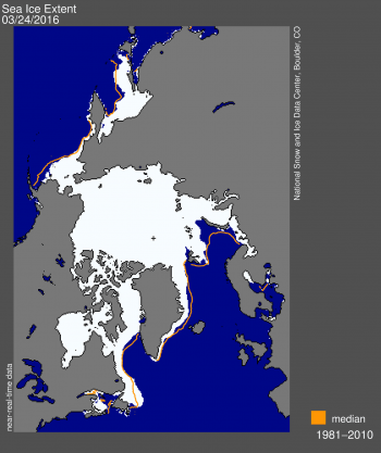
2016: maximum set March 24 (day 84), at 14.52 mkm2
[The difference in area? Smaller than the Islands of the Bahamas]
Latest maximum extent (since 1979) occurred in 2010 on April 2 (Day 92).
The average date for maximum extent is March 12.
I note, however, that given the lateness of the winter sea ice surge meant that the amount of ice present at 24 March 2016 (see NSIDC Interactive) was more than was present on the same date in 2006, 2007 and 2015.
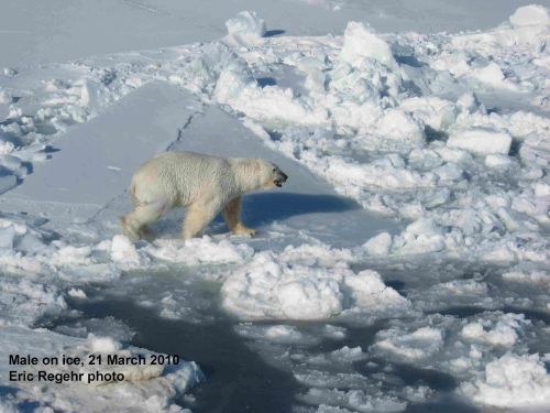
Clearly, there was plenty enough sea ice in the spring of those years for most polar bears to hunt seals successfully and put on the weight they needed to survive the summer fast ahead. I see no reason to expect 2016 to be different.
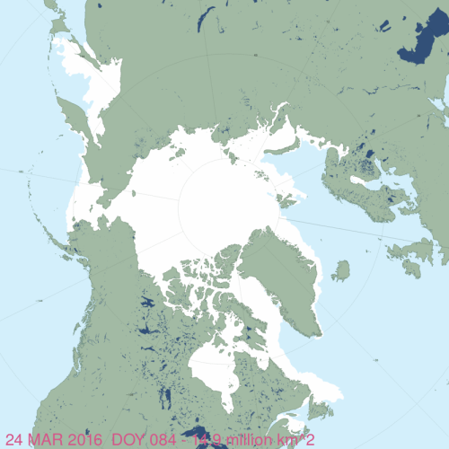
[NSIDC Masie ice charts, like the one above, uses data from several sources and that’s why they usually show a higher extent than the simple passive microwave NSIDC chart displayed on the daily sea ice page]
From the NSIDC regular sea ice page (which will remain in the archive):
“On March 24, 2016, Arctic sea ice likely reached its maximum extent for the year, at 14.52 million square kilometers (5.607 million square miles). This year’s maximum ice extent was the lowest in the satellite record, with below-average ice conditions everywhere except in the Labrador Sea, Baffin Bay, and Hudson Bay.
The maximum extent is 1.12 million square kilometers (431,000 square miles) below the 1981 to 2010 average of 15.64 million square kilometers (6.04 million square miles) and 13,000 square kilometers (5,000 square miles) below the previous lowest maximum that occurred last year. This year’s maximum occurred twelve days later than the 1981 to 2010 average date of March 12. The date of the maximum has varied considerably over the years, occurring as early as February 24 in 1996 and as late as April 2 in 2010.
…
These unusually warm conditions have no doubt played a role in the record low ice extent this winter. Another contributing factor has been a predominance of southerly winds in the Kara and Barents seas that have helped to keep the ice edge northward of its typical position. This area has also seen an influx of warm Atlantic waters from the Norwegian Sea.
There is little correlation between the maximum winter extent and the minimum summer extent—this low maximum does not ensure that this summer will see record low ice conditions. A key factor is the timing of widespread surface melting in the high Arctic. An earlier melt onset is important to the amount of energy absorbed by the ice cover during the summer. If surface melting starts earlier than average, the snow darkens and exposes the ice below earlier, which in turn increases the solar heat input, allowing more ice to melt. With the likelihood that much of the Arctic cover is somewhat thinner due to the warm winter, early surface melting would favor reduced summer ice cover.” [my bold]
Compare the above to this NSIDC press release issued Monday, 28 March 2016:
“BOULDER, Colo, March 28, 2016—Arctic sea ice was at a record low maximum extent for the second straight year, according to scientists at the National Snow and Ice Data Center (NSIDC) and NASA.
“I’ve never seen such a warm, crazy winter in the Arctic,” said NSIDC director Mark Serreze. “The heat was relentless.” Air temperatures over the Arctic Ocean for the months of December, January and February were 2 to 6 degrees Celsius (4 to 11 degrees Fahrenheit) above average in nearly every region.
…
Scientists are watching extent in this area because it will help them understand how a slower Atlantic Meridional Overturning Circulation (AMOC) may affect Arctic sea ice. “Some studies suggest that decreased heat flux of warm Atlantic waters could lead to a recovery of all Arctic sea ice in the near future,” said NSIDC senior research scientist Julienne Stroeve. “I think it will have more of a winter impact and could lead to a temporary recovery of winter ice extent in the Barents and Kara seas.”
This year’s maximum extent is 1.12 million square kilometers (431,000 square miles) below the 1981 to 2010 average of 15.64 million square kilometers (6.04 million square miles) and 13,000 square kilometers (5,000 square miles) below the previous lowest maximum that occurred last year.” [my bold]


You must be logged in to post a comment.