
Port aux Basques in SW Newfoundland has been particularly badly hit by Fiona, called ‘total devastation’. I know this region well from researching my latest science-based novel, UPHEAVAL, about a sea ice tsunami that hits Cape Breton Island and the Port aux Basques region in 2026 causing similar but more extensive damage. I discovered that many coastal areas in the Gulf of St. Lawrence are only 10m or so above sea level and since houses are often built close to shore, they are extremely vulnerable to high wave heights and storm surges.
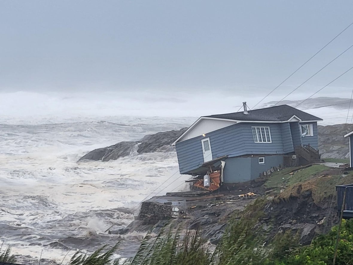
Some waves along Nova Scotia’s Eastern Shore could build to be more than 10 metres, with waves along southern Newfoundland on Saturday morning reaching higher heights. “Waves over eastern portions of the Gulf of St. Lawrence and Cabot Strait could be higher than 12 metres,” Environment Canada said. CBC News 24 September 2022.
I may post updates as more information comes in. See the map below to orient yourself regarding news reports.
Continue reading


You must be logged in to post a comment.