
Finally, an unbiased first-hand report about Churchill polar bears and freeze-up on Hudson Bay.
Over the last few weeks, biologists Andrew Derocher and Steve Amstrup have been repeating their tired old tales of doom and gloom about the polar bears around Churchill and I’ve done my best to refute the worst of their nonsense.

Figure 1. Polar bear female with cub, 2009, Churchill, Western Hudson Bay. Wikipedia.
To that effort we can now add this report from PolarBearAlley, where Kelsey Eliasson has posted a good-news story about the bears of Cape Churchill and the progress of freeze-up, including sightings of a number of mothers with cubs.
Here is some of what Kels had to say about his helicopter trip to Cape Churchill on Sunday 9 November [I’ve added a map of the area, Fig. 1, and the latest sea ice map, Fig. 2]:
“We cruised south to Thompson Point, about 1/3 of the way down the coast to the Nelson River. Between Thompson Point and Cape Churchill, you should get a pretty good idea of what is building up east of Churchill and maybe a little snapshot of the overall health of the population.
Between Thompson Point and the Cape there were about 25 bears, however, the hopeful sign is that many of these bears were mothers with cubs including two sets of mothers with twins. When we got to Cape itself, a sandy spit reaching northward off the corner of the shelf, we were amazed at how many bears were gathered right there.
Another 25-30 bears were counted just in this tiny area surrounding the research tower, including 12-15 bears nestled in day beds right on the spit, lying 20-30m away from each other, if that – that’s pretty close… Mostly, these were big males, likely still around 1000 lbs, the true ‘lords’ of the arctic, bears that will never make their way to Churchill simply because they are so healthy that they don’t need to put in that extra effort. What was truly amazing, however, was that two sets of mothers and cubs were nestled into the day-beds right next to these arctic behemoths.” [my bold]
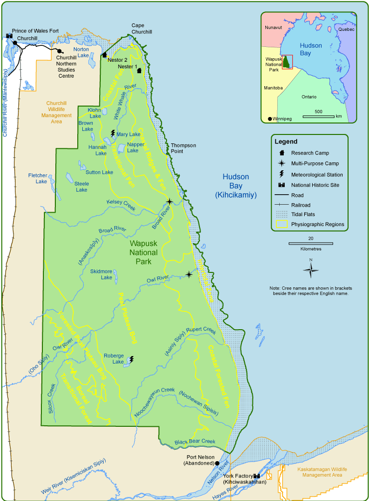
Figure 1. Map of Wapusk National Park and the Churchill region, courtesy Parks Canada. Click to enlarge.
“Cape is known as ‘where the big bears are’ not so much for mothers and cubs hanging out there. Over that two hour trip, we saw eight family groups including four females with twins. To me, this is a really positive sign, we have not had a cub year like this for maybe five or six years. Way beyond expectations.
…
The ice out at Cape looks great, I would say we a pretty much on schedule for freezeup, maybe another week or ten days. LaPeruse Bay is almost locked in and same goes for Button Bay. Long spits like Halfway Point, Gordon Point and The Cape are all catching freshwater ice that pours out of the Churchill River. More pancake ice can be seen around the end of Cape, spread out along the eastern edge of Wapusk National Park. Honestly, there are already places with just enough ice for early season seal hunting, judging by the tracks to and from the ice edge near Cape, I’d say there has already been a fair degree of success.“ [my bold]
Read it all here.
Below is the most recent sea ice map from the Canadian Ice Service [Updated 11 November, Fig. 3]
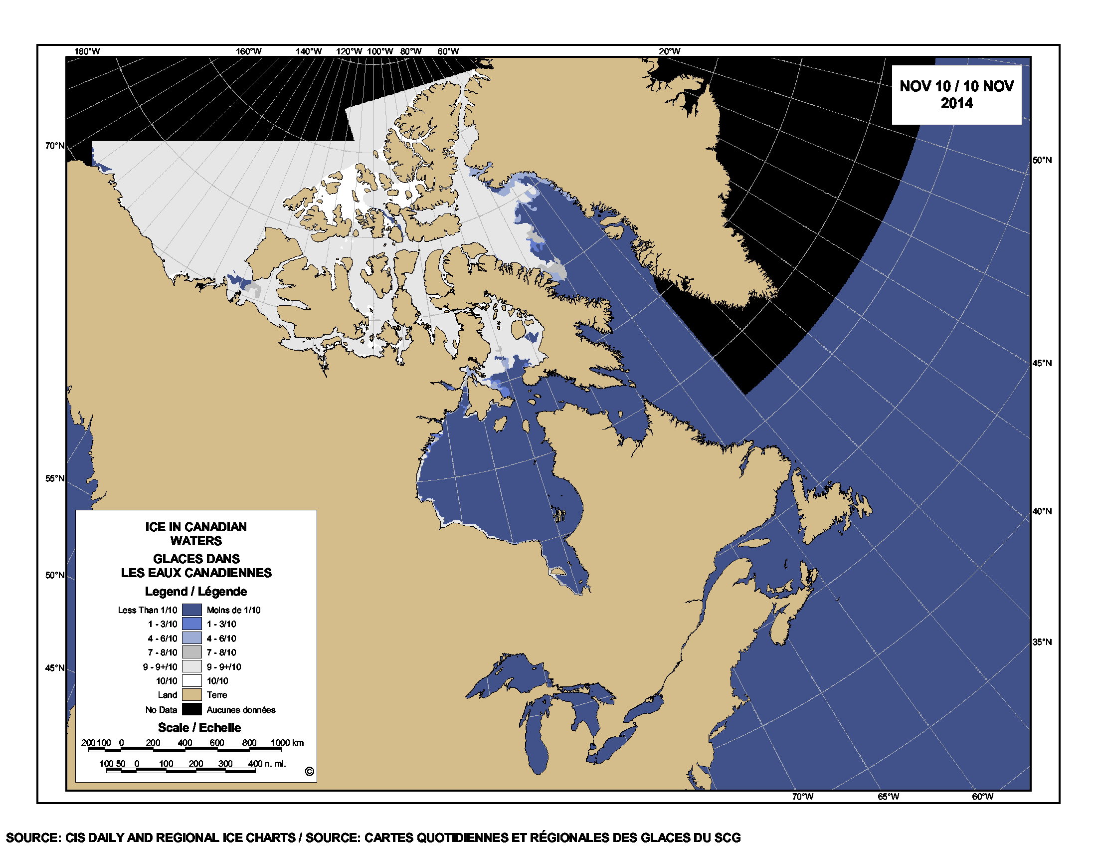
Figure 2. Sea ice concentration for 10 November 2014. Note the ice forming along the western shore of Hudson Bay. Click to enlarge.

Figure 3. Sea ice concentration for 11 November 2014. Note the ice forming along the western shore of Hudson Bay. Click to enlarge


You must be logged in to post a comment.