
Great news for Western Hudson Bay polar bears! Following up from sea ice conditions last week, CIS maps show ice forming all along western Hudson Bay – not a huge amount, but the beginning of the end of the ice-free season, which recently has not occurred until mid-November (Cherry et al. 2013).
There is above-average sea ice coverage in Foxe Basin and Davis Strait, and only slightly below average coverage in the Beaufort Sea (see graphs below). Polar bear habitat is shaping up very nicely indeed across Canada and the US this year.
If this freeze-up pattern continues, it’s possible polar bears will be able to leave the shore of western Hudson Bay much earlier than usual, perhaps as early as the first week in November. They will then be able to resume hunting, thus ending their usual summer fast.
Breakup on Hudson Bay was unusual this year: a bit earlier than usual for WHB bears in the north of the region but later than usual for those who came off the ice further south (and for Southern Hudson Bay bears, who had a very late breakup year). Now we see ice forming all along the coast, which is unusual for this early in the fall – for example, in 2009 breakup was much later than usual but freeze-up was late too.
Late breakup over the bay combined with early freeze-up (like in the ‘good old days’ of the 1980s) may be very good news for Hudson Bay polar bears – unless it signals the formation of very thick ice next spring, which would then be bad news for some bears.
Compare the amount of ice in Canadian waters this year at 29 October (above) to amounts in 2013 on the 31st: less ice in Baffin Bay (west of northern Greenland) this year but more in Davis Strait, Foxe Basin, Hudson Bay, and the Beaufort Sea (click to enlarge).
Pretty much the same story last year, on the same date (29 October): less ice in Baffin Bay (west of northern Greenland) this year but more in Davis Strait, Foxe Basin, Hudson Bay, and the Beaufort Sea.

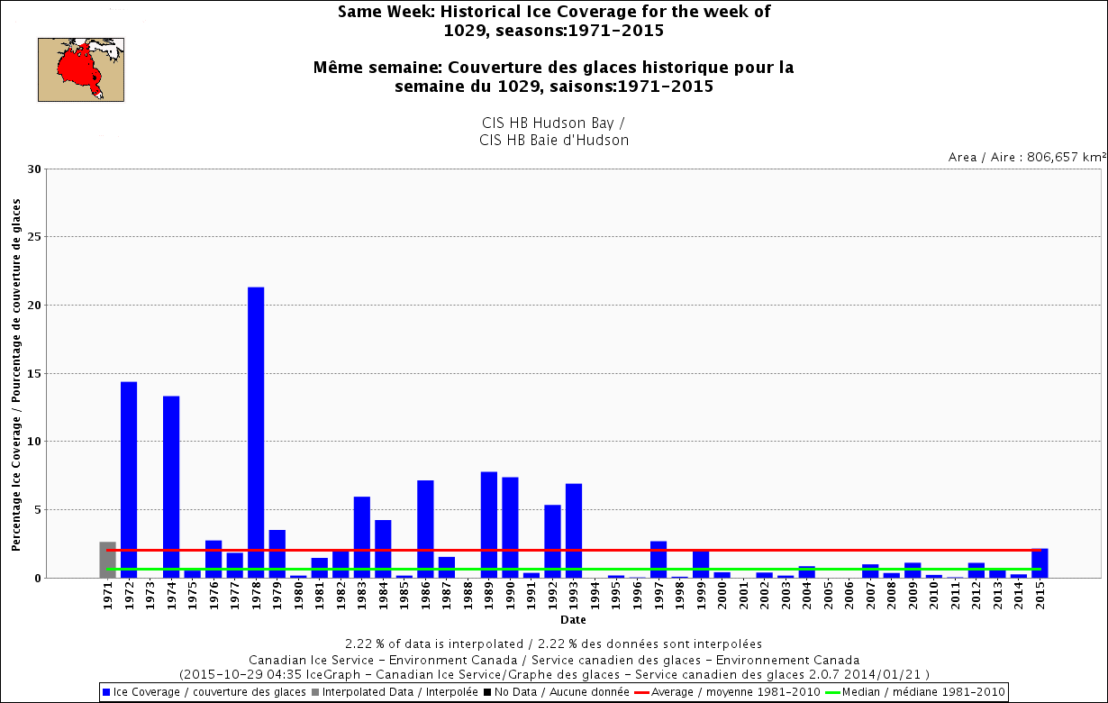
In Hudson Bay, comparative CIS ice graphs show more ice this week (about 2.5% coverage) than any year since 1997 (1999 was about the same, looks ever so slightly less than 2015):
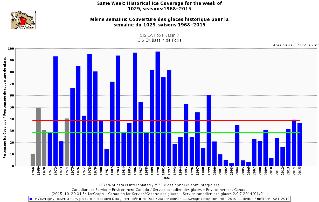
And ice in Foxe Basin ice is higher than average for this week for the third year in a row:
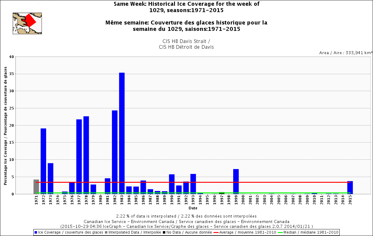
Davis Strait ice is slightly above average for this week and the highest it’s been at this time of year since 1999:
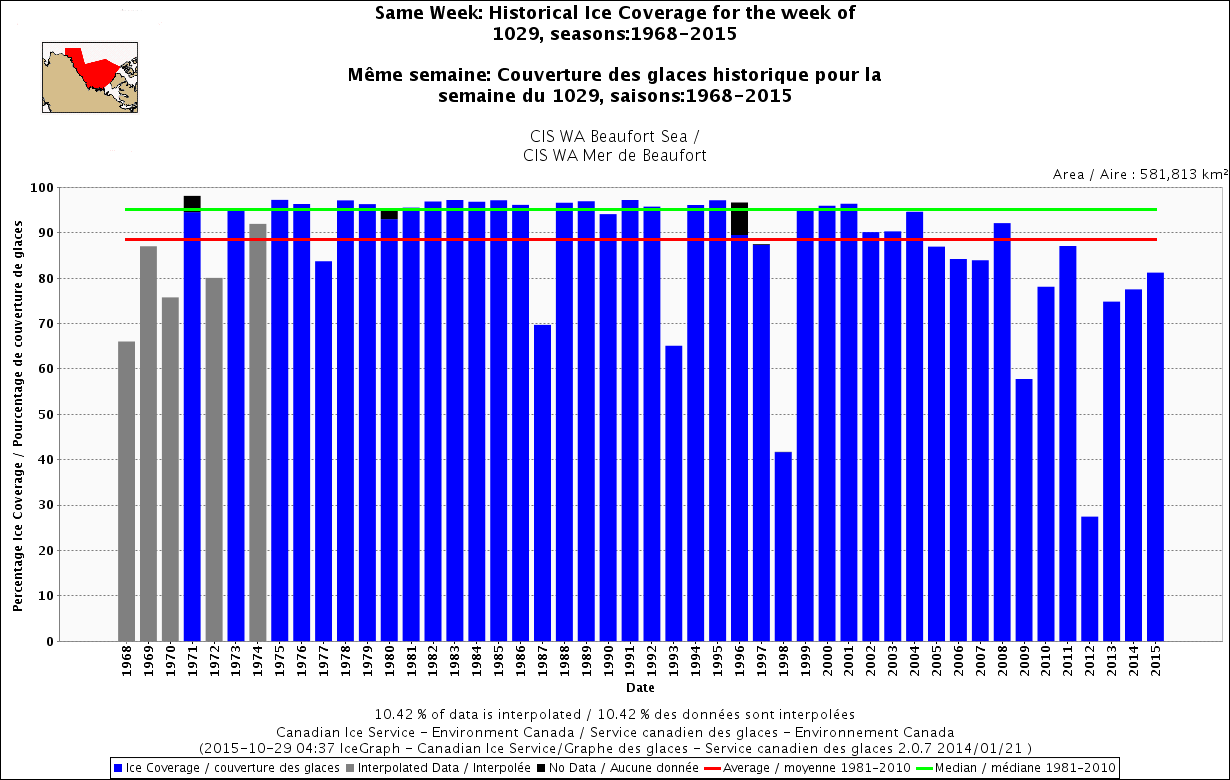
Beaufort Sea ice is somewhat below average for this week – for the third year in a row – but the region has still got over 80% coverage, which is way more than southern regions have this time of year:
As the next two maps from the US Navy Research Lab show, Beaufort Sea is mostly covered in 100% concentrated ice and at least 0.3 m thick – which is plenty thick enough to support a polar bear:
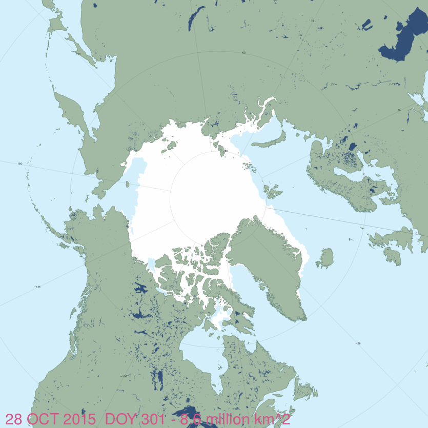
Finally, here’s the NSIDC Masie global ice map, showing 8.0 mkm2 of polar bear habitat at 28 October 2015:
References
Cherry, S.G., Derocher, A.E., Thiemann, G.W., Lunn, N.J. 2013. Migration phenology and seasonal fidelity of an Arctic marine predator in relation to sea ice dynamics. Journal of Animal Ecology 82(4):912-921.
http://onlinelibrary.wiley.com/doi/10.1111/1365-2656.12050/abstract


You must be logged in to post a comment.