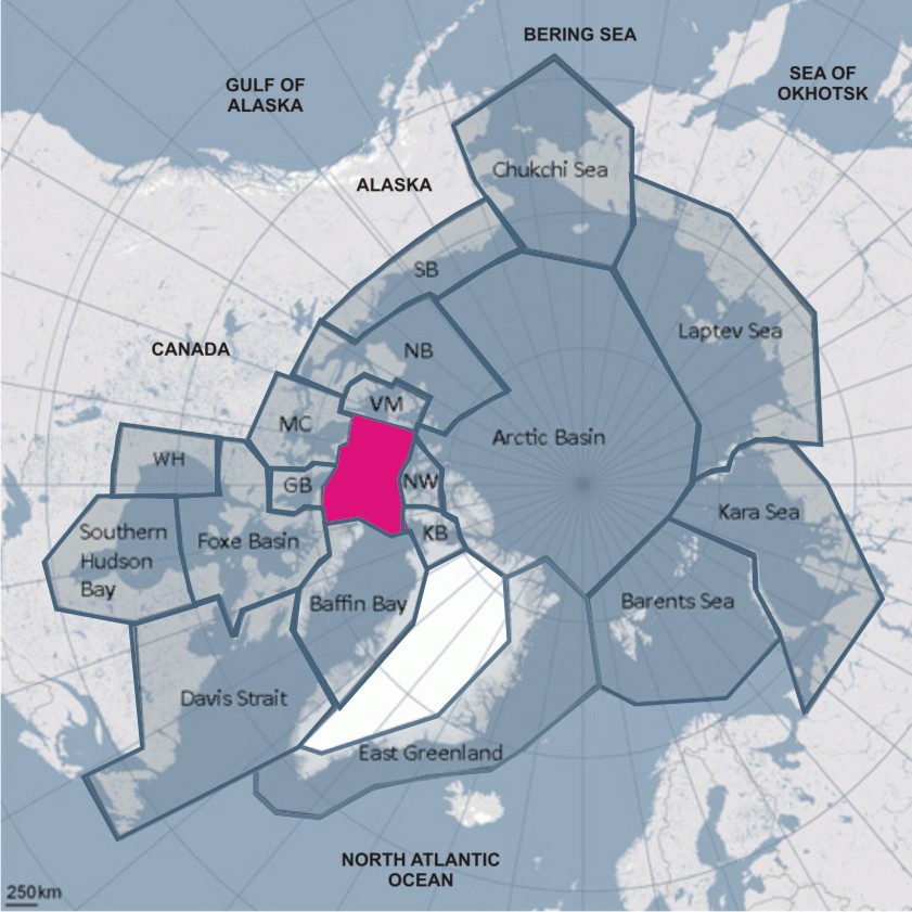
The polar bear subpopulation designated as Lancaster Sound lies at the eastern entrance to the Northwest Passage in the Canadian High Arctic (Fig.1). We rarely hear about it but this region has one of the largest polar bear populations anywhere in the Arctic – only the Barents Sea and Foxe Basin have higher estimated population sizes.

Figure 1. Polar bear subpopulations with Lancaster Sound marked. Map courtesy IUCN Polar Bear Specialist Group, additional labels added.
Lancaster Sound includes the communities of Arctic Bay on northwestern Baffin Island and Resolute Bay on Cornwallis Island. Devon Island, which lies on the northern boundary, has no permanent communities, although two research stations are present (see here and here). A more detailed map showing the exact boundaries is available in Vongraven and Peacock (2011).
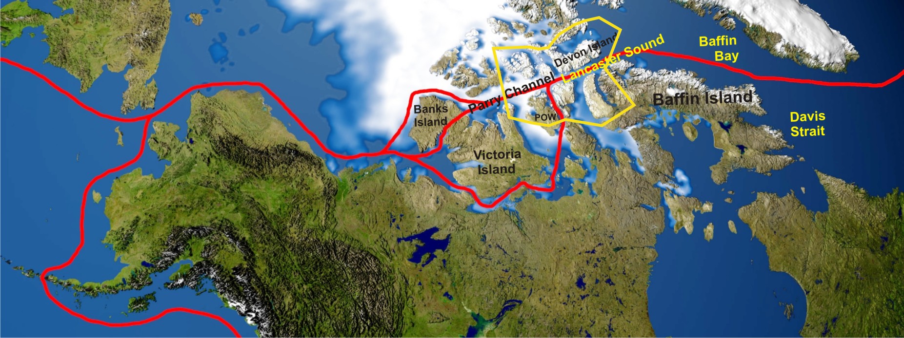
The eastern portion of Lancaster Sound is generally clear of ice by late summer (hence the Northwest Passage) but the western third of the region not only retains pack ice later in the season but some multiyear ice remains throughout the year.
The proximity of Lancaster Sound to Baffin Bay and the eastern Northwest Passage (Fig.2) undoubtedly exposed polar bears there to hunting by European whalers during the 1800s and early 1900s (see previous post here, especially Fig. 5), from which the population appears to have recovered.
On the other hand, the proximity of Lancaster Sound to oil and gas reserves further north in the High Arctic generated much-needed funds for polar bear biologists in the mid-to-late 1970s to collect essential baseline data for the entire region (Schweinsburg et al. 1982; Stirling et al. 1979, 1984; Stirling and Latour 1978).

Figure 2. The main Northwest Passage route starts at Lancaster Sound and runs east through Parry Channel because these waterways routinely clear of ice in late summer. The approximate boundary of the Lancaster Sound polar bear subpopulation is marked in yellow; POW is Prince of Wales Island. Map from Wikipedia, labels added. Click to enlarge.
Continue reading

![Figure 1. How do polar bears look so clean most of the time when they get this bloody on a regular basis? They wash up! [This picture is not from Stirling’s paper].](https://polarbearscience.com/wp-content/uploads/2014/02/pbear_withcubs_feeding.jpg)


You must be logged in to post a comment.