Tag Archives: heavy ice

Polar bear habitat update: abundant sea ice across the Arctic, even in the Barents Sea

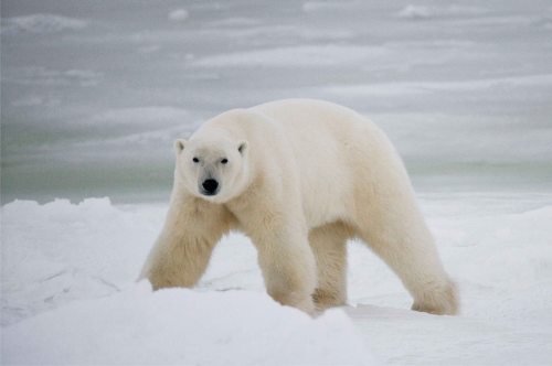
Abundant ice in Svalbard, East Greenland and the Labrador Sea is excellent news for the spring feeding season ahead because this is when bears truly need the presence of ice for hunting and mating. As far as I can tell, sea ice has not reached Bear Island, Norway at this time of year since 2010 but this year ice moved down to the island on 3 March and has been there ever since. This may mean we’ll be getting reports of polar bear sightings from the meteorological station there, so stay tuned.

Walking bear shutterstock_329214941_web size

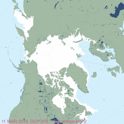
Sea ice extent as of 11 March 2019, from NSIDC Masie:

masie_all_zoom_4km 2019 March 11

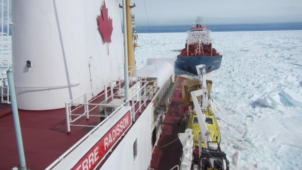
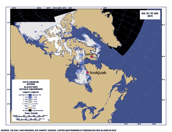
Much of the ice that was blown out of the Bering Sea early in the month has returned and ice in the Gulf of St. Lawrence on the East Coast of Canada is the highest its been in years, threatening to impede ferry traffic between Nova Scotia and Newfoundland, as it did in 2015 and again in 2017. The fishing season off Newfoundland might also be delayed by the heavy ice, as it was in 2017.

Continue reading

Heavy ice in Hudson Bay derails ArcticNet global warming research plans: irony bites

Heavy ice in Hudson Bay derails CCGS Amundsen’s research plans” – just in from the CBC (22 July 2015, via Twitchy). Worst ice in 20 years.

ccgs-pierre-radisson-in-sea-ice_to_Iqaluit_july 17_2015

[original caption for the above photo: “The CCGS Pierre Radisson escorts the oil tanker Havelstern to Iqaluit July 17. Tough ice conditions in area have delayed this summer’s annual resupply, and have now derailed the CCGS Amundsen from its carefully planned summer research program.”]

Worst ice conditions in 20 years force change of plans to icebreaker research program

That would be 1992 they’re talking about, the cold year that everyone blamed on the eruption of Mt. Pinatubo. Unfortunately, there are no good detailed ice maps from 1992 (see previous post here). What’s the excuse this year?

CCGS Amundsen is an icebreaker that is usually released from duty to serve as an Arctic research vessel in the summer. And who’s on board? GEOTRACES 2015 Arctic Expedition out of the University of British Columbia with a plan to study (in part) global warming caused “ocean acidification.” Their short blog post shows a map without ice and not a hint they see the irony of the situation.

Here’s the ice they’re talking about (from the Canadian Ice Service), with the communities mentioned in the study marked:

Sea ice at 22 July 2015, with Inukjuak (EHB) and Iqaliuk, Baffin Island marked. Click to enlarge.

Sea ice at 22 July 2015, with Inukjuak, Eastern Hudson Bay, and Iqaliuk, Baffin Island, marked. CIS map. Click to enlarge.

Continue reading