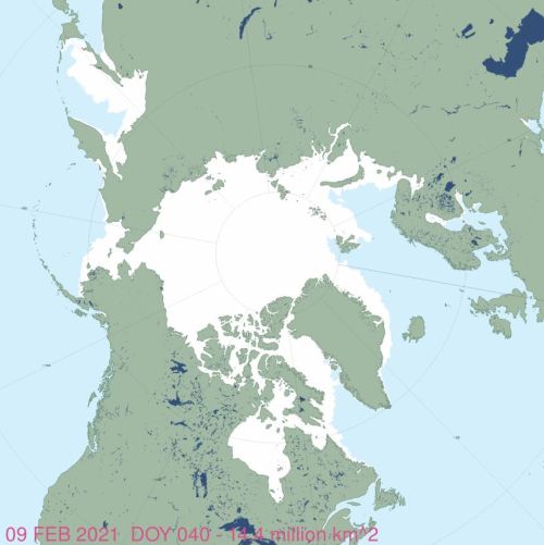
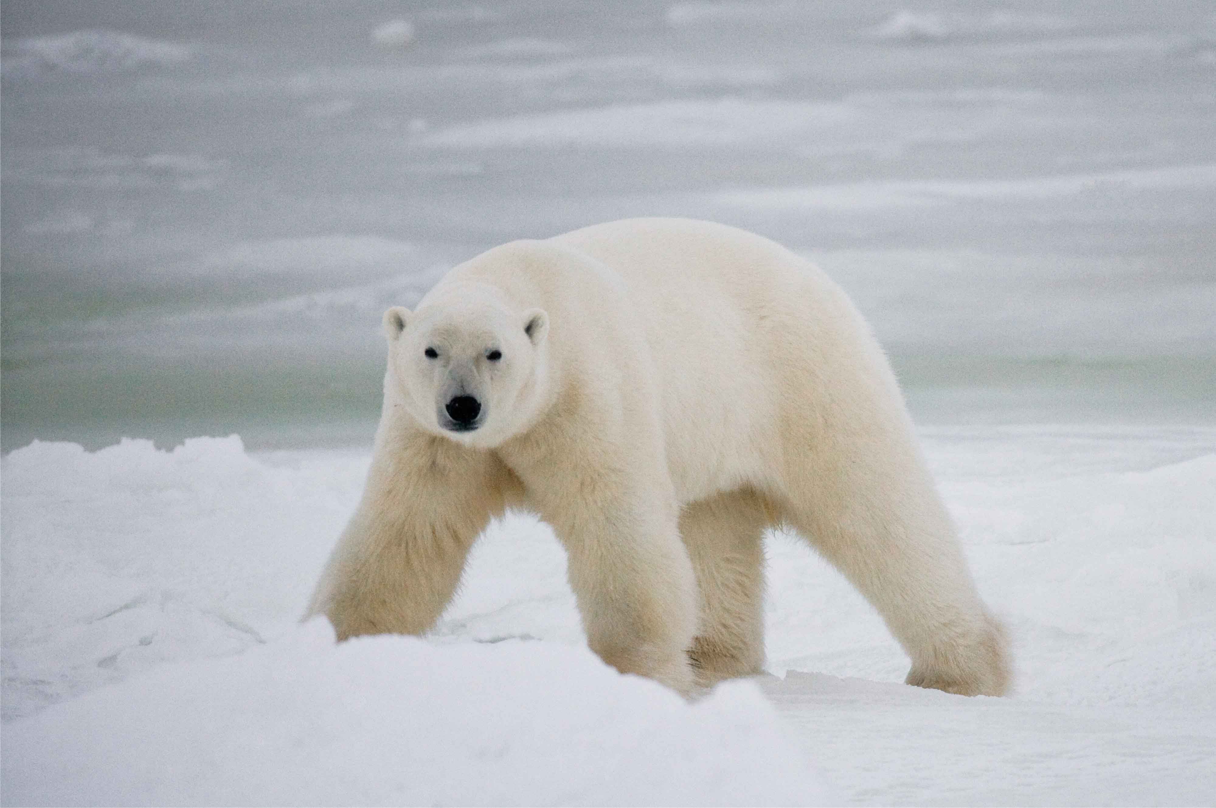
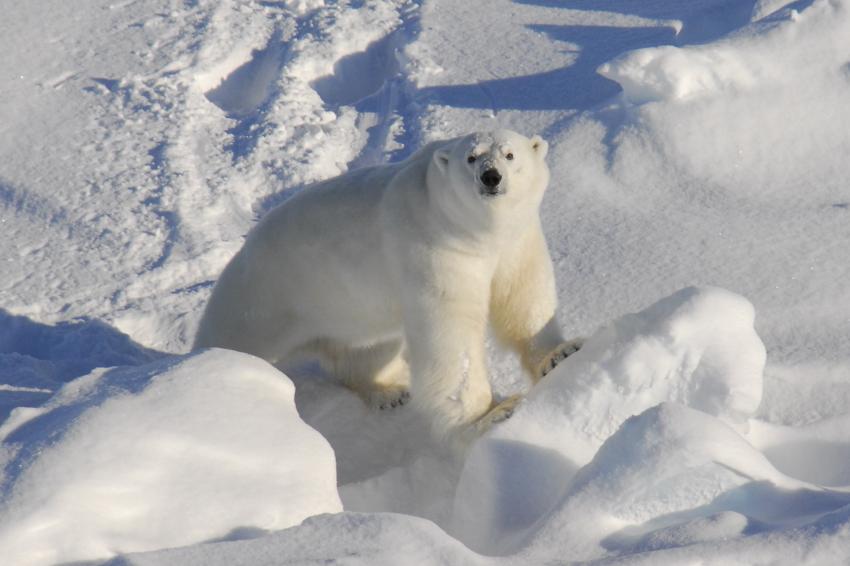
In contrast to summer sea ice, winter ice in the Arctic was again abundant this year. The slight decline since 1979 has so far been no cause for concern to polar bears, who are thriving.

In contrast to summer sea ice, winter ice in the Arctic was again abundant this year. The slight decline since 1979 has so far been no cause for concern to polar bears, who are thriving.
Comments Off on Winter sea ice habitat for polar bears still abundant enough to sustain a thriving species
Posted in Life History, Sea ice habitat
Tagged Barents Sea, Bering Sea, extent, first year ice, Hudson Bay, polar bear, sea ice, seals, subpopulations, thickness, walrus
Compared to last year, polar bear habitat at 15 December 2021 is way up in the Barents and Bering Seas but way down in Hudson Bay but nothing any polar bear has to worry about.

Here’s what the ice charts look like.
Continue readingComments Off on Mid-December polar bear habitat update
Posted in Life History, Sea ice habitat
Tagged Barents Sea, Bering Sea, December, Hudson Bay, polar bear, sea ice
After years of hype, including documentary over-reach by David Attenborough and his collaborators at WWF and Netflix, there has been relatively abundant ice in the Chukchi Sea this summer, particulary along the Russian coast and around Wrangel Island, which in recent years have been important summer refuge areas for polar bears and Pacific walrus.

This year, there has been nothing like the complete retreat of ice into the Arctic Basin as happened in 2007, 2012, and 2020. The chart below shows the ice extent at 11 October 2021:

Wrangel Island was surrounded by ice in 2000 and 2001, which made access to walrus haulouts on the island impossible (Kochnev 2004). Most of the walrus haulouts along the Chukotka coast were also ice-covered in September in those years, as were all of the western locations in 2021 – as the ice charts below show. The extra ice will have drastically affected the distribution of walrus this year, which in turn will have meant no walrus carcasses for polar bears to feast on as they have done for many years now.
Continue readingComments Off on Most Chukchi Sea ice in 20 years means no walrus feasts for polar bears at famous Russian cliffs
Posted in walrus
Tagged Bering Sea, birth, Cape Schmidt, Chukchi Sea, mating, polar bear, Ryrkaypiy, sea ice, walrus
Sea ice across the Arctic in the first week of February is a mix of highs and lows. Bering Sea is back up to almost normal coverage, as is the Barents Sea. However, ice coverage on the East Coast of Canada is the lowest its been in four decades. This is not yet a worry for polar bears because harp seals don’t pup until mid-March in this region so there is at least four weeks of potential ice growth that can happen before the seals are forced to pup on much reduced ice – where polar bears are sure to find them.
Here is a close-up look at sea ice conditions by region at the edges of the Arctic. Continue reading
Comments Off on Polar bear sea ice habitat highs and lows in early February
Posted in Sea ice habitat
Tagged Barents Sea, Bering Sea, East Coast, harp seal, polar bear, pupping habitat, sea ice, Svalbard
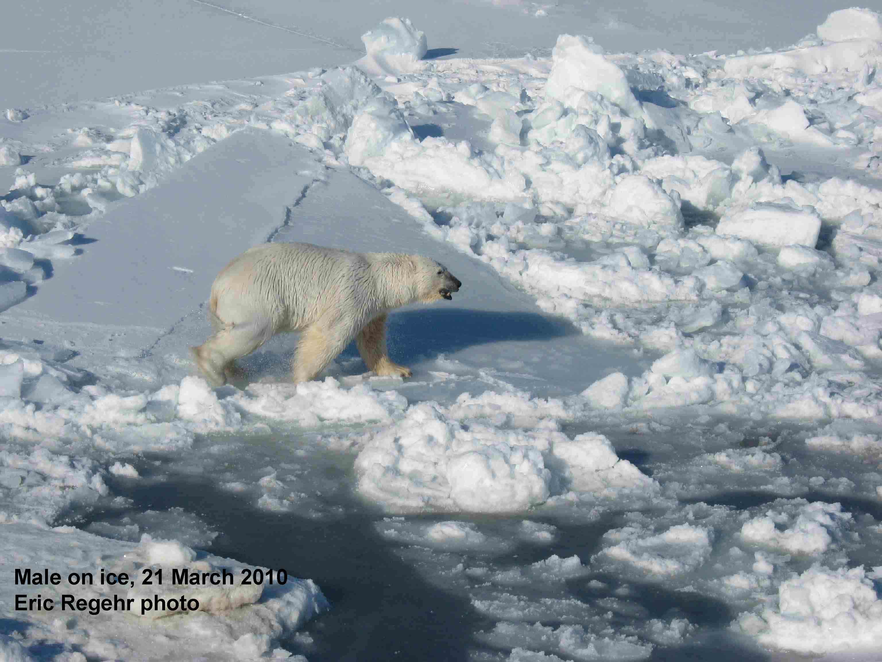
Another day, another bogus starving polar bear claim from an environmental organization. Polar bear starvation is virtually never caused by climate change but apparently, Greenpeace thinks there are still some gullible folks out there who will believe anything they are told. A young male polar bear in poor condition found far south on the Russian coast of the Bering Sea a few days ago is an isolated incident: it is not evidence of anything except the sad fact that the life of a polar bear can sometimes be brutal. In contrast to these reports, Chukchi Sea polar bears are doing extremely well overall.
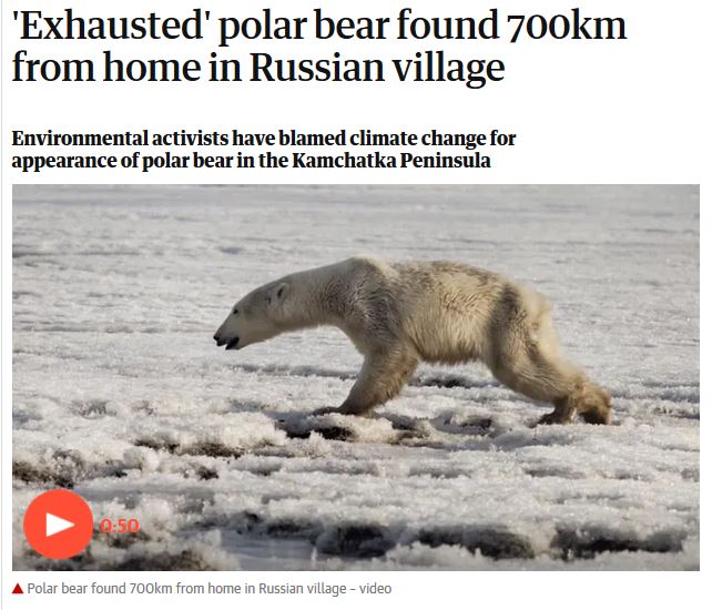
Headline from The Guardian 18 April 2019
Comments Off on Bogus Greenpeace claim that lost Russian polar bear is evidence of climate change
Posted in Advocacy, Polar bear attacks, Sea ice habitat
Tagged Bering Sea, climate change, exhausted, Greenpeace, Kamchatka, lost, polar bear, Russia, sea ice, shrinking ice, starving, Tilichiki
Fancy that! After a load of handwringing earlier this month, mobile pack ice in the Bering Sea has returned. Just like ice in the Barents Sea, Bering Sea ice is highly variable (Brown et al. 2011): it moves with winds and currents, so a ‘decline’ during the winter usually indicates redistribution, not melting.
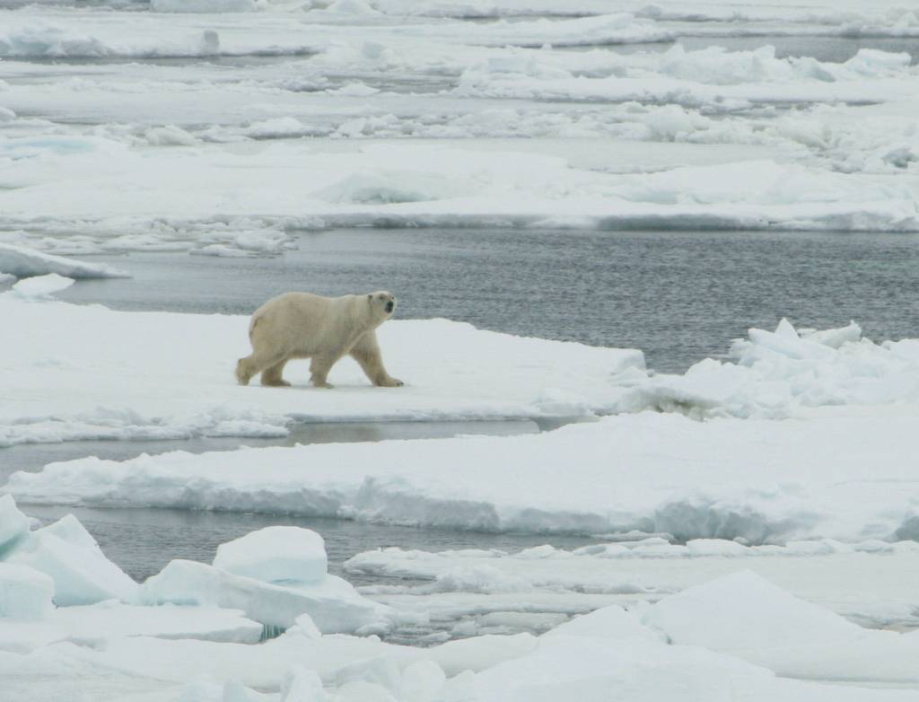
Polar bear on Bering Sea ice 2007 USFWS
According to researcher Rick Thoman from the University of Alaska Fairbanks, quoted by the Canadian Press:
“Wind blew ice to Russian beaches in the west and to the south side of Norton Sound south of Nome but left open water all the way to Chukchi Sea north of the Bering Strait.”
Polar bears that venture into the Bering Sea are part of the Chukchi Sea subpopulation, which is known to be thriving (Crockford 2019; AC SWG 2018; Regehr et al. 2018; Rode and Regehr 2010; Rode et al. 2013, 2014, 2015, 2018).
Comments Off on It’s back: Bering Sea polar bear habitat has recovered from a low earlier this month
Posted in Advocacy, Sea ice habitat
Tagged Bering Sea, Chukchi Sea, decline, disappearing, facts, gone, open water, polar bear, science, sea ice, winds, winter
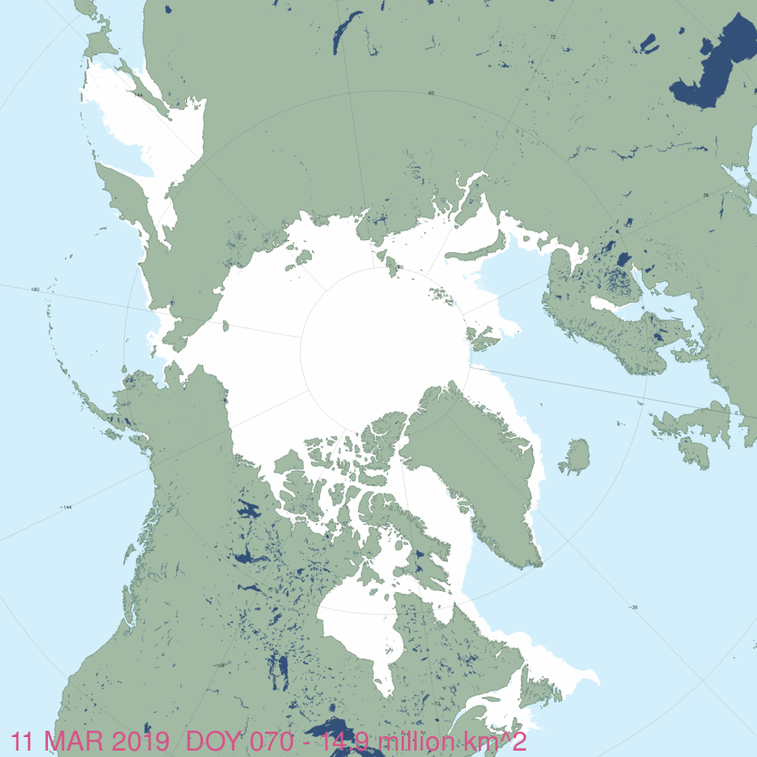
Abundant ice in Svalbard, East Greenland and the Labrador Sea is excellent news for the spring feeding season ahead because this is when bears truly need the presence of ice for hunting and mating. As far as I can tell, sea ice has not reached Bear Island, Norway at this time of year since 2010 but this year ice moved down to the island on 3 March and has been there ever since. This may mean we’ll be getting reports of polar bear sightings from the meteorological station there, so stay tuned.
Sea ice extent as of 11 March 2019, from NSIDC Masie:
Much of the ice that was blown out of the Bering Sea early in the month has returned and ice in the Gulf of St. Lawrence on the East Coast of Canada is the highest its been in years, threatening to impede ferry traffic between Nova Scotia and Newfoundland, as it did in 2015 and again in 2017. The fishing season off Newfoundland might also be delayed by the heavy ice, as it was in 2017.
Comments Off on Polar bear habitat update: abundant sea ice across the Arctic, even in the Barents Sea
Posted in Polar bear attacks, Sea ice habitat
Tagged Barents Sea, Bear Island, Bering Sea, facts, Gulf of St. Lawrence, heavy ice, Labrador, Newfoundland, polar bear, science, sea ice, Svalbard
Sea ice in the Bering Sea this winter was said to be the lowest since the 1850s, largely driven by persistent winds from the south rather than the usual north winds although warm Pacific water was a factor early in the season (AIRC 2018). But what, if any, impact is this surprisingly low winter and spring ice cover likely to have on Chukchi Sea polar bear health and survival?

In fact, research on Chukchi Sea polar bears has included so few examples of individuals utilizing the Bering Sea in winter (Jan-March) and early spring (April-May) that any conclusions regarding an impact from this year’s sea ice conditions are likely to be invalid. In short, we don’t know what will happen since it has not happened before within living memory; the opinions of polar bear specialists must be taken with a grain of salt because so many of their previous assumptions have turned out to be wrong (Crockford 2017a,b, 2018), see here, here, and here. Seals, walrus and polar bears are much more flexible and resilent to changes in habitat conditions than most modern biologists give them credit for and consequently, it will be fascinating to see how the ice will change over the coming months and how the animals will respond.
Comments Off on Low Bering Sea ice mostly due to south winds, no data on an impact for polar bears
Posted in Conservation Status, Life History, Sea ice habitat
Tagged Bering Sea, Chukchi Sea, facts, fast, feeding, habitat, hunting, ice-free period, mating, polar bear, science, sea ice, seals, starving
Panic over Arctic temperatures got smeared across news networks last week, so I think a bit of perspective is in order, including an assessment of what this means for polar bears and their prey (because some of the hysteria is being amplified from that corner).
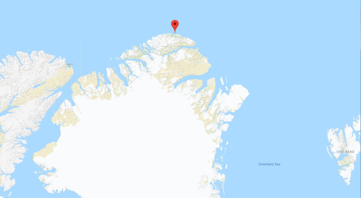
The region causing all the kerfuffle is at the northernmost tip of Greenland (see map below), where there is a weather station at Cape Morris Jesup. Next-nearest stations are at Alert, Canada (to the west) and Longyearbyen, Svalbard (Norway, to the east).
Arctic temps spike over 30 degrees in the midst of winter (The Weathern Network, Friday, February 23, 2018) included the tweet below, showing a fracture of sea ice north of Greenland so transient that it does not show up on daily sea ice maps:
“Along with those spikes in temperature, Lars Kaleschke’s tweet, above, also shows the large rift in the sea ice that opened up just north of Cape Morris Jesup, at the same time. Kaleschke is a professor of sea ice remote sensing at the Center for Earth System Research and Sustainability, at the University of Hamburg, in Germany.“
Summary: Temperature and sea ice “abberations” in northern Greenland are transient phenomena that have clearly happened before (e.g. 2011) without major consequences except perhaps through impacts on eastern Arctic and subArctic weather conditions (including the UK).
Lack of sea ice north of Svalbard in the Barents Sea occuried last year and in 2012 in Februrary. But by mid-to-late March, when seal are beginning to give birth on the ice and polar bears are busy hunting them, ice had again covered the region. This year is likely to be the same. However, we won’t know until the end of March or ealry April if a recovery will or won’t happen, so any alarm-ringing about impacts on Arctic fauna surival have no foundation in fact until then.
Scorsby Sound, East Greenland bear in March 2011. Rune Dietz, press photo.
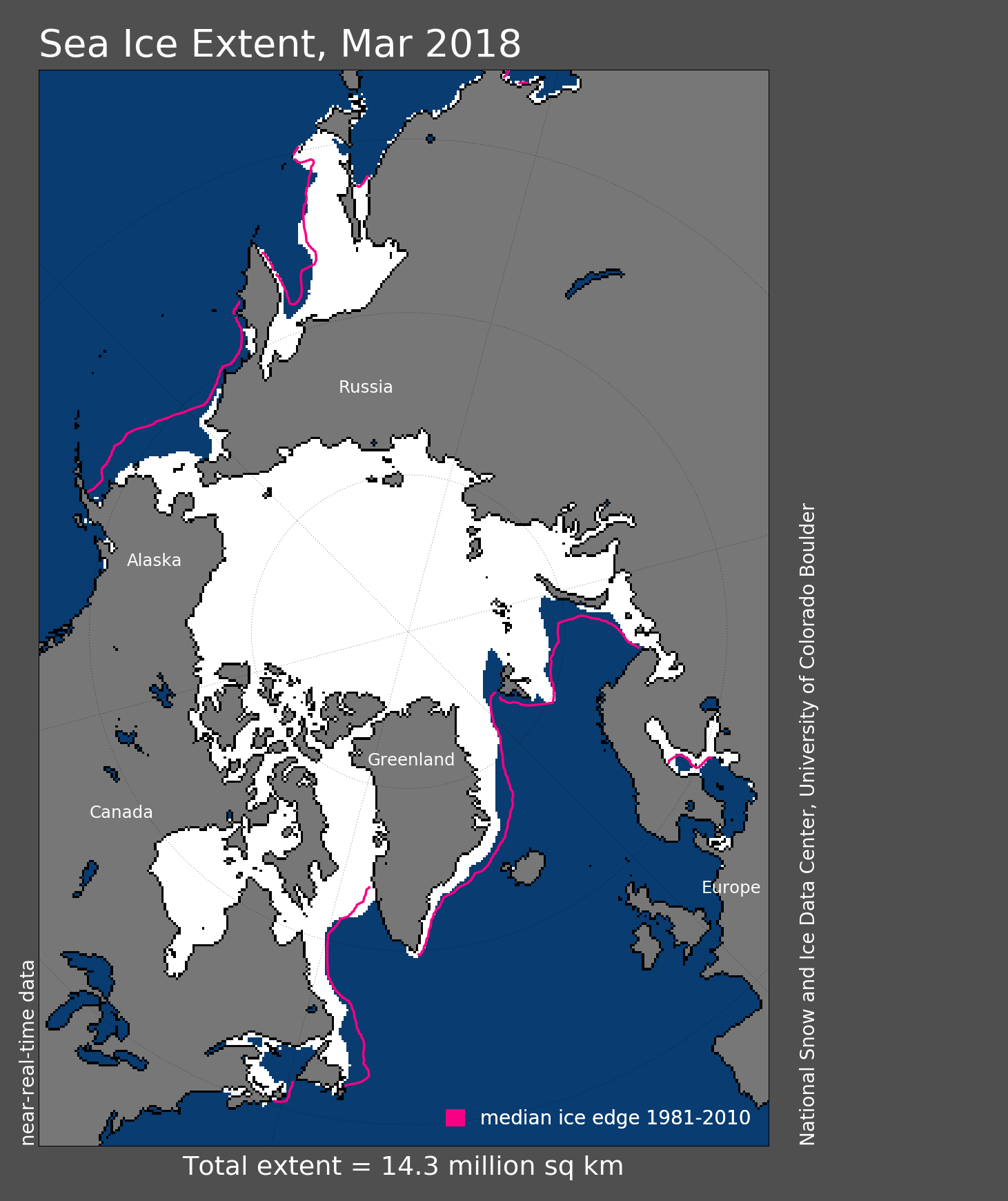
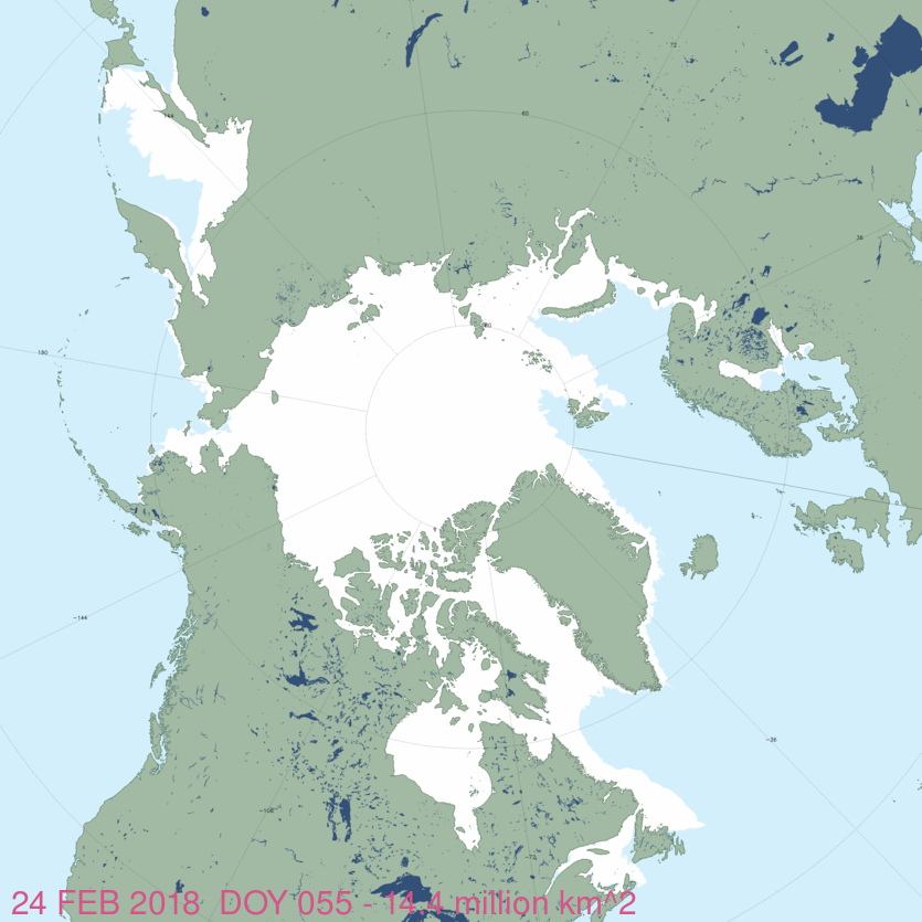
In the Bering Sea, ice extent is well below average for this time of year but studies show the one consistent feature of Bering Sea ice is its variability. Low ice levels have distressing impacts for St. Lawrence island seal and whale hunters. However, there is certainly enough ice in the Bering Sea/Chukchi Sea region for polar bears and Arctic seals to do what they do this time of year (which is try to survive until early April, at which time seals start giving birth to their pups and polar bears start to eat them, with gusto). And the ice season isn’t over: maximum extent of ice in the Bering sea doesn’t usually come until late April or May, and the dramatic decline of mid-February already shows signs of reversing.
Details below this ice map for 24 February 2018, courtesy NSIDC Masie:
PS. I’m off within hours to Toronto for the launch of my State of the Polar Bear Report in honour of International Polar Bear Day, 27 February. Watch for reports in the news and for my op-ed 27 February at the Financial Post.
Comments Off on Histrionics over Arctic temperatures & sea ice extent: implications for polar bears
Posted in Sea ice habitat
Tagged Arctic basin, Bering Sea, Cape Morris Jesup, extent, facts, Greenland, polar bear, press conference, sea ice, spike, State of the Polar Bear, Svalbard, temperature, Toronto
Walrus researchers from the US Geological Survey have a new report on the history of walrus haulouts in the Chukchi and Bering Seas – yet their media efforts (via press release and interviews) fail to mention the relationship between fluctuating size of walrus haulouts and fluctuating walrus population size that is evident in that history. In fact, overall population size is not mentioned at all.

Two articles came out over the weekend that announced the results of this new joint US-Russian initiative [PBS, Walrus beaching in Alaska might not be as harmful as it looks. Here’s why – 31 July 2016 and ADN, Alaska and Russia join forces to create 160-year database of walrus haulouts – 31 July 2016]
But neither articles nor the new USGS paper they are touting (Fischback et al. 2016) mention the huge summer/fall haulouts of females, calves, and juveniles that were documented in the 1970s that coincided with the huge population size at that time, which crashed in the 1980s.
Only now has the population grown (to at least 200,000) to the point that huge haulouts are again being reported – conservation has done it’s job. But when walrus numbers get too high the animals out-strip their food source and numbers plummet, as they did in the 1980s (Fay et al. 1989; Garlich-Miller et al. 2011). See my fully referenced summary paper, Crockford 2014 (On The Beach: Walrus Haulouts are Nothing New).
Here’s the concern: When (not if) a population crash happens again, will it be blamed on global warming rather than natural causes? According to the PBS article:
“The database is supposed to help federal officials with conservation, especially as more ships start sailing through the newly open waters. The U.S. Fish and Wildlife Service is determining whether walrus should be listed as a threatened species.” [my bold]
My GWPF video on the issue (The Walrus Fuss) below:
See excerpts from the USGS database below, with a map:
Comments Off on USGS report on history of walrus haulouts leaves out correlation with population size
Posted in Advocacy, Conservation Status, Sea ice habitat, walrus
Tagged Alaska, beaching, Bering Sea, change, Chukchi Sea, facts, Fischbach, global warming, GWPF, haul out, haulout, history, Point Lay, population size, report, St. Lawrence Island, threatened, USGS, video, walrus, Walrus Fuss


You must be logged in to post a comment.