
I’ve said it before but it’s worth saying again now that the sea ice in the Arctic is approaching its seasonal maximum extent and thickness: polar bears are limited by winter sea ice extent (Fig.1), not by the minimum extent of ice in the summer. Otherwise, their distribution would resemble the summer sea ice minimum (Fig. 2), not the winter maximum.
Despite the hue and cry about “declining sea ice,” polar bears are still as well distributed throughout their available winter habitat as they were in 1979, when detailed sea ice records began – see the map below. See further details on polar bear distribution here.
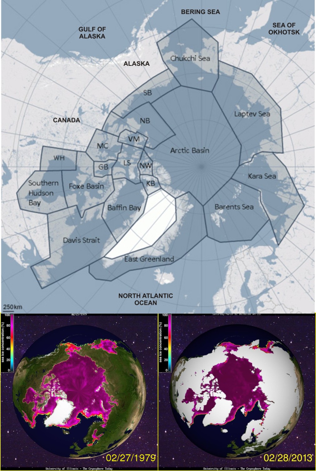
Figure 1. Polar bear distribution map (adapted from the one provided by the PBSG) compared to sea ice concentration at Feb 28 (at or near the seasonal maximum extent) 1979 and 2013. I can’t see a difference – can you see a difference? The only place there is consistently sea ice in winter but not polar bears is the Sea of Okhotsk, but there is no evidence that polar bears have ever lived there despite the presence of seals. Click to enlarge


You must be logged in to post a comment.