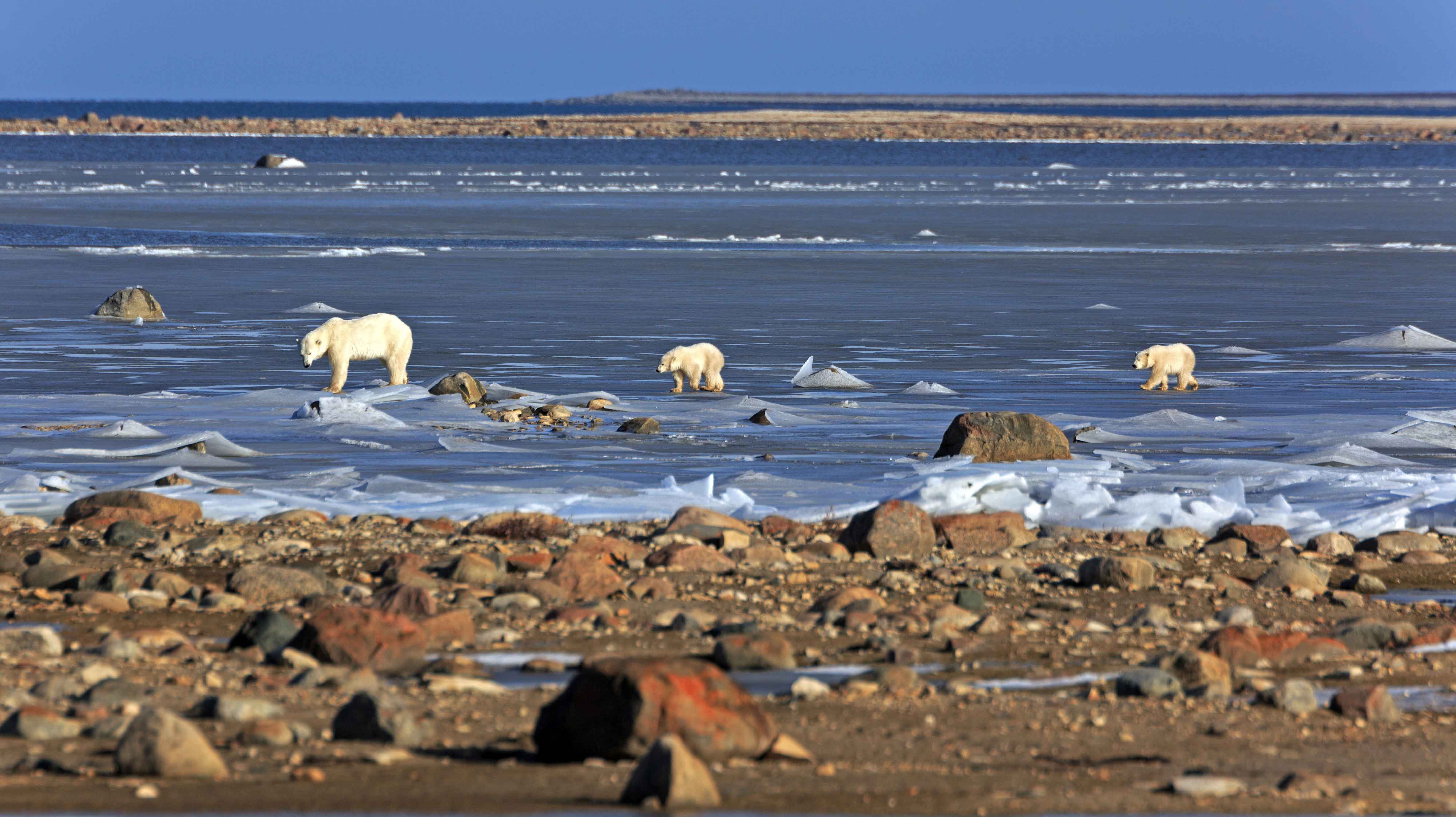
Tag Archives: ice thickness

Earth Day sea ice habitat during critical spring season for Arctic seals, polar bears, and walrus

This is the most important time of year for Arctic marine mammals that spend time above the ice: birthing, breeding, and feeding. And there is plenty of the right kind of ice available for those activities this year, as there was two years ago at the same time.

Continue reading

Good news for polar bears and seals: new study finds multiyear Arctic sea ice is getting thinner

The fact that multiyear sea ice got thinner between 2018 and 2021 as documented by a new study, is ultimately good news for polar bears: less multiyear ice compared to first year ice is better for all marine mammals in the Arctic. Polar bears and seals, for example, are dependent on the seasonal ice that forms every winter (Atwood et al. 2016; Durner et al. 2009). Multiyear ice is simply too thick for any purpose except as a summer refuge for polar bears (for which land will do just as well) and a platform for maternity dens over the winter, for which thick first year ice will often do just as well (Anderson et al. 2012; Rode et al. 2018).

Continue reading

Surprising sea ice thickness across the Arctic is good news for polar bears

This year near the end of May the distribution of thickest sea ice (3.5-5m/11.5-16.4 ft – or more) is a bit surprising, given that the WMO has suggested we may be only five years away from a “dangerous tipping point” in global temperatures. There is the usual and expected band of thick ice in the Arctic Ocean across northern Greenland and Canada’s most northern islands but there are also some patches in the peripheral seas (especially north of Svalbard, southeast Greenland, Foxe Basin, Hudson Strait, Chukchi Sea, Laptev Sea). This is plenty of sea ice for polar bear hunting at this time of year (mating season is pretty much over) and that thick ice will provide summer habitat for bears that choose to stay on the ice during the low-ice season: not even close to an emergency for polar bears.

Continue reading

Early freeze-up in progress on Hudson Bay – what a difference a year makes

In contrast to 2016, when freeze-up along Western Hudson Bay was about as late as its ever been (early December), ice is already forming along the shore of northern Hudson Bay. There is much more ice than usual for this date, indicated by the dark blue in the latest weekly ice chart below:

Hudson Bay weekly departure from normal 2017 Oct 30

The ice is still thin, as the chart below indicates, but that’s how freeze-up starts. As long as strong winds don’t blow the ice away (as it sometimes does at this stage), the ice gets thicker day by day — and advances further and further off shore. Polar bears get out on the ice as soon as they are physically able, when the ice is about 3-4 inches thick (about 10 cm) or less.

Hudson Bay North daily ice stage of development 2017_Nov 1

Below is a video of a bear traversing that thin ice yesterday (1 November 2017), near Churchill. Is this a portend of a freeze-up date as early as occurred in the 1980s?
Continue reading

Beaufort Sea fractured ice due to strong Beaufort Gyre action – not early melt

The Canadian Ice Service has a cool NASA animated video showing the Beaufort Gyre in action – you can actually see the solid mass of ice crack and swirl west and north under the pressure of the massive corkscrew current – see original here (tips on getting yourself oriented in the video below the screencap) and view below, for Apri 4- May 3, 2016:

Beaufort Gyre video screencap_21 April 2016_labelled

Note that the video is oriented with Banks Island on the bottom and the shore of Alaska along the left-hand side, as if the locator map provided was rotated as below:

Beaufort Gyre video screencap_locator map_rotated

The big ‘bite” of ice being torn out to the south of Banks Island is the Amundsen Gulf.

The caption for the NASA video says this (my bold):

“MODIS Terra imagery taken between April 4 and May 3, 2016 of the Beaufort Sea. The animation highlights the gradual ice breakup due to the Beaufort gyre.

So, early breakup here is due to Beaufort Gyre action – not early seasonal melt.
Continue reading

Tracking polar bears in the Beaufort Sea – new crop of tagged bears for 2016

Five more bears were tagged near the Southern Beaufort Sea coast last month, all in the western portion of the coast where Chukchi Sea bears are often encountered. They join the one female who seems to have made a den way out over the continental shelf, where she’s been all winter.

putting_collar_on_polar_bear_slider_USGS

This is the March 2016 follow-up to my post on the July 2013 track map for female polar bears being followed by satellite in the Beaufort Sea by the US Geological Survey (USGS) – “Ten out of ten polar bears being tracked this summer in the Beaufort Sea are on the ice.”

Five tagged bears are relatively few compared to eight last spring, and thirteen in 2013 [added to 7 from the previous year for a total of twenty, which were down to 13 by June]  but the same as five tagged in 2014.  This spring, three of the USGS tagged bears have glue-on transmitters, which means they are either males or juvenile bears rather than females (which are fitted with collars):

“In collaboration with the U.S. Fish and Wildlife Service we are also experimenting with glue-on and ear tag satellite transmitters, which can be deployed on adult male bears and younger, still-growing bears.”

Continue reading

W. Hudson Bay polar bear numbers declined then stabilized, says new paper

Polarbear_Parks Canada Wapusk in August

Western Hudson Bay bear, Wakusp National Park, August 2011.

In the just-published version of their Western Hudson Bay (WHB) population survey conducted in 2011, Nick Lunn and colleagues highlighted in the abstract:

“Our analysis suggested a long-term decline in the number of bears from 1,185 (993-1411) in 1987 to 806 (653-984) in 2011…” 

But they didn’t mention that the 806 estimate for 2011 was based on only a portion of the WHB region (Fig. 1) and has not been accepted by their peers as a valid estimate of the population size. They also failed to mention that the decline occurred due to thick spring ice and/or unsuitable snow conditions for ringed seals between 1989 and 1992 (Fig. 2), which resulted in reduced availability of polar bear prey (as I discussed in detail in Crockford 2015).

They know the “long-term” population decline is what the media will grab onto and run with – rather than the next sentence, which says “In the last 10 years of the study, the number of bears appeared stable due to temporary stability in sea ice conditions.

In other words, their study shows there has been no decline in the population since 2004, which had been predicted to occur (see previous post, Prediction #1), and there has been no trend in either breakup or freeze-up dates between 2001 and 2010 (or since). See previous post on the government report on which this paper is based here.

The bottom line is this: no one is buying this population estimate of 806 bears for the Western Hudson Bay population – both the IUCN Polar Bear Specialist Group and Environment Canada are using Seth Stapleton and colleagues (2014) estimate from their aerial survey done the same year and that official population size number is 1030 bears. Continue reading

Tracking polar bears in the Southern Beaufort June 2015 – all 17 bears out on the sea ice

Sixteen females with satellite collars plus one with a glue-on transmitter – down from 17 with collars and 6 with tags last month – all out on the ice during the month of June 2015.

Tranquilized_pb570_S Beaufort March 2014_USGS

Polar bears were captured by USGS biologists in 2014 and 2015 on the spring-time sea ice of the southern Beaufort Sea. The glue-on tags don’t seem to be holding up very well, with only one remaining out of the original eight deployed this spring.
Continue reading

Beaufort Sea polynyas open two weeks before 1975 – open water is good news for polar bears

With masses of very thick, multiyear ice off Alaska this spring, the developing polynyas (open water) at either end of the Beaufort Sea are providing essential polar bear hunting habitat.

SB polynyas on ice thickness map 14 May 2015_PolarBearScience

Patches of open water in the Beaufort Sea are naturally recurring phenomena. This year we have two excellent examples, shown by the yellow arrows in the sea ice thickness map above (from the Naval Research Laboratory).

The eastern-most polynya forms in the Canadian portion of the Beaufort most years in the spring. This open water feature is so common it has a name – the Cape Bathurst polynya. Last year, there wasn’t an obvious polynya there until sometime in June, but in 1975, a patch of open water almost as large (or larger) as this year’s had developed by the end of May (Fig. 1).

Figure 1. Cape Bathurst polynya at 28 May 1975 (Smith and Rigby 1981: Fig. 14h), with the extent probably underestimated, and the polynya this year at 14 May (Canadian Ice Service). Click to enlarge.

Figure 1. Cape Bathurst polynya at 28 May 1975 (Smith and Rigby 1981:Fig. 14h) and the polynya this year at 14 May (Canadian Ice Service). See discussion in the text below about the relative sizes. Click to enlarge.

According to the experts that study them, the timing and extent of the polynya formation depends on wind (Dunbar 1981:29), not temperature. This means that this spring’s polynya formation in the eastern Beaufort isn’t a symptom of global warming, it isn’t missing polar bear habitat,” and it isn’t a sign of early sea ice breakup.

In fact, the Cape Bathurst polynya is a critical place for ringed seals and bearded seals to congregate in spring. Therefore, this is where many Southern Beaufort polar bears go to hunt. The presence of the polynya is especially crucial in years like this one, when very thick sea ice covers most of the Beaufort Sea.  Continue reading

Polar bears are not in peril due to recent sea ice changes

To counter the misleading ploy used by the Sunday Times — of implying polar bears are in peril because of recent changes in Arctic sea ice (Sunday Times & The Australian, 21/22 Sept. 2014 Arctic ice cap in a ‘death spiral’) — I’ll go over again why the polar bear as a species is not threatened by declines in summer sea ice or even winter ice that is predominantly “thin” (first year) ice.

Polar Peril_Arctic ice cap in a death spiral_SundayTimes_Sept 21 2014_21_NWS_20_POLAR_1096592k
Graphic above from the Sunday Times, September 21, 2014
Continue reading