
USGS biologists were clearly busy this spring putting more satellite radio collars and glue-on tags on Southern Beaufort Sea polar bears but there’s some surprising information in their April 2015 tracking map about current sea ice conditions.
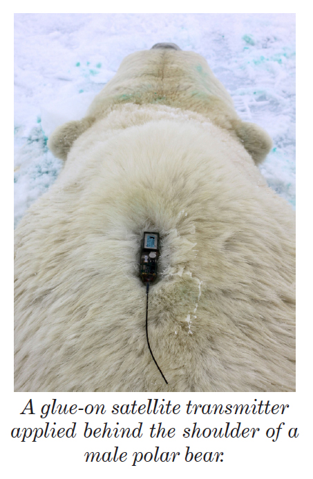
From the 2013-2014 issue of “Polar Bear News” (USFWS).
What’s interesting is that the sea ice maps they use show less dark spots that might be open water this year than were present last year in late April. Oddly, this phenomenon has one prominent biologist worried about “challenging” polar bear habitat developing this year – without mentioning last year at all.
The USGS track map for April 2015 is copied below.1
Continue reading


You must be logged in to post a comment.