
Walt Meier, sea ice scientist at NASA Goddard, made a statement yesterday about this year’s ice conditions [2016 Climate Trends Continue to Break Records: July 19, 2016]:
“It has been a record year so far for global temperatures, but the record high temperatures in the Arctic over the past six months have been even more extreme,” Meier said. “This warmth as well as unusual weather patterns have led to the record low sea ice extents so far this year.“ [my bold]
Well, except for Davis Strait/Labrador Sea this spring. And Western Hudson Bay/Foxe Basin this month – plus the fact that late July sea ice in the Laptev Sea is higher than it’s been for more than a decade (more on that below).
I guess totals matter for some things – just not for polar bears. However, it’s nice to see the issue of melt ponds get some attention, since they are such a prominent feature of polar bear habitat during the summer melt season.
Sea ice melt ponds get air time
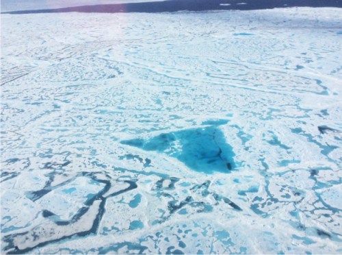
Courtesy of NASA, we now have some very nice photos of Arctic melt ponds in the Beaufort Sea:
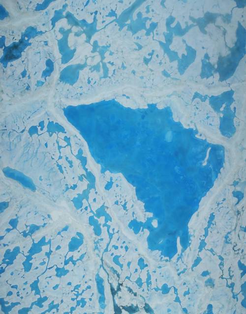
“A large pool of melt water over sea ice, as seen from an Operation IceBridge flight over the Beaufort Sea on July 14, 2016. During this summer campaign, IceBridge will map the extent, frequency and depth of melt ponds like these to help scientists forecast the Arctic sea ice yearly minimum extent in September. Credits: NASA/Operation IceBridge”
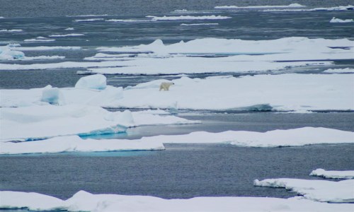
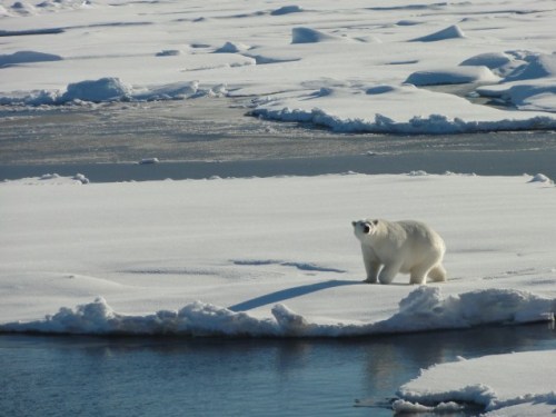
Those would be the melt ponds that make it appear that polar bears with satellite radio collars are standing in open water – as discussed here and here – and which make determining how much sea ice there really is at this time of year at bit error-prone. In other words, there is generally more ice out there than satellites detect – but polar bears know how to use it (Coast Guard photo below from August 2015).
Below, another view of melt ponds in the Beaufort Sea at mid-July 2016 (courtesy NASA ICEBRIDGE):
And in the Chukchi Sea (below):
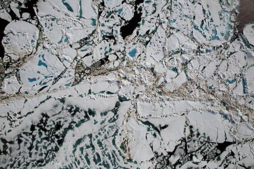
“Chunks of sea ice, melt ponds and open water are all seen in this image captured at an altitude of 1,500 feet by the NASA’s Digital Mapping System instrument during an Operation IceBridge flight over the Chukchi Sea on Saturday, July 16, 2016.” [2016 Climate Trends Continue to Break Records: July 19, 2016]
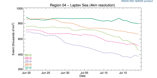
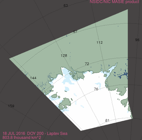
Meanwhile, the Laptev Sea is choked with ice
You might not have noticed, but directly across the Arctic Basin from northern Greenland, the ice off central Siberia is thicker than it’s been in more than a decade. And that means that the Northeast Passage from Europe to Asia along the Siberian coast is currently impassable (which is probably always true at this time of year for boats without an icebreaker escort).
Not much is known about Laptev Sea polar bears (e.g. Belikov et al. 1998) but the best guess estimate puts the population size at about 800-1200 (Wiig et al. 2015).

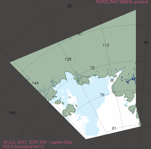
Compare the ice charts below, from NSIDC Masie (at 18 July), to this year (2016):
2006, 18 July (earliest year available):

2007, 18 July:
2012, 18 July:

2014, 18 July:

2015, 18 July:

References
Belikov, S.E., Garner, G.W., Wiig, Ø., Boltunov, A.N. and Gorbunov, Y.A. 1998. Polar bears of the Severnaya Zemlya Archipelago of the Russian Arctic. Ursus 10:33-40. Pdf here.
Wiig, Ø., Amstrup, S., Atwood, T., Laidre, K., Lunn, N., Obbard, M., Regehr, E. & Thiemann, G. 2015. Ursus maritimus. The IUCN Red List of Threatened Species 2015: e.T22823A14871490. Published online here


You must be logged in to post a comment.