
What did I tell you, back in mid-September?
Have a look at all the polar bear habit, ten days shy of the end of November!
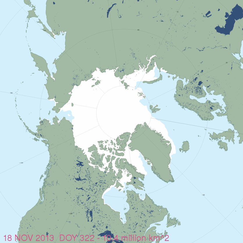
Figure 1. MASIE sea ice extent for November 18, 2013 (using US National Ice Center data). You have to look closely but there is indeed ice forming around Svalbard (just above the tip of Greenland) and in James Bay (southern Hudson Bay). Click to enlarge. High resolution map here.
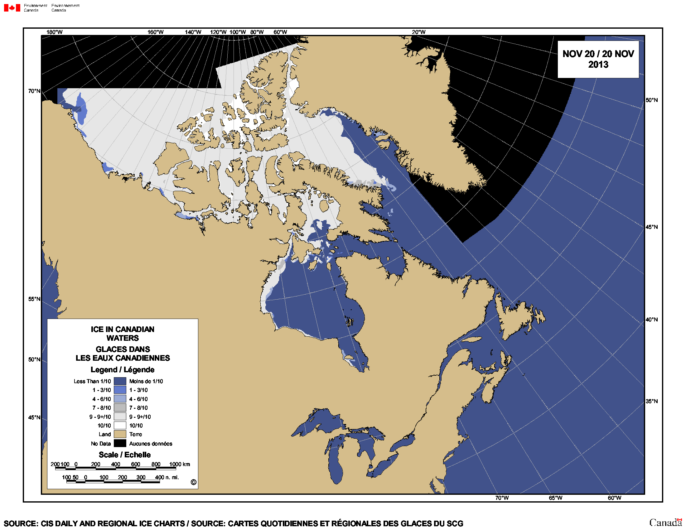
Figure 2. Canadian Ice Service map. Ice developing rapidly in northern Hudson Bay, Foxe Basin and Davis Strait (between southern Greenland and Baffin Island), with ice also forming along the shore in James Bay (the southern-most region where polar bears are onshore at the moment). Click to enlarge.


You must be logged in to post a comment.