
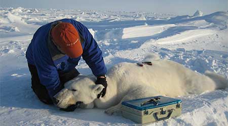
Here is the March 2015 follow-up to my post on the July 2013 track map for female polar bears being followed by satellite in the Beaufort Sea by the US Geological Survey (USGS) – “Ten out of ten polar bears being tracked this summer in the Beaufort Sea are on the ice.”
See that post for methods and other background on this topic, and some track maps from 2012 (also available at the USGS website here). The USGS track map for March 2015 is copied below.
Three out of eight female bears tagged in the Southern Beaufort Sea were in the Chukchi Sea subpopulation region during March – not surprising, many bears cross this “boundary.”
Figure 1. From original caption: “Movements of 8 satellite-tagged polar bears for the month of March, 2015. Polar bears were tagged in 2014 on the spring-time sea ice of the southern Beaufort Sea. All eight of these bears have satellite collar transmitters.” Ice map for 30 March, 2015. Original here.
Note that the circles with the polar bear icons are the end points (final positions for the month), while the tail ends of the strings are the positions at the first of the month.
See last month’s map is copied below, discussed here.
Figure 2. Movements of 7 satellite-tagged polar bears for the month of February, 2015. Polar bears were tagged in 2014 on the spring-time sea ice of the southern Beaufort Sea. All seven of these bears have satellite collar transmitters. The teal-green track was not present in January. Polar bear satellite telemetry data are shown with AMSR2 remotely-sensed ice coverage for 28 February, 2015. Click to enlarge. Original here.


You must be logged in to post a comment.