
Have polar bears suffered a contraction of their historical range due to recent declines in summer sea ice? Buried in a recent journal article lies such a claim, one I can’t recall having seen before. That makes it worth close examination.
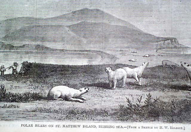
A drawing of polar bears on St. Matthew Island that accompanied the May 1, 1875 Harper’s Weekly Journal of Civilization article written by Henry Elliot. See here.
The assertion appears in the introduction of a recently published paper that got a lot of attention online (“Implications of the Circumpolar Genetic Structure of Polar Bears for Their Conservation in a Rapidly Warming Arctic” by Peacock and colleagues (2015), discussed previously here, news coverage here and here).
Here is how the authors put it:
“There is already evidence of change in the contemporary distribution of polar bears. For example, polar bears, once common in Newfoundland [29], are now seen there only infrequently and in small numbers. Similarly, polar bears once regularly summered on St. Lawrence and St. Matthew islands in the Bering Sea [30–32]. Now they are irregularly observed in the Bering Sea and do not spend summers on St. Matthew Island. Although these changes in polar bear distribution may also have been related to overharvest, the recent reductions in the extent of sea-ice due would prevent current and regular use of these areas.” [my emphasis]
There are three main reasons the claim doesn’t hold up to scrutiny:
Continue reading


You must be logged in to post a comment.