Tag Archives: shorefast ice

Polar bears of SE Greenland get shorefast ice necessary to hunt seals: not so unique after all

The 234 or so polar bears inhabiting the SE tip of Greenland, said to be genetically and ecologically unique because they are “surviving without ice“, have been experiencing sea ice formation along the shoreline this month just like other bears across the Arctic. Recall that shorefast ice formation attracts seals in the fall, which polar bears hunt successfully, and the following spring (April/May) provide a platform for ringed seals to give birth to their pups, which polar bears eat with gay abandon.

The photo above was taken by Kristin Laidre in March 2016: a bear this fat at the end of winter (i.e. before ringed seals are born in the spring) is living in productive habitat.

Continue reading

Late freeze-up for W. Hudson Bay polar bears at odds with ice conditions elsewhere

Sea ice is finally starting to form along the western shore of Hudson Bay, lagging well behind ice formation in the rest of the Arctic. Oddly, however, last year it was just the opposite: some WH bears were able to start hunting as early as 31 October (see photo below) while ice formation lagged behind in the Chukchi and Barents Seas.

Continue reading

Shorefast ice formation and the fall feeding season for polar bears

What may seem like a silly question is actually fundamental to polar bear survival: in the fall, why do Western Hudson Bay bears correctly expect to find seals in the new ice that forms offshore? Why are seals attracted to that new ice – called ‘shorefast ice’ or ‘fast ice’ – when they would clearly be safer out in the open water where there is no ice and no bears?

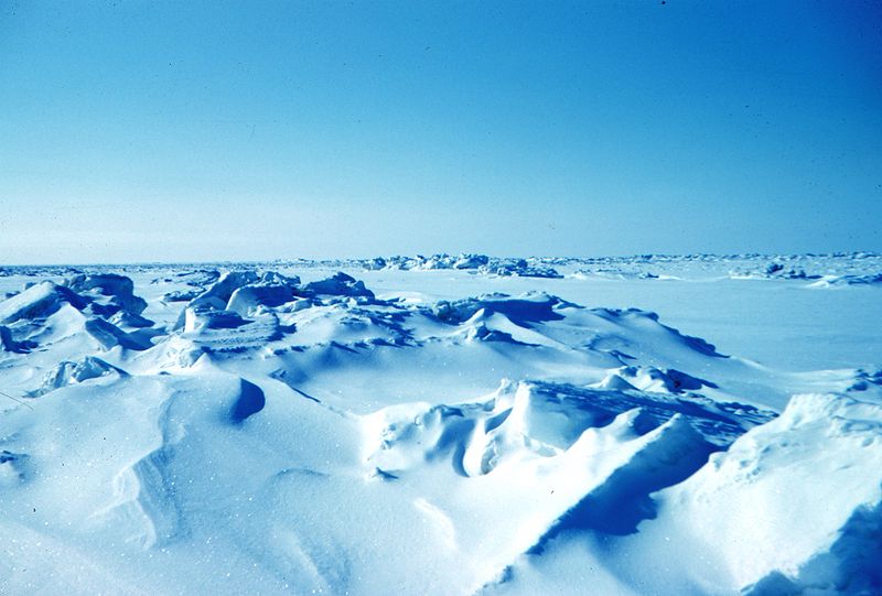
As the picture below attests, polar bears can and do kill ringed seals in the new ice that forms off the coast of Western Hudson Bay even when it is but a narrow strip of thin ice – and so close to shore their successes can be caught on camera.

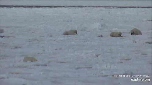
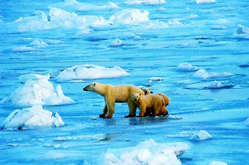
Three adult male polar bears share a seal kill on the newly-formed ice off Wapusk National Park, Western Hudson Bay. 5 November 2020. Buggy cam, Explore.org

A different bear was also filmed killing another seal on 31 October. And these are only the kills we know about along a very short stretch of coast – the killing is almost certainly going on up and down the entire coast, into James Bay (see below), where there is just as much ice but no cameras.

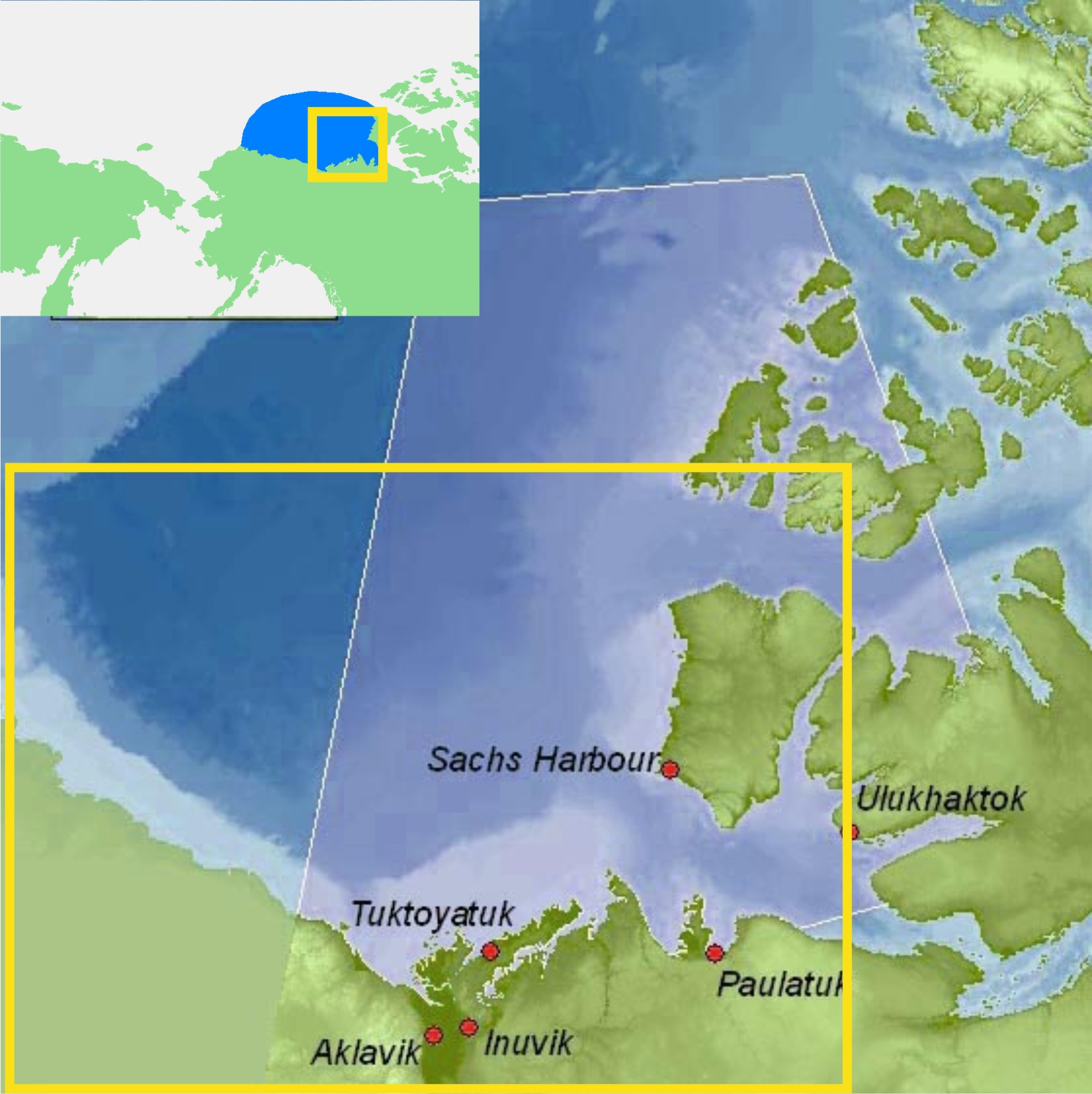
As far as I am aware, this seal killing by polar bears goes on in newly-formed shorefast ice everywhere across the Arctic in early fall, not just in Hudson Bay. Although the timing varies, virtually everywhere in the peripheral seas of the Arctic Ocean (Barents, Kara, Laptev, Chukchi, Beaufort, as well as Baffin Bay and Davis Strait), shorefast ice forms before the mobile ice pack expands to meet the ice developing from shore.

This shorefast ice formation in fall provides a predictable but short-lived source of prey for polar bears as they strive to regain some of the weight lost over the summer.

Continue reading

Some surprises in polar bear sea ice habitat at mid-October 2020

Arctic sea ice has been growing steadily since the minimum extent was reached a month ago, with shorefast ice now developing along the Russian and Alaskan coastlines as ice cover expands in the Central Canadian Arctic. So while it’s true that the main pack of Arctic ice is far from the Russian shoreline, rapidly developing shorefast ice will allow bears to begin hunting seals long before ice in the central Arctic Basin reaches the Siberian shore, as they do in Western and Southern Hudson Bay every fall.

Cropped sea ice extent at 15 October 2020 (Day 289), NSIDC Masie.

And speaking of Western Hudson Bay, it’s a very slow season around Churchill for problem polar bears (photo below) – the quietest mid-October for the Polar Bear Alert Program in the last five years and perhaps the quietest in decades (which I could say for sure if I had the records but I do not).

Continue reading

New ice on Hudson Bay a week earlier than 2017: another early freeze-up ahead?

Last year, an early freeze-up of Western Hudson Bay sea ice almost ruined the Polar Bear Week campaign devised by Polar Bears International to drum up donation dollars and public sympathy for polar bear conservation. Many bears were on the ice hunting by 7-8 November in 2017 before the celebratory week was done (the average date that bears left the ice in the 1980s): sea ice charts suggest the same may be happening this year.

Polar bears off Churchill_2000-11-20_wikipedia

Ice is forming along the Hudson Bay coast more than a week earlier than it was last year (barely discernible on the map below but detailed ice charts show it clearly), consistent with early build-up of ice in the Canadian Archipelago, East Greenland, and Foxe Basin since mid-September.

Sea ice Canada 2018 Oct 23

The question is: will the ice continue to build over the next few weeks or get blown offshore? See the ice charts below for this year and 2017.
Continue reading

Svalbard polar bears thrive in part due to ringed seal pups in the spring pack ice

Few people know that Arctic ringed seals (Phoca hispida, aka Pusa hispida) give birth and breed in the offshore pack ice in the spring, as it is seldom mentioned by either seal or polar bear specialists.

While it is true that some ringed seals give birth in stable shorefast ice close to shore, many others give birth well offshore in thick pack ice – where polar bears also live and hunt in the spring but where few Arctic scientists ever venture – and the existence of pack ice breeding ringed seals is one of the reasons that polar bears are such a resilient species.

ringed-seal-in-snow-cave_b-kelly-wikipedia

Ringed seal pup in a snow cave, B. Kelly photo (Wikipedia).

As a consequence, despite fears expressed by Ian Stirling, low shorefast ice and associated snow around Svalbard this winter (and any time in the past) is not necessarily a hindrance to polar bear survival because there are ringed seal pups available out in the surrounding pack ice – where bearded seals also give birth.

Of course, ringed seals pups are also available to Svalbard polar bears in the shorefast ice in the Franz Josef Land archipelago to the east (see map below) but it is the pups born in the offshore pack ice that are of interest here. The existence of pack ice breeding ringed seals may be why Norwegian biologists do not currently monitor ringed seals in the Barents Sea, despite many years of poor ice conditions around Svalbard in spring – this simply is not a species of concern.

barents-sea-ice-2017-feb-6_nis

The fact that distinct ringed seal ecotypes (or habitat-specific morphotypes) exist in the Arctic – one that gives birth and breeds in shorefast ice and another that gives birth and breeds in offshore pack ice, perhaps driven by competition for limited shorefast ice habitat – is a phenomenon a colleague and I discussed in a peer-reviewed book chapter published several years ago. Have a look at the excerpt below and see what you think.

Save

Continue reading

Kaktovik polar bears could be back on the ice this weekend

This is a quick follow up on my last post (here) on Kaktovik polar bears of the Southern Beaufort Sea subpopulation.

Kaktovik is the bright pink dot on the ice map below (October 3, 2013: click to enlarge), from the Canadian Ice Service – if the ice doesn’t get to the polar bears waiting on shore this weekend, it will be within swimming distance.

Note that this map doesn’t show the shorefast ice that is already forming along the beaches, bridging the gap between land and the offshore ice.

Shorefast ice provides the fall’s first ice platform for polar bears to hunt seals. It doesn’t need to be extensive for the bears to get out there — researchers working in Western Hudson Bay found that an ice concentration of only 10% marked the point when polar bears left the shore.

Kaktovik on CIS chart Oct 3 2013

Why is it that every decade, Eastern Beaufort sea ice gets really thick?

I’ve written before about the incidents of starving polar bears in the eastern portion of the Southern Beaufort Sea (here, here, and here). For two or three years every decade since the 1960s, shorefast ice in the Eastern Beaufort (Fig. 1) has become too thick and compressed in the spring for ringed seals to maintain their breathing holes, so most or all of them presumably go elsewhere — as seals did in Greenland when ice got too thick there (Vibe 1965). With few or no seal pups born during March and April in thick ice years, some bears had a hard time finding enough food: starving bears and dying cubs were the result.

Figure 1. Eastern portion of the southern Beaufort Sea.  The communities of Tuktoyatuk (locally known as ‘Tuk’), and Sachs Harbour on southern Banks Island, have been useful starting points for polar bear research because they are accessible by plane via the larger community of Inuvik The light blue portions, e.g. along western Banks Island and the Eastern Beaufort/Yukon mainland coast, indicate shallow continental shelf areas (20 km wide in places) where extensive shorefast ice develops every winter. Main map from Beaufort Sea Partnership, inset map from Wikipedia.

Figure 1. ‘Eastern Beaufort’ (yellow square) polar bear study region.
The communities of Tuktoyatuk (locally known as ‘Tuk’), and Sachs Harbour on southern Banks Island have been used as base camps for polar bear research because they are accessible by plane via the larger community of Inuvik.
The light blue portions along western Banks Island and the Eastern Beaufort/Yukon mainland coast indicate shallow continental shelf areas (20 km wide in places) where extensive shorefast ice develops every winter.
Main map from Beaufort Sea Partnership, inset map from Wikipedia.

I’ve been trying to get my head around why this would happen in the Eastern Beaufort. Once or twice – maybe – but several times every decade? What on earth drives such a process?

So, I did some reading (actually, quite a lot of reading) and have what appears to be at least a partial answer.

All indications are that the occasional development of exceptionally thick spring ice in the Eastern Beaufort is the result of an entirely natural, cyclical phenomenon. However, some polar bear biologists are attempting to blame the latest episode (but not earlier ones) on increased amounts of open water in the Chukchi Sea during fall of the early 2000s. That doesn’t seem a plausible explanation to me, given the history of the sea ice in this region. Have a look.

Figure 2. Beaufort sea pressure ridges, spring 1949. Courtesy Wikipedia (from NOAA “At the ends of the Earth” image collection #corp1014).

Figure 2. Beaufort sea pressure ridges, spring 1949. Courtesy Wikipedia (from NOAA’s “At the ends of the Earth” image collection #corp1014).

Continue reading

Sea ice maximum reached March 15: what it means for polar bears

On Monday, March 25, the National Snow and Ice Data Center (NSIDC) announced that March 15 2013 was likely the maximum extent reached this winter. Note that just a few days ago, I discussed the relationship between maximum extent of sea ice and the global distribution of polar bears around the Arctic (see March 20th post here).

NSIDC says: “Arctic sea ice extent on March 15 was 15.13 million square kilometers (5.84 million square miles). The orange line shows the 1979 to 2000 median extent for that day. The black cross indicates the geographic North Pole.”

NSIDC says: “Arctic sea ice extent on March 15 was 15.13 million square kilometers (5.84 million square miles). The orange line shows the 1979 to 2000 median extent for that day. The black cross indicates the geographic North Pole.” Click to enlarge.

Continue reading