Tag Archives: Beaufort Gyre

Much more sea ice in NW Hudson Bay this year than 2016 or 2015 at 27 May

In recent years, sea ice loss over Hudson Bay has begun with open water in the NW corner (which is just as likely due to prevailing offshore winds as ice melt) rather than along the east coast but this year that patch of ice is smaller than its been for the last two years. In addition, despite two patches of open water at either end of the Beaufort Sea, most of the coast of Alaska is still covered in thick ice — much more than existed last year, yet masses of polar bears did not die as far as I know (actually, WHB bears came ashore in excellent condition last year).

Sea ice Canada 2017 May 27

Compare to previous years:

Continue reading

Southern Beaufort sea ice melt in May: good news for polar bears or catastrophe?

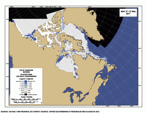
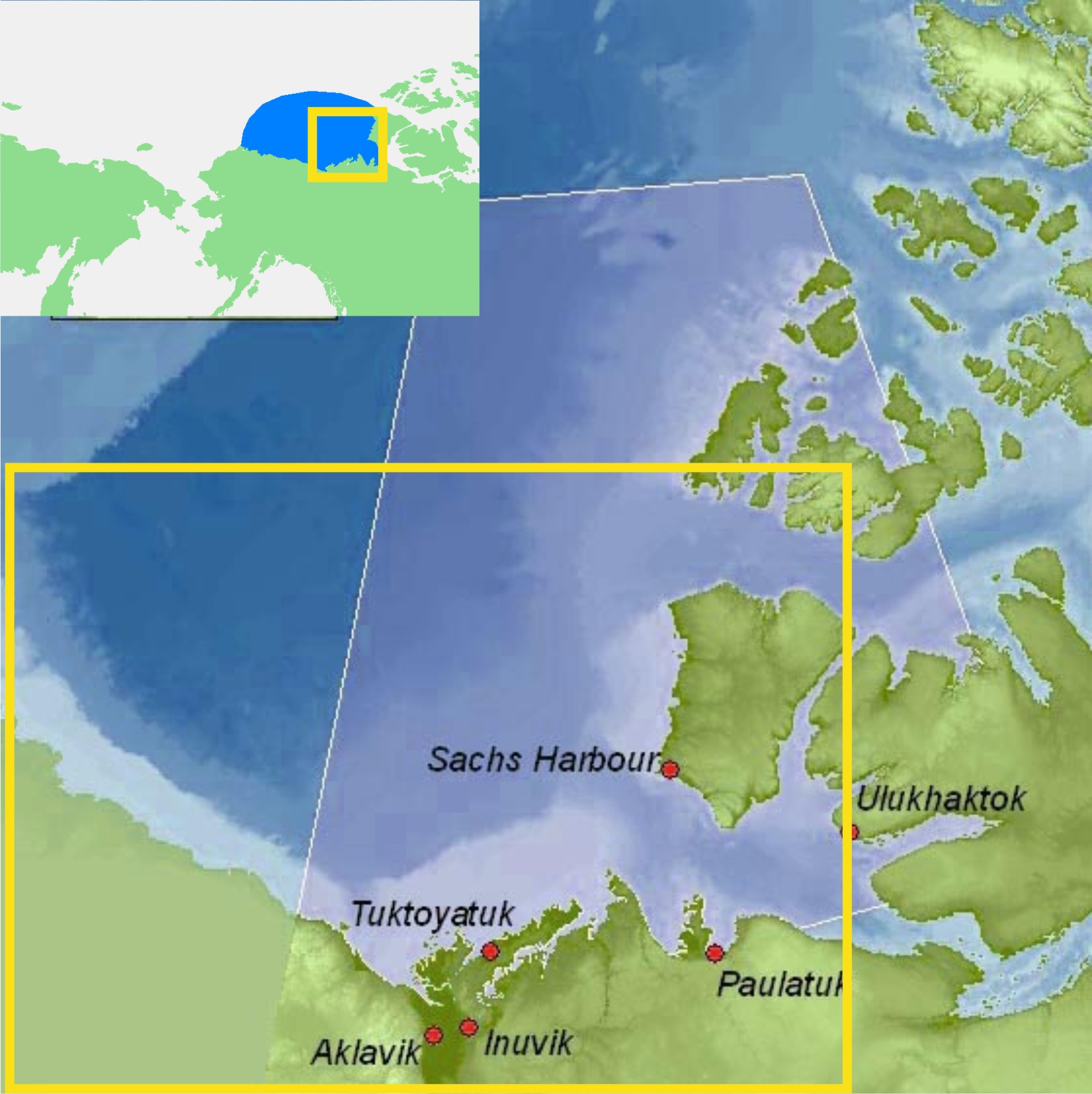
Last week biologist Andrew Derocher recently implied via twitter that less sea ice in the eastern portion of the Southern Beaufort (SB) this year at mid-May is harmful to polar bears (calling it “a hole in the ice where polar bears used to live“), but both long-term and short-term data don’t support such a glass-half-empty interpretation.

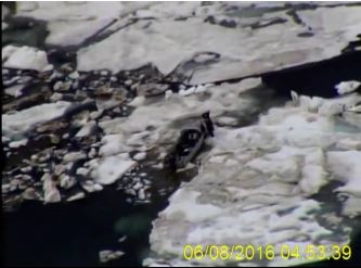
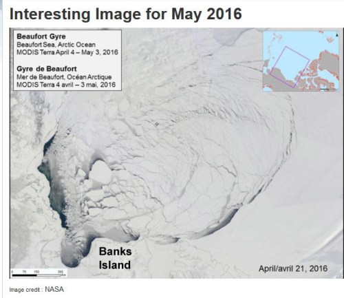
Not only does spring breakup of sea ice in the SB normally begin with such open patches of water (see the video above from last year) — driven by the powerful currents of the Beaufort Gyre, not ice melt (explained in detail here) — it may actually be necessary for the survival of local seals, polar bears and whales in spring and early summer (Citta et al. 2015; Crawford et al. 2015; Harwood et al. 2015; Stirling et al. 1981).

As I’ve pointed out before, the biggest threat to SB bears is thick sea ice in spring and its associated late breakup, a 2-3 year-long phenomenon unique to this region known to have occurred about every 10 years since the early 1960s (well documented in the scientific literature) but which has not (as far as I know) happened since 2004-2006.

In other words, a considerable patch of open water and less concentrated ice in the eastern SB around Cape Bathurst is almost certainly a good thing for this particular subpopulation (see previous post here for an in-depth discussion) because historically, when a polynya of some extent has not formed by April or May it has been devastating for local marine mammals.

The fact that an extensive patch of open water existed at mid-May in this region last year and the year before (2015 and 2016) — with no public hue-and-cry about a great dying of SB bears from Derocher or anyone else — suggests that open water in the eastern SB this year is likely to be beneficial for SB polar bears, or at least benign. Continue reading

Ice maps vs. observations in the W. Arctic – polar bear habitat reality check

Last Wednesday (8 June 2016), the US Coast Guard rescued walrus hunters from Shishmaref in the Bering Strait who got stuck in sea ice that is barely visible on sea ice maps. It’s a rare glimpse of what sea ice really looks like up close compared to what you see on the ice maps.

Watch the video here: https://www.dvidshub.net/video/embed/467959

[Unfortunately, the screencaps from the video, like the one below, are less impressive than the film. In the video, you can see the hunters walking on the ice around their trapped boat – the ice does not visibly move]

Shishmaref_ice_CoastGuard 02_8 June 2016

Have a look at the sea ice maps below for the day the incident took place. They show what appears to be hardly any ice in the area.

This is a good lesson for assessing what’s been going on in the Beaufort Sea a bit further east, where winds and currents have opened up a rather large patch of open water surrounded by considerable expanses of sea ice – at issue is the possible impact on polar bear spring feeding for April and May.
Continue reading

Beaufort Sea fractured ice due to strong Beaufort Gyre action – not early melt

The Canadian Ice Service has a cool NASA animated video showing the Beaufort Gyre in action – you can actually see the solid mass of ice crack and swirl west and north under the pressure of the massive corkscrew current – see original here (tips on getting yourself oriented in the video below the screencap) and view below, for Apri 4- May 3, 2016:

Beaufort Gyre video screencap_21 April 2016_labelled

Note that the video is oriented with Banks Island on the bottom and the shore of Alaska along the left-hand side, as if the locator map provided was rotated as below:

Beaufort Gyre video screencap_locator map_rotated

The big ‘bite” of ice being torn out to the south of Banks Island is the Amundsen Gulf.

The caption for the NASA video says this (my bold):

“MODIS Terra imagery taken between April 4 and May 3, 2016 of the Beaufort Sea. The animation highlights the gradual ice breakup due to the Beaufort gyre.

So, early breakup here is due to Beaufort Gyre action – not early seasonal melt.
Continue reading

Why is it that every decade, Eastern Beaufort sea ice gets really thick?

I’ve written before about the incidents of starving polar bears in the eastern portion of the Southern Beaufort Sea (here, here, and here). For two or three years every decade since the 1960s, shorefast ice in the Eastern Beaufort (Fig. 1) has become too thick and compressed in the spring for ringed seals to maintain their breathing holes, so most or all of them presumably go elsewhere — as seals did in Greenland when ice got too thick there (Vibe 1965). With few or no seal pups born during March and April in thick ice years, some bears had a hard time finding enough food: starving bears and dying cubs were the result.

Figure 1. Eastern portion of the southern Beaufort Sea.  The communities of Tuktoyatuk (locally known as ‘Tuk’), and Sachs Harbour on southern Banks Island, have been useful starting points for polar bear research because they are accessible by plane via the larger community of Inuvik The light blue portions, e.g. along western Banks Island and the Eastern Beaufort/Yukon mainland coast, indicate shallow continental shelf areas (20 km wide in places) where extensive shorefast ice develops every winter. Main map from Beaufort Sea Partnership, inset map from Wikipedia.

Figure 1. ‘Eastern Beaufort’ (yellow square) polar bear study region.
The communities of Tuktoyatuk (locally known as ‘Tuk’), and Sachs Harbour on southern Banks Island have been used as base camps for polar bear research because they are accessible by plane via the larger community of Inuvik.
The light blue portions along western Banks Island and the Eastern Beaufort/Yukon mainland coast indicate shallow continental shelf areas (20 km wide in places) where extensive shorefast ice develops every winter.
Main map from Beaufort Sea Partnership, inset map from Wikipedia.

I’ve been trying to get my head around why this would happen in the Eastern Beaufort. Once or twice – maybe – but several times every decade? What on earth drives such a process?

So, I did some reading (actually, quite a lot of reading) and have what appears to be at least a partial answer.

All indications are that the occasional development of exceptionally thick spring ice in the Eastern Beaufort is the result of an entirely natural, cyclical phenomenon. However, some polar bear biologists are attempting to blame the latest episode (but not earlier ones) on increased amounts of open water in the Chukchi Sea during fall of the early 2000s. That doesn’t seem a plausible explanation to me, given the history of the sea ice in this region. Have a look.

Figure 2. Beaufort sea pressure ridges, spring 1949. Courtesy Wikipedia (from NOAA “At the ends of the Earth” image collection #corp1014).

Figure 2. Beaufort sea pressure ridges, spring 1949. Courtesy Wikipedia (from NOAA’s “At the ends of the Earth” image collection #corp1014).

Continue reading