
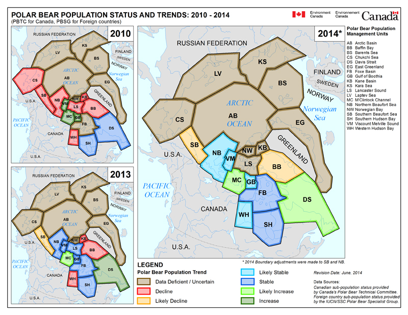
Just out (6 June 2018) — new population assessment and status maps of the 19 polar bear subpopulations according to Environment Canada. Contrary to the map presented at the Range State meeting in February 2018 (pdf here), these maps show Western Hudson Bay and Southern Hudson Bay (along with the Southern Beaufort) as “likely declined.” A new category has been added for the Barents Sea: it’s considered “data deficient/uncertain,” but a population estimate of 2,001-3,000 has been provided.
No press release or other notice regarding the availability of these new maps was issued, as far as I know: I came across them by accident while looking for something else.
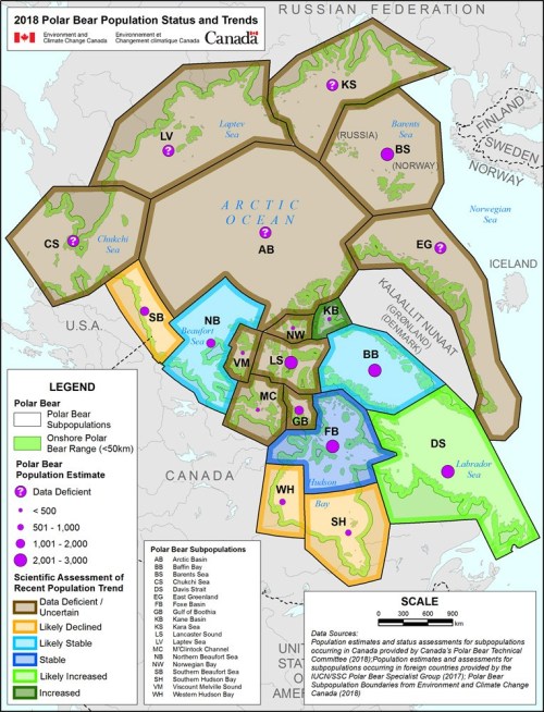
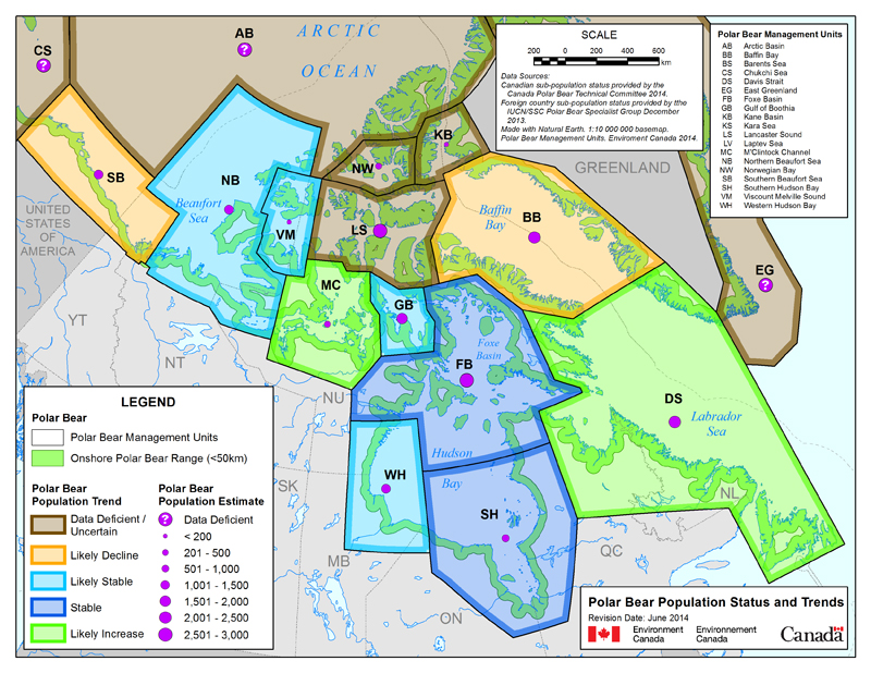
Global map above, more below, including a comparative map that shows 2010, 2014, and 2018 together. I will update the two recent posts of mine (here and here) that used the February Range State map with the information that more recently revised maps are now available.


You must be logged in to post a comment.