Tag Archives: shore leads

Polar bear habitat update mid-May: little change since 1989 despite CO2 increase

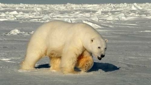
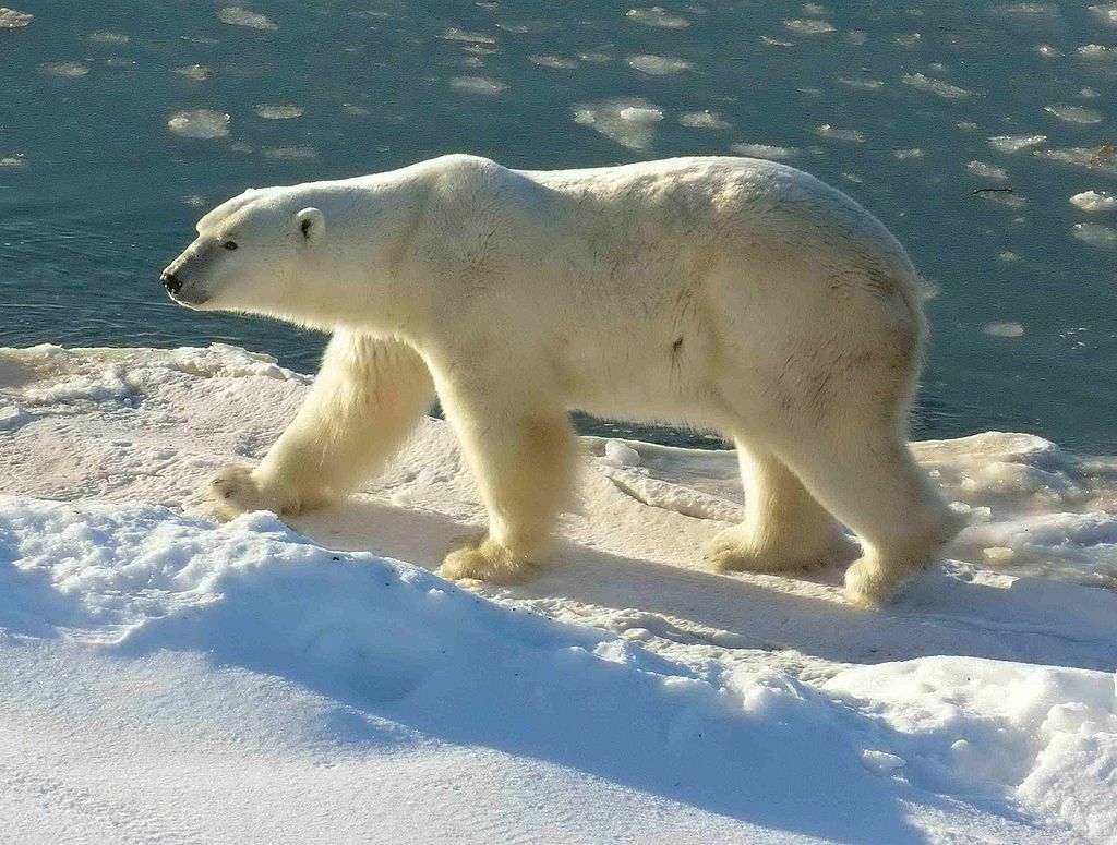
Sea ice habitat for polar bears has not become progressively worse each year during their season of critical feeding and mating, as some scaremongers often imply. It’s true that absolute extent of Arctic ice is lower this spring than it was in 1979. However, according to NSIDC Masie figures, polar bear habitat at mid-May registers about 12 million km2, just as it did in 2006 (although it is distributed a little differently); other data show spring extent has changed little since a major decline occurred in 1989, despite ever-rising CO2 levels.

Polar bear feeding_Shutterstock_sm

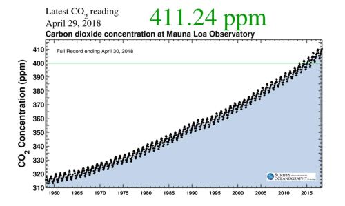
In other words, there has been virtually no change in sea ice cover over the last 12 years, despite the fact that atmospheric CO2 has now surpassed 410 parts per million, a considerable and steady increase over levels in 2006 which were about 380 ppm (see below, from the Scripps Oceanographic Laboratory, included in the Washington Post story 3 May 2018):

Scripps CO2 curve at 29 April 2018

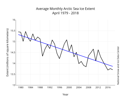
Not only that, but if rising CO2 levels were responsible for the decline of sea ice and implied effects on polar bears since 1979 (when CO2 levels were around 340 ppm), why has spring ice extent been so variable since 1989 (when the first big decline occurred) but so little changed overall since then? See the NSIDC graph below for April:

Sea ice 2018 April average_NSIDC graph

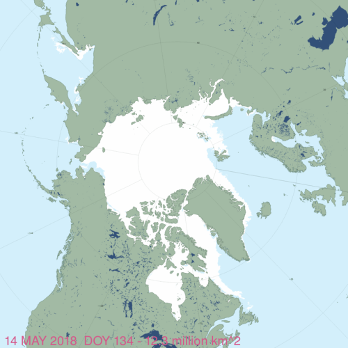
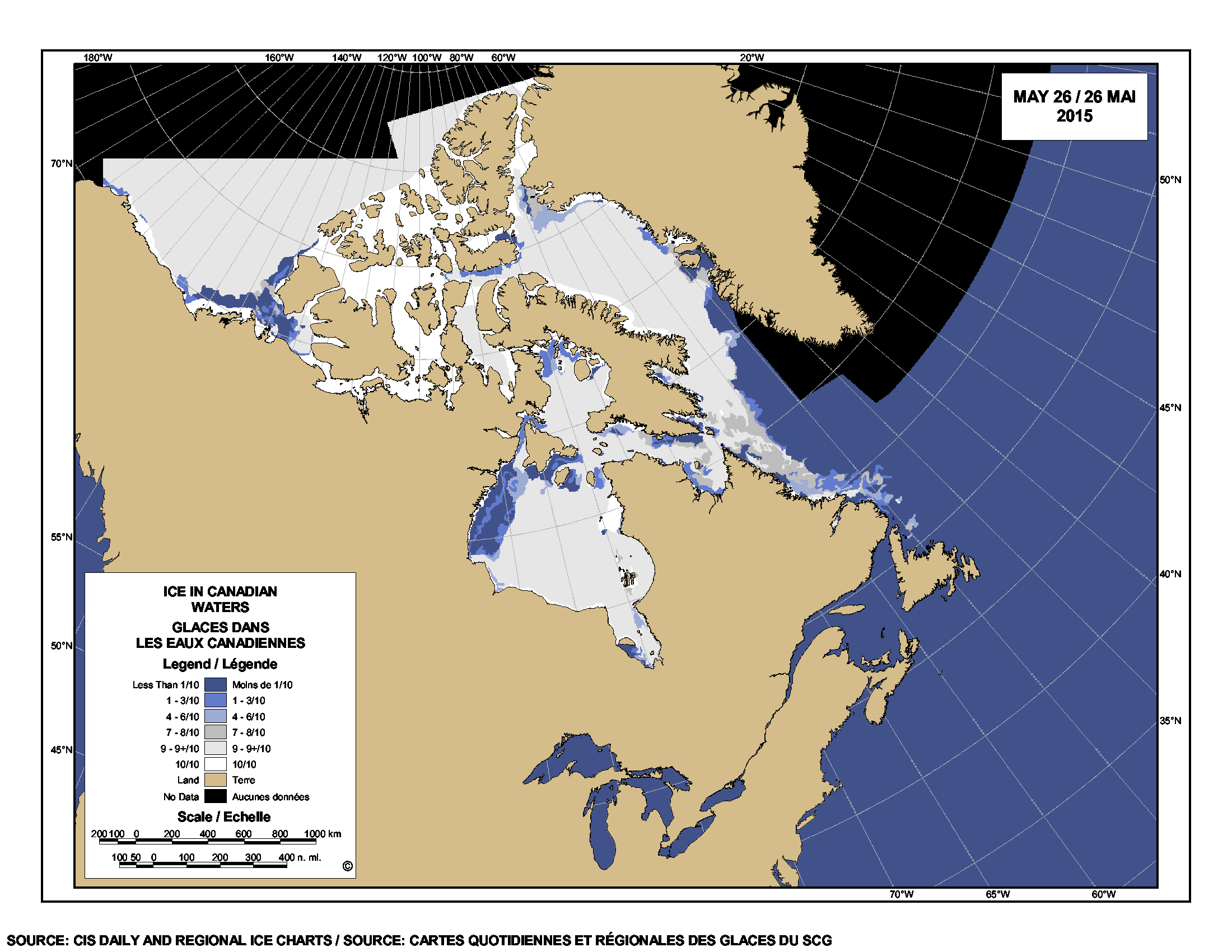
This year on day 134 (14 May), global ice cover registered 12.3 mkm2:

masie_all_zoom_4km 2018 May 14

In 2016 on the same day, the overall extent was much the same but there was more ice in the Chukchi and Bering Seas and less in the eastern Beaufort:

masie_all_zoom_4km 2016 May 14

More close-up charts of different regions below for 2018 vs. 2016, showing more detail.

Continue reading

Polynya refresher: open water in spring is due to winds & currents, not ice melt

Arctic sea ice begins to open up in spring at predictable locations due to currents and prevailing winds and this was as true in the 1970s as it is today. Polynyas and widening shore leads that most often get mistaken for early sea ice melt are those in the Beaufort and Chukchi Seas and in Hudson Bay.

Beaufort Sea male polar bear USGS_2005 Amstrup photo

But contrary to concerns expressed about possible negative implications of these early patches of open water, these areas have always been critical congregation areas for Arctic seals and are therefore important feeding areas for polar bears.

Seal habitat frozen open lead_Beaufort 2008_Miller

Seals hauled out beside a lightly frozen over lead in Beaufort Sea ice, 2008. USFWS.

Continue reading

Southern Beaufort sea ice melt in May: good news for polar bears or catastrophe?

Last week biologist Andrew Derocher recently implied via twitter that less sea ice in the eastern portion of the Southern Beaufort (SB) this year at mid-May is harmful to polar bears (calling it “a hole in the ice where polar bears used to live“), but both long-term and short-term data don’t support such a glass-half-empty interpretation.

Not only does spring breakup of sea ice in the SB normally begin with such open patches of water (see the video above from last year) — driven by the powerful currents of the Beaufort Gyre, not ice melt (explained in detail here) — it may actually be necessary for the survival of local seals, polar bears and whales in spring and early summer (Citta et al. 2015; Crawford et al. 2015; Harwood et al. 2015; Stirling et al. 1981).

As I’ve pointed out before, the biggest threat to SB bears is thick sea ice in spring and its associated late breakup, a 2-3 year-long phenomenon unique to this region known to have occurred about every 10 years since the early 1960s (well documented in the scientific literature) but which has not (as far as I know) happened since 2004-2006.

In other words, a considerable patch of open water and less concentrated ice in the eastern SB around Cape Bathurst is almost certainly a good thing for this particular subpopulation (see previous post here for an in-depth discussion) because historically, when a polynya of some extent has not formed by April or May it has been devastating for local marine mammals.

The fact that an extensive patch of open water existed at mid-May in this region last year and the year before (2015 and 2016) — with no public hue-and-cry about a great dying of SB bears from Derocher or anyone else — suggests that open water in the eastern SB this year is likely to be beneficial for SB polar bears, or at least benign. Continue reading

Hudson Bay sea ice coverage is atypical this year but what does that mean for polar bears?

Churchill_Polar_Bear_2004-11-15 Wikipedia

There is a rather large patch of open water in the northwest sector but what’s also unusual about breakup this year is the virtual lack of open water in eastern Hudson Bay – that almost never happens (compare to 2013 here). In addition, there’s still very little open water in Hudson Strait, which connects Hudson Bay to Davis Strait in the east – that’s also unusual.

Figure 1.  Sea ice extent over Hudson Bay and Hudson Strait at 26 May 2015. Canadian Ice Service.

Figure 1. Sea ice extent over Hudson Bay and Hudson Strait at 26 May 2015. Canadian Ice Service. Click to enlarge.

The question is: does the somewhat unusual pattern of ice cover at this date – which developed rapidly over the last few weeks – suggest we can predict whether polar bears will have a shorter-than-average hunting season?

To answer that, you have to look at maps generated by the same source over several years. The result, in my opinion, is inconclusive – while so far, this year looks a bit more like 2009 (which was a very late sea ice breakup year) than it does 2011 (which was an early breakup year), it’s really too early to tell.

I suggest we simply won’t know for another month or so which pattern will prevail. However, that hasn’t stopped IUCN Polar Bear Specialist Group member Andrew Derocher (via Twitter, e.g., here and here, among many others) from suggesting that this year’s pattern is likely a portend of doom for Hudson Bay polar bears. See what you think.
Continue reading