Tag Archives: open water

Spring polynyas in the Arctic then and now as feeding areas for hungry polar bears

Patches of open water in the Arctic that develop in the spring, including polynyas and widening shore leads, are largely due to the actions of wind and currents on mobile pack ice rather than ice melt. Contrary to concerns expressed about possible negative implications of these early patches of open water, these areas have always been critical congregation areas for Arctic seals and are therefore important feeding areas for polar bears in late spring.

Continue reading

Spring feeding season almost over for polar bears & sea ice becomes less important

Here are ice conditions at the end of May, which signals the near-end of the critical spring feeding period for polar bears. This is because young-of-the-year seals take to the water to feed themselves, leaving only predator-savvy adults and subadults on the ice from some time in June onward (depending on the region).

masie_all_zoom_4km 2020 May 31_Day 152

Spring is the critical feeding period for polar bears (Crockford 2019, 2020; Lippold et al. 2020; Obbard et al. 2016):

“Unexpectedly, body condition of female polar bears from the Barents Sea has increased after 2005, although sea ice has retreated by ∼50% since the late 1990s in the area, and the length of the ice-free season has increased by over 20 weeks between 1979 and 2013. These changes are also accompanied by winter sea ice retreat that is especially pronounced in the Barents Sea compared to other Arctic areas. Despite the declining sea ice in the Barents Sea, polar bears are likely not lacking food as long as sea ice is present during their peak feeding period. Polar bears feed extensively from April to June when ringed seals have pups and are particularly vulnerable to predation, whereas the predation rate during the rest of the year is likely low. [Lippold et al. 2019:988]

Continue reading

Death by drowning: Al Gore told us this was the future of polar bears but it wasn’t

In this short interview clip with Friends of Science director Michelle Stirling, I talk about the drowning polar bears in Al Gore’s 2007 movie that he implied would lead to the extinction of the species. Except that it didn’t…

My new book, The Polar Bear Catastrophe That Never Happened, explains why.

Polar bear habitat update: open water primarily due to winds pushing pack ice

Here is a look at what polar bear habitat looks like this year at the end of May compared to previous years. It helps put any predictions of impending doom into perspective.

Polar_bear Bering Sea 2007 USFWS lg

This is the time year when declining sea ice gets some people all worked up. However, declining ice is normal at this time of year and there is always variation in where the most open water appears first. At this time of year, there isn’t much ice ‘melt’ going on. Rather, what we are seeing is the opening up of shore leads and polynyas by winds.

Continue reading

It’s back: Bering Sea polar bear habitat has recovered from a low earlier this month

Fancy that! After a load of handwringing earlier this month, mobile pack ice in the Bering Sea has returned. Just like ice in the Barents Sea, Bering Sea ice is highly variable (Brown et al. 2011): it moves with winds and currents, so a ‘decline’ during the winter usually indicates redistribution, not melting.

Polar_bear Bering Sea 2007 USFWS lg

Polar bear on Bering Sea ice 2007 USFWS

According to researcher Rick Thoman from the University of Alaska Fairbanks, quoted by the Canadian Press:

“Wind blew ice to Russian beaches in the west and to the south side of Norton Sound south of Nome but left open water all the way to Chukchi Sea north of the Bering Strait.”

Polar bears that venture into the Bering Sea are part of the Chukchi Sea subpopulation, which is known to be thriving (Crockford 2019; AC SWG 2018; Regehr et al. 2018; Rode and Regehr 2010; Rode et al. 2013, 2014, 2015, 2018).

Continue reading

Polynya refresher: open water in spring is due to winds & currents, not ice melt

Arctic sea ice begins to open up in spring at predictable locations due to currents and prevailing winds and this was as true in the 1970s as it is today. Polynyas and widening shore leads that most often get mistaken for early sea ice melt are those in the Beaufort and Chukchi Seas and in Hudson Bay.

Beaufort Sea male polar bear USGS_2005 Amstrup photo

But contrary to concerns expressed about possible negative implications of these early patches of open water, these areas have always been critical congregation areas for Arctic seals and are therefore important feeding areas for polar bears.

Seal habitat frozen open lead_Beaufort 2008_Miller

Seals hauled out beside a lightly frozen over lead in Beaufort Sea ice, 2008. USFWS.

Continue reading

Tracking polar bears in the Beaufort Sea in April 2016 and early polynya formation

putting_collar_on_polar_bear_slider_USGS

Here’s the update on the polar bears fitted with satellite collars or ear tags in the Beaufort by USGS biologists over the last two years. Five new bears were added last month, which means there are now thirteen bears being tracked. Ice conditions are somewhat different than they have been in the past but concluding that such a situation means trouble is premature, I think (see here). Continue reading

Beaufort Sea swimming polar bears far from land but not very far from sea ice

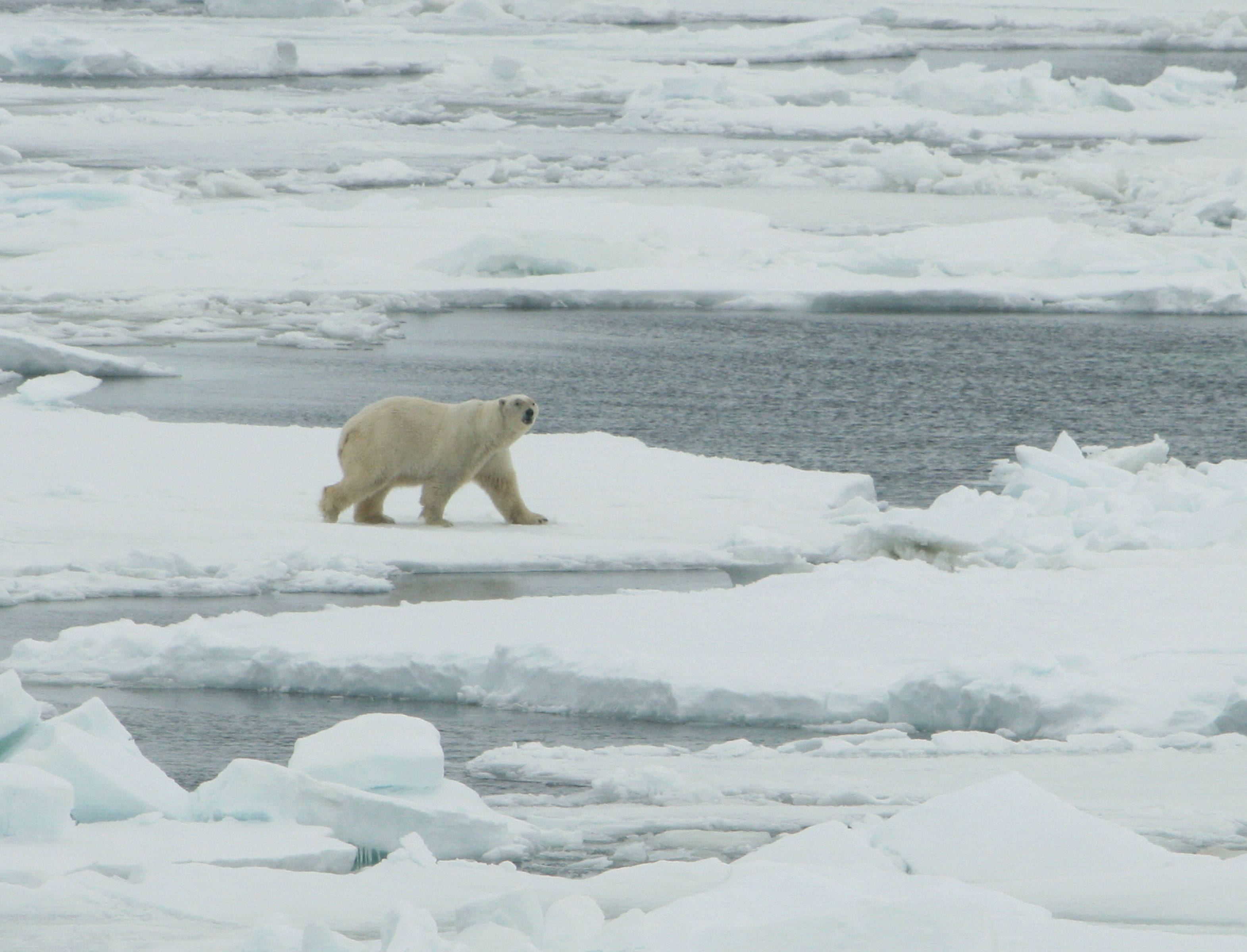
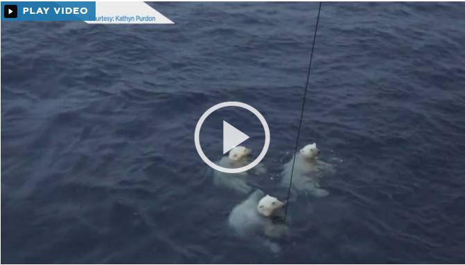
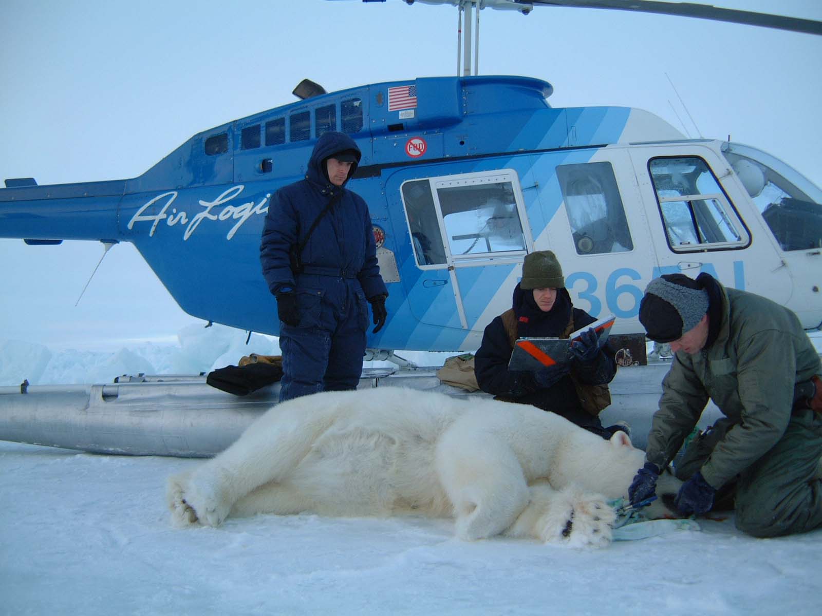
Recent accounts of an encounter with a curious polar bear female and her two older cubs in the Beaufort Sea on 16 September give contradictory details about the position of sea ice at the time. The same researcher told one reporter that the ship was 240 km from land, another that it was 240 km from the sea ice, and in another account (that he wrote himself), said the ship had been far from land and sea ice.

Beaufort swimming polar bears_Sept 30 2015_Global news

University of Victoria (Canada) chemical oceanographer Jay Cullen said on the expedition web site:

“After arriving on station and beginning work the crew noticed three polar bears in the water together which swam around to the ship when our water sampling system was nearly 3500 meters below the surface. The ship was located far from sea ice and land. Indeed, Arctic sea ice extent was the fourth lowest on record this year and there has been speculation that this imposes stress on polar bears which rely on the ice to hunt.”  [my bold]

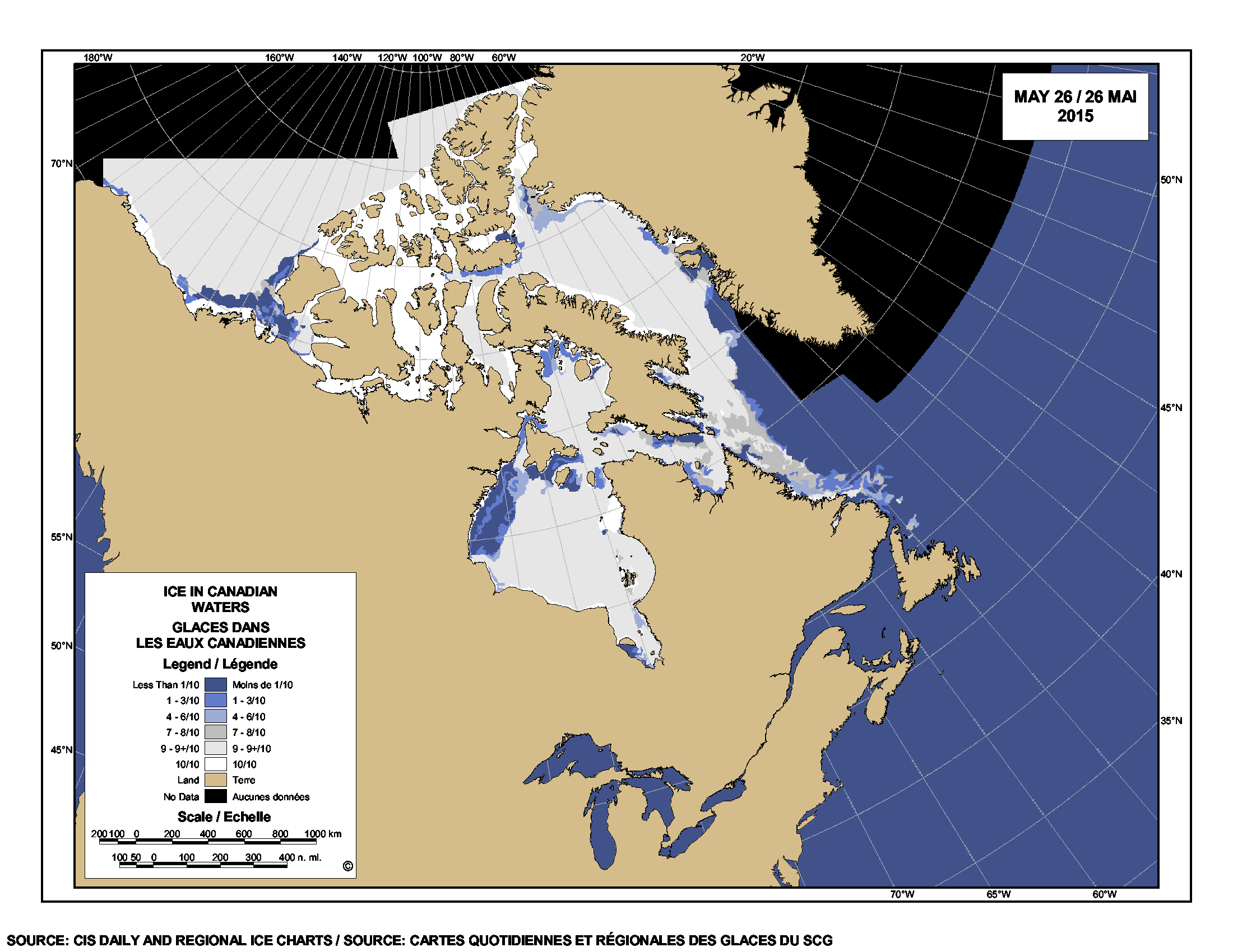
But the maps below show that at the time of the incident (taken from the expedition web site) and the NSIDC Masie sea ice map for 16 September 2015, the ship [the CCGS Amundsen, acting as a research vessel] was actually quite close to an isolated large patch of sea ice, although further from the edge of the main pack. A patch of sea ice plenty big enough for a polar bear to rest upon – no wonder the bears did not appear stressed.

And the polar bear biologist Cullen consulted (Dr. Andrew Derocher) implied by his response that the bear was indeed far from sea ice. Reminds me of the swimming polar bear off the Hibernia oil platform off Newfoundland March 2015, which turned out to be not far from ice at all. See what you think.
Continue reading

Tracking polar bears in the Southern Beaufort May 2015 – thick ice and polynyas

Polar bear habitat in the Southern Beaufort for May 2015 was a contrast between the development of recurring polynyas (patches of open water) and tremendously thick sea ice. So it’s interesting to see where the polar bears tagged by USGS biologists chose to hang out.

Polar_Bear_Biologist_USFWS_working_with_a_Bear_Oct 24 2001 Amstrup photo

The total number of bears being tracked in May – 23 – is down markedly from the 30 bears USGS biologists started with in April.

Most of the collared bears were concentrated in May along the shore lead (crack of open water) that normally develops between the shorefast ice and the pack ice offshore. That’s especially understandable this year, since most of that pack ice is 3-5 m thick (10-16 ft) – see the maps below.
Continue reading

Hudson Bay sea ice coverage is atypical this year but what does that mean for polar bears?

Churchill_Polar_Bear_2004-11-15 Wikipedia

There is a rather large patch of open water in the northwest sector but what’s also unusual about breakup this year is the virtual lack of open water in eastern Hudson Bay – that almost never happens (compare to 2013 here). In addition, there’s still very little open water in Hudson Strait, which connects Hudson Bay to Davis Strait in the east – that’s also unusual.

Figure 1.  Sea ice extent over Hudson Bay and Hudson Strait at 26 May 2015. Canadian Ice Service.

Figure 1. Sea ice extent over Hudson Bay and Hudson Strait at 26 May 2015. Canadian Ice Service. Click to enlarge.

The question is: does the somewhat unusual pattern of ice cover at this date – which developed rapidly over the last few weeks – suggest we can predict whether polar bears will have a shorter-than-average hunting season?

To answer that, you have to look at maps generated by the same source over several years. The result, in my opinion, is inconclusive – while so far, this year looks a bit more like 2009 (which was a very late sea ice breakup year) than it does 2011 (which was an early breakup year), it’s really too early to tell.

I suggest we simply won’t know for another month or so which pattern will prevail. However, that hasn’t stopped IUCN Polar Bear Specialist Group member Andrew Derocher (via Twitter, e.g., here and here, among many others) from suggesting that this year’s pattern is likely a portend of doom for Hudson Bay polar bears. See what you think.
Continue reading