Tag Archives: sea ice

Foxe Basin and Hudson Bay have more than average polar bear hunting habitat

This is shaping up to be a banner year for polar bears in Foxe Basin (central Canada), with more ice in this region than there’s been since 1992. Hudson Bay still has a large patch of thick first year ice, more than there has been at this date since 2009, which was a late breakup year.

Hudson Bay Foxe Basin ice map Aug 7 2014 labeled_sm

Ice maps and charts below tell the story.
Continue reading

Tracking polar bears in the Beaufort Sea – July 2014 map and subpopulation boundary issues

Here is the July 2014 follow-up to my post on the July 2013 track map for female polar bears being followed by satellite in the Beaufort Sea by the US Geological Survey (USGS) – “Ten out of ten polar bears being tracked this summer in the Beaufort Sea are on the ice.”

See that post for methods and other background on this topic, and some track maps from 2012 (also available at the USGS website here).

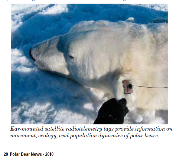
The USGS track map July 2004 is copied below (Fig. 1).

Compare this to June’s map (Fig. 4). The 20 bears from May (down to 14 in June) are now down to 13. All seven of the bears outfitted with glue-on satellite transmitters in April [either males or subadult animals] have either moved out of the area or their tags have fallen off or stopped transmitting. This means that all of the bears shown on the June and July maps below are females.

One bear has moved into Canadian territory and another is well into the Chukchi Sea. This is now known to be a typical rather than unusual phenomenon, and is pertinent to the bigger picture of what constitutes a discrete geographic subpopulation for polar bears.
Continue reading

Polar bear habitat: Spring 2014 in Eastern Canada was much better than 1969

It was a good year for polar bear habitat in the southern portions of Eastern Canada this spring – surprisingly, much better than it was in 1968 through 1970. And since spring conditions are what really matter to polar bears, this is good news indeed.

Environment Canada’s Canadian Ice Service recently published a nice little summary that has some rather eye-opening graphs. These describe the conditions for polar bears in the southern Davis Strait subpopulation – the one whose population size increased so dramatically between 1974 and 2007 despite lower-than-average ice extent in some years, even while their body condition declined (see here and here).

Environment Canada - Ice maps regions at July 26 2014

[Fitting post for the second anniversary of this blog, I think – more below1]

Note that I’ve added a “Blog Archive” page that lists all of my posts, easier to browse now that there are more than 200 of them.
Continue reading

Counting bears from space can be just as accurate as by helicopter, claims new study

Satellites images might be able to replace aerial counts of polar bears in some places — if there are no clouds. But it seldom distinguishes cubs and can’t tell males from females, found a 2012 study of Foxe Basin bears that’s just been published.

Foxe Basin polar_bears_rowley_island_Stapleton 2012 press photo labeled sm

Note: This is my 200th post since July 26, 2012!

Continue reading

Tracking polar bears in the Beaufort Sea: June 2014 map

Here is the June 2014 follow-up to my post on the July 2013 track map for female polar bears being followed by satellite in the Beaufort Sea by the US Geological Survey (USGS) – “Ten out of ten polar bears being tracked this summer in the Beaufort Sea are on the ice.”

See that post for methods and other background on this topic, and some track maps from 2012 (also available at the USGS website here).

The USGS track map for June 2004 is copied below (Fig. 1).

Compare this to May’s map (Fig. 2) – the 20 bears from last month are down to 14, and all seven of the bears outfitted with glue-on satellite transmitters in April [either males or subadult animals] have either moved out of the area or their tags have fallen off or stopped transmitting. This means that all of the bears shown on the June map below are females with satellite radio collars.
Continue reading

Barents Sea polar bear cubs – new data for 2014 made to sound ominous

Last week, Damian Carrington (May 28, 2014) at The Guardian offered a scary-sounding polar bear story, based on the work of Jon Aars and colleagues from the Norwegian Polar Institute (Fewer polar bear cubs are being born in the Arctic islands, survey finds). As often is the case however, once you see the scientific data, you will sleep better.

[Dr Aars also gave a radio interview with CBC Canada (May 29): Is climate change the cause of lower polar bear birth rates in Norway?”; audio available]

[Update June 24, 2014 — see below]

Female polar bear with cubs. (U.S. Fish & Wildlife Service/AP)

Female polar bear with cubs. (U.S. Fish & Wildlife Service)

Continue reading

Tracking polar bears in the Beaufort Sea – more bears added to the April 2014 map

Polar bears were tagged in 2013 and 2014 on the spring-time sea ice of the southern Beaufort Sea. Seventeen of these bears have satellite collar transmitters and 7 of these bears have glue-on satellite transmitters” say the folks at the USGS Alaska Science Center.

I guess that’s why the April map was late getting posted.

Polar bear ear tag_USFWS_PolarBearNews2010

Continue reading

Tracking polar bears in the Beaufort Sea – April map not yet available

Cannot do my April follow-up to my post on the July 2013 track map for female polar bears being followed by satellite in the Beaufort Sea by the US Geological Survey (USGS) – Ten out of ten polar bears being tracked this summer in the Beaufort Sea are on the ice.

“Tracking Polar Bears by Satellite” has not yet been updated with the April map, which is unusual for this late in the month (it is usually updated within the first few working days of every month). Perhaps the sea ice data they use was late being processed?

Here is the map for March, discussed previously here.

Figure 1. Movements of 5 satellite-tagged polar bears for the month of March, 2014. Polar bears were tagged in 2013 on the spring-time sea ice of the southern Beaufort Sea. All 5 of these bears have satellite collar transmitters. Note that the dots with the polar bear icons are the end points (end March), while the other end of the string is their position in early March. These are the same 5 females that were present in January. Click to enlarge.

Figure 1. Movements of 5 satellite-tagged polar bears for the month of March, 2014. Polar bears were tagged in 2013 on the spring-time sea ice of the southern Beaufort Sea. All 5 of these bears have satellite collar transmitters. Note that the dots with the polar bear icons are the end points (end March), while the other end of the string is their position in early March. These are the same 5 females that were present in January. Click to enlarge.

Previous dates for tracking available here.

Tracking polar bears in the Beaufort Sea: March map

Here is the March 2014 follow-up to my post on the July 2013 track map for female polar bears being followed by satellite in the Beaufort Sea by the US Geological Survey (USGS) – “Ten out of ten polar bears being tracked this summer in the Beaufort Sea are on the ice.”

See that post for methods and other background on this topic, and some track maps from 2012 (also available at the USGS website here).

The USGS track map March 2014 is copied below (Fig. 1).

Compare this to February’s map (Fig. 2) – you’ll be surprised at how little has changed!

Figure 1. Movements of 5 satellite-tagged polar bears for the month of March, 2014. Polar bears were tagged in 2013 on the spring-time sea ice of the southern Beaufort Sea. All 5 of these bears have satellite collar transmitters. Note that the dots with the polar bear icons are the end points (end March), while the other end of the string is their position in early March. These are the same 5 females that were present in January. Click to enlarge.

Figure 1. From original caption: “Movements of 5 satellite-tagged polar bears for the month of March, 2014. Polar bears were tagged in 2013 on the spring-time sea ice of the southern Beaufort Sea. All 5 of these bears have satellite collar transmitters.” Note that the dots with the polar bear icons are the end points (end March), while the other end of the string is their position in early March. These are the same 5 females that were present in January. Click to enlarge.

Continue reading

Tracking polar bears in the Beaufort Sea: February map

Here is the February 2014 follow-up to my post on the July 2013 track map for female polar bears being followed by satellite in the Beaufort Sea by the US Geological Survey (USGS) – Ten out of ten polar bears being tracked this summer in the Beaufort Sea are on the ice.

See that post for methods and other background on this topic, and some track maps from 2012 (also available at the USGS website here).

The USGS track map February 2014 is copied below (Fig. 1).

Continue reading