Polar bear habitat update – sea ice for hunting plentiful in all subpopulation regions

Preferred polar bear habitat is said to be 50% concentration or higher over continental shelves, which describes all but the fringes of sea ice extent today, including Hudson Bay, the Southern Beaufort, and the Barents Sea.

Preferred polar bear habitat 50pc concentration_May 8 2015_PolarBearScience

However, polar bears – excellent swimmers that they are – are quite capable of utilizing areas with 15-50% sea ice concentration if necessary (Durner et al. 2004; Rode et al. 2014:79), especially when prey are plentiful.  This would account for the fact that there are still sightings of polar bears in and around northern Newfoundland (see previous post here and photo below1), where ice concentration is in the 30-50% range.

Photo with this news story (7 May 2015): "(Update) Polar bear sighting in Croque"

Photo with this news story (7 May 2015): “(Update) Polar bear sighting in Croque”

Continue reading

Designated critical habitat for Alaskan polar bears offers no protection from thick spring ice deaths

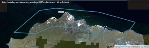
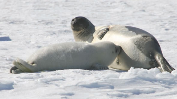
The Obama administration is apparently attempting to overturn a previous ruling that rejected proposed Alaskan “critical habitat” for polar bears in 2013 – as if “critical habitat” would protect the bears from the repeated episodes of thick spring ice that develop in this region every 10 years or so.

Polar_Bear_male on sea ice_Alaska Katovik Regehr photo_April 29, 2005_sm labeled

According to a Reuters report today (5 May 2015):

Seeking to reverse a ruling throwing out its designation of critical habitat for polar bears, the Obama administration has defended its decision to list large swathes of the Arctic as necessary for the conservation of the threatened species.

A coalition of oil industry groups and Alaska Natives, represented by Stoel Rives and Holland & Hart, successfully persuaded the U.S. District Court for Alaska to vacate the government’s polar bear habitat designation in 2013.” [my bold]

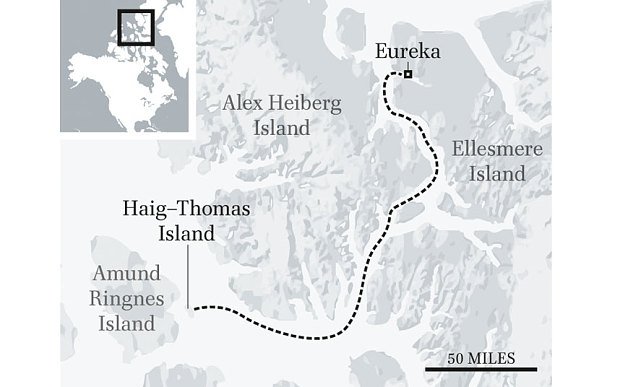
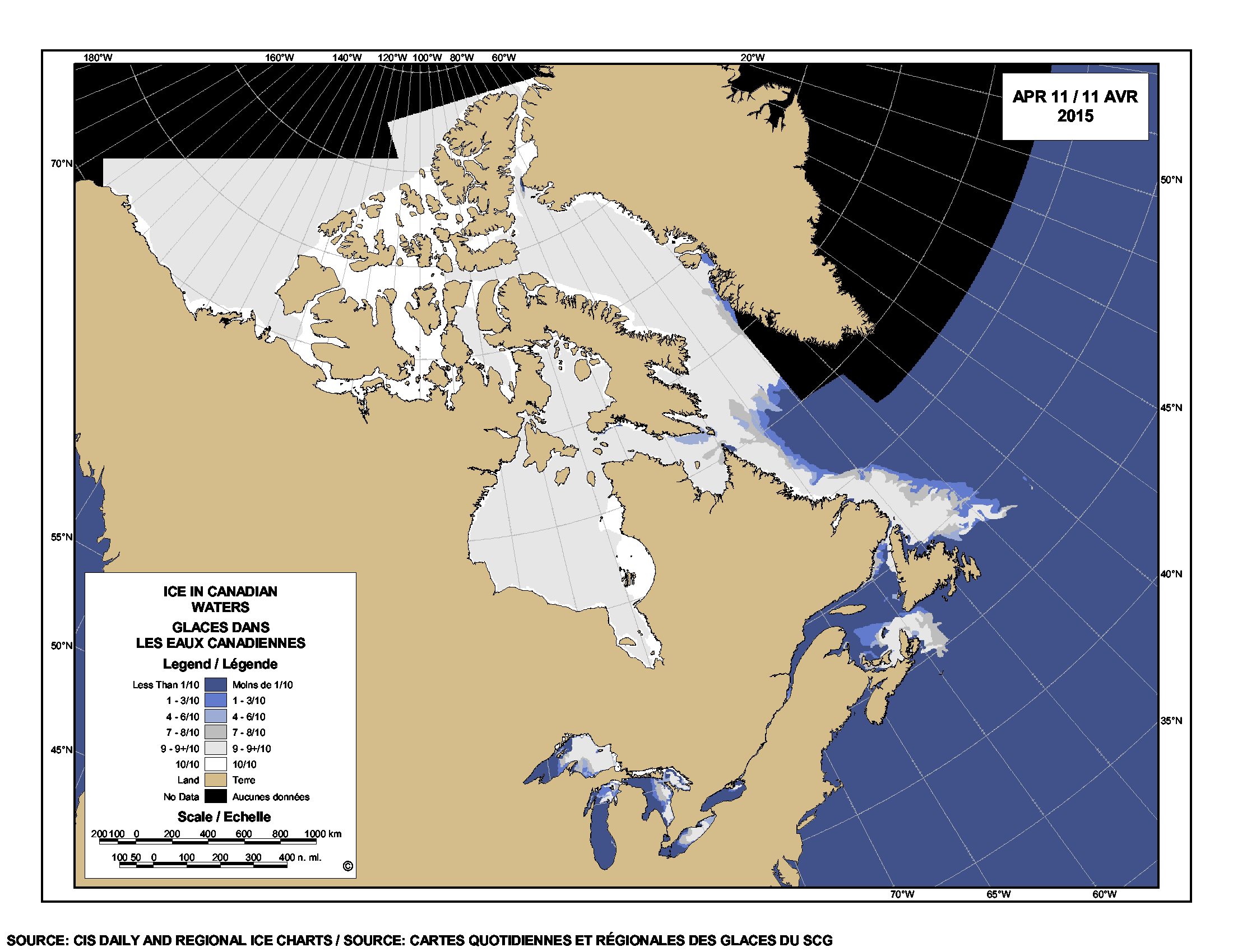
If they succeed, it would put most of the north coast of Alaska under special ESA rules, as the map below shows (click to enlarge).

Critical habitat Polar Bears US_NorthSlopeOrg map_labeled_PolarBearScience

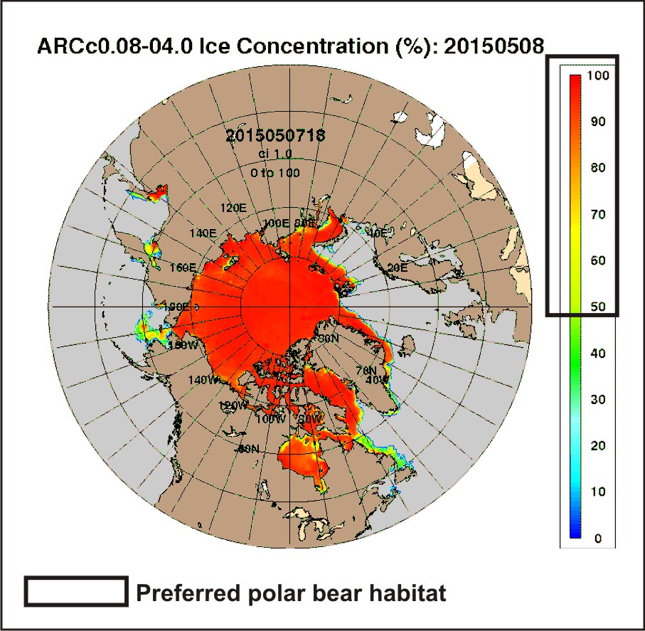
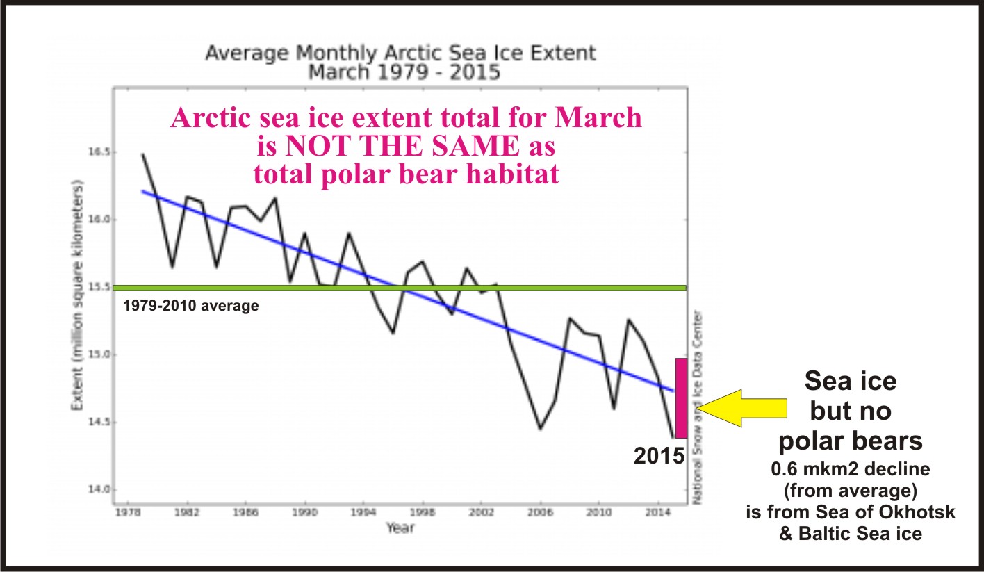
As I commented previously, regarding the Obama administration’s recommendation to congress that they approve a proposed Arctic wildlife refuge area on Alaska’s North Slope, this move (if implemented) would not protect polar bears from the starvation deaths due to thick spring ice conditions that have occurred in this region for 2-3 years out of every 10 since 1960 at least.

The other issue is how much additional, biologically meaningful protection a critical habitat designation would provide for Southern Beaufort and Chukchi Sea polar bears – over and above that already provided by the Marine Mammal Protection Act.
Continue reading

Tracking polar bears in the Southern Beaufort, with a sea ice surprise – April 2015 map

USGS biologists were clearly busy this spring putting more satellite radio collars and glue-on tags on Southern Beaufort Sea polar bears but there’s some surprising information in their April 2015 tracking map about current sea ice conditions.

From the 2013-2014 issue of  “Polar Bear News” (USFWS).

From the 2013-2014 issue of “Polar Bear News” (USFWS).

What’s interesting is that the sea ice maps they use show less dark spots that might be open water this year than were present last year in late April. Oddly, this phenomenon has one prominent biologist worried about “challenging” polar bear habitat developing this year – without mentioning last year at all.

The USGS track map for April 2015 is copied below.1
Continue reading

Polar bear season for Newfoundland residents still going strong, recent sightings confirm

Two recent sightings of polar bears along the north shore of Newfoundland are a reminder that sea ice is still a prominent feature of the Davis Strait polar bear subpopulation landscape at this time of year.

LaScie_Newfoundland_April 27 2015_ColleenGray label

A polar bear was sighted in the community of La Scie, northern Newfoundland Monday, 27 April (pictured above, swimming in the harbour), while another landed in the town of Fogo, on Fogo Island, last week (see maps below).
Continue reading

Melt season update – Bering Sea ice abundant & Davis Strait ice 2nd highest since 1971

Polar bear habitat in the eastern Bering Sea has expanded since the official spring “maximum extent” was called for late February, and Davis Strait sea ice is tied for 2nd highest since 1971 for this week. Both regions have healthy polar bear populations and spring conditions suggest this will continue into this year.

Rode and Regehr 2010_Chukchi_report2010_Fig1_triplets_labelled

Although the melt season is underway, as of yesterday (22 April, Julian day 112) overall Arctic sea ice extent (Fig. 1) was higher than it was on the same date in 2014, 2007, and 2004 (see also Fig. 2). Despite the record low extent in February (Fig. 3), that pessimists at Polar Bears International suggested was relevant to polar bear heath and survival, I showed that was misleading.

Figure 1. Sea ice extent at 22 April (Julian day 112) for 2015, at 13.976 mkm2, was well within 2 standard deviations and higher than 2007 (shown) as well as 2004 and 2014 (not shown – see it for yourself here).

Figure 1. Sea ice extent at 22 April (Julian day 112) for 2015, at 13.976 mkm2, was well within 2 standard deviations and higher than 2007 (shown), as well as higher than 2004 and 2014 (not shown – see it for yourself here). Click to enlarge.

Sea ice maps and charts tell the story of current polar bear habitat throughout the Arctic.
Continue reading

Polar bears barely survived the sea ice habitat changes of the last Ice Age, evidence suggests

While the polar bear is an Ice Age species, genetic and fossil evidence suggests it barely survived the profound sea ice changes associated with the Last Glacial Maximum, one of the most severe glacial periods of the Pleistocene.

polar_bear_usfws_no date_sm

A map of sea ice extent at the climax of the Last Glacial Maximum (both perennial and seasonal ice), prepared with the help of a colleague, makes it possible to discuss what genetic and fossil evidence can tell us about the probable effects of glacial conditions on polar bears and ringed seals.

Continue reading

Polar bear encounter in the Canadian High Arctic reminiscent of recent attacks

Men recreating the 1938 expedition of explorer David Haig-Thomas have a mid-April 2015 polar bear encounter reminiscent of two recent polar bear attacks (Labrador, 2013, Svalbard, 2011) but with a happier ending.

Haig-Thomas expedition map_Telegraph_April 18 2015

Continue reading

Spring ice alarm deflated – 2015 ice now as high as 2014 & Davis Strait highest since 1971

Arctic ice extent (at 14.1mkm2) on 15 April, was virtually identical to 2014 on that date, and higher than 2006. But the record goes to Davis Strait, which recorded the highest ice extent since 1971 for the week of April 16, while the waters of Eastern Newfoundland to the south (where most harp seals have their pups) had the third highest ice extent since 1969. Lots of fat baby seals are just what polar bears need at this time of year.

Harp seal pup_DFO Newfoundland

Continue reading

Polar bear habitat update: highly concentrated ice in eastern Hudson Bay this spring

Sea ice in eastern Hudson Bay (bright white in the map below) is more concentrated than at this time last year and similar to the ice found in the Central Canadian Arctic.

Sea ice extent Canada 2015 April 11 CIS

There is more concentrated ice (10/10 concentration) in the east side of the Bay than there was in 1992, a heavy ice year blamed in part on the eruption of Mt. Pinatubo (Chambellant et al. 2012) that resulted in the latest breakup date for Western Hudson Bay since 1991.

Continue reading

Challenging polar bear fearmongering about Arctic sea ice extent for March 2015

Here are some facts to counter the misinformation and fearmongering being spread via twitter by a polar bear biologist who is getting carried away with his conservation activism.

Arctic Sea ice extent March greater than PB habitat_April 12 2015

Following up on my last post, I note that Arctic regions with sea ice but not polar bears were about 0.32 mkm2 below last year’s March average extent – which means the total ice decline from 2014 (0.4 mkm2) represents only a slight decline in polar bear habitat, most of which is in the Barents Sea (and due primarily to the state of the AMO, not global warming).

Sea ice extent for the Sea of Okhotsk and Baltic Sea combined (both areas without polar bears)1 were about 0.6 mkm2 below average this year for March. Average extent for March (according to NSIDC) is 15.5 mkm2, which means this year’s extent (14.4 mkm2) was 1.1 mkm2 below average, of which less than half (0.5 mkm2) was “lost” polar bear habitat.

IUCN Polar Bear Specialist Group biologist Andrew Derocher has been saying this is a “huge loss for polar bears” (see below): rational analysis of the facts show it is not. Continue reading