Tag Archives: sea ice

Tracking polar bears in the Beaufort Sea – November 2014 map

Here is the November 2014 follow-up to my post on the July 2013 track map for female polar bears being followed by satellite in the Beaufort Sea by the US Geological Survey (USGS) – “Ten out of ten polar bears being tracked this summer in the Beaufort Sea are on the ice.”

See that post for methods and other background on this topic, and some track maps from 2012 (also available at the USGS website here). The USGS track map for November 2014 is copied below.

 Figure 1. Original caption: "Movements of 12 satellite-tagged polar bears for the month of November, 2014. Polar bears were tagged in 2014 on the spring-time sea ice of the southern Beaufort Sea. All twelve of these bears have satellite collar transmitters. Polar bear satellite telemetry data are shown with AMSR2 remotely-sensed ice coverage for 30 November, 2014." Click to enlarge, original here.


Original caption: “Movements of 12 satellite-tagged polar bears for the month of November, 2014. Polar bears were tagged in 2014 on the spring-time sea ice of the southern Beaufort Sea. All twelve of these bears have satellite collar transmitters. Polar bear satellite telemetry data are shown with AMSR2 remotely-sensed ice coverage for 30 November, 2014.” Click to enlarge, original here.

All twelve bears (all females) are finally visible on this map, confirming my suspicion that two were so close together they overlapped. Three out of the twelve “Southern Beaufort” bears were in the Chukchi Sea at the end of November (west of Point Lay, see discussion here). If you missed it, my October 2014 post on the progress of these bears has some maps from previous years that are worth reviewing.

Hudson Bay sea ice above average for this date – more good news for polar bears

It’s only the 4th of December and Hudson Bay ice formation is way up over late 2000s coverage for this date — and higher than 2012, which had the lowest overall September ice extent for the Arctic since 1978.

Hudson Bay freeze-up same week_Dec 4 1971_2014 w average

This means boom times for Western and Southern Hudson Bay polar bears as sea ice formation is several days to a week ahead of last year. And as I mentioned in my last post, average November ice coverage across the Arctic this year was higher than 2003. Don’t forget that 2/3’s of the world’s polar bears live in Canada (see recent status update here; map below).

Figure 4. The Davis Strait (DS) subpopulation region runs from just below the Arctic Circle at the north end to at least 470N in the south. About half of DS lays at the same latitude as Western Hudson Bay (WH). Courtesy Environment Canada.

Polar bear population status in Canada. Courtesy Environment Canada.

More maps and charts below.
Continue reading

Amstrup knows his polar bear predictions are flawed – but continues to promote them

The largest conservation organization in the world says that predictive models developed by polar bear biologist Steven Amstrup are utterly unsuitable for scientifically estimating future populations. Earlier this year, mathematical modeling experts  at the International Union for the Conservation of Nature, who maintain the Red List of Threatened Species, made it clear that Amstrup’s models (used in 2008 to convince the US Fish and Wildlife Service to list polar bears as ‘threatened’ due to predicted global warming) do not meet IUCN standards.

I’d say this makes Amstrup’s polar bear projections (Amstrup et al. 2008, 2010) no more scientifically useful than a crystal ball prophesy, but you wouldn’t know it by his recent actions — or the silence of his fellows.

crystal ball_3c

Continue reading

Davis Strait polar bear habitat – the sea ice is forming, but it’s late!

Since 1971, there have been only two years with as little sea ice in Davis Strait as there was this year at this time – 2003 and 2010. But the ice is forming rapidly and history shows it will likely catch up enough by next week to allow most Davis Strait polar bears to start hunting seals except along the Labrador coast.

Courtesy IUCN PBSG

Courtesy IUCN PBSG

Have a look at the ice maps and charts below from the Canadian Ice Service for the status of freeze-up in Davis Strait.

UPDATE 30 November 2014: Sea ice extent map from NSIDC added.

Continue reading

Hudson Bay freeze-up: way more ice for this day than in 2013

On this day (20 November 2014), there is way more sea ice over Hudson Bay and Foxe Basin than 2013, with ice starting to form in Hudson Strait.

The polar bears of Hudson Bay are on the ice (except pregnant females, who will be in their dens); Churchill polar bear season is over (see previous discussions here and here).

Ice maps and graph courtesy Canadian Ice Service.

Sea ice extent Canada 2014 Nov 20 CIS
Continue reading

Polar bear researchers knew S Beaufort population continued to increase up to 2012

Why did the Southern Beaufort polar bear population survey stop in 2010? It’s clear that the recently-published and widely-hyped new study stopped before the population rebound from a known decline was complete.

USFWS 2013-2014 PB News_cover_PolarBearScience

The researchers of the recently-published paper knew before starting their mark-recapture study in 2007 that the population decline had taken place. They also knew why the numbers dropped and that previous declines, caused by similar conditions, had been followed by a full recovery.

Did they really think a full recovery in population numbers was possible in only three four years, when cubs born in 2007 would not yet have been old enough to reproduce?

In fact, a US Fish and Wildlife Service (USFWS) fall survey of Southern Beaufort polar bears in 2012 found numbers were higher than they had been in a decade.
Continue reading

S Beaufort polar bears largely recovered from known 2004-2006 decline, says new study

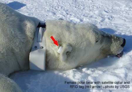
A bit more good news about polar bear populations, this time from an abundance study in the Southern Beaufort Sea. A paper released yesterday showed a 25-50% decline in population size took place between 2004 and 2006 (larger than previously calculated). However, by 2010 the population had rebounded substantially (although not to previous levels).

All the media headlines (e.g. The Guardian) have followed the press release lead and focused on the extent of the decline. However, it’s the recovery portion of the study that’s the real news, as it’s based on new data. Such a recovery is similar to one documented in the late 1970s after a significant decline occurred in 1974-1976 that was caused by thick spring ice conditions.

Polar bear with collar and tag_USGS_labeled

The title of the new paper by Jeffery Bromaghin and a string of polar bear biologists and modeling specialists (including all the big guns: Stirling, Derocher, Regehr, and Amstrup) is “Polar bear population dynamics in the southern Beaufort Sea during a period of sea ice decline.” However, the study did not find any correlation of population decline with ice conditions. They did not find any correlation with ice conditions because they did not include spring ice thickness in their models – they only considered summer ice conditions.

I find this very odd, since previous instances of this phenomenon, which have occurred every 10 years or so since the 1960s, have all been associated with thick spring ice conditions (the 1974-76 and 2004-2006 events were the worst). [Another incident may have occurred this spring (April 2014) but has not been confirmed].

Whoever wrote the press release for this paper tried hard to suggest the cause of the 2004-2006 event might have been “thin” winter ice caused by global warming that was later deformed into thick spring ice, an absurd excuse that has been tried before (discussed here). If so, what caused the 1974-1976 event?

It seems rather unscientific as well as implausible to even try to blame this recent phenomenon on global warming. However, neither the authors of the paper or the press release writers seemed to want to admit that 2-3 years of thick ice development in the Southern Beaufort could have been the cause of the population decline in 2004 (as for all of the previous events). No, that wouldn’t do, not in the age of global warming.

So, we are left with this equally absurd conclusion from the author:

The low survival may have been caused by a combination of factors that could be difficult to unravel,” said Bromaghin, “and why survival improved at the end of the study is unknown.

I’ve summarized the paper to the best of my understanding (there was a lot of model-speak to wade through), leaving out the prophesies of extinction, which in my opinion don’t add anything.

UPDATE November 19, 2014: Don’t miss my follow-up post, with some startling new information, Polar bear researchers knew S. Beaufort population continued to increase up to 2012
Continue reading

Hudson Bay freeze-up update – most polar bears on the ice

Latest sea ice maps and charts from the Canadian Ice Service show significant ice building quickly along the west coast of Hudson Bay, enough to allow polar bears out to hunt.

Kelsey Eliasson reported from Churchill earlier today that most of the polar bears have moved onto the ice.

Sea ice extent Canada 2014 Nov 17 CIS

Continue reading

Tracking polar bears in the Beaufort Sea – October 2014 map shows most ice since 2010

Here is the October 2014 follow-up to my post on the July 2013 track map for female polar bears being followed by satellite in the Beaufort Sea by the US Geological Survey (USGS) – “Ten out of ten polar bears being tracked this summer in the Beaufort Sea are on the ice.”

See that post for methods and other background on this topic, and some track maps from 2012 (also available at the USGS website here). The USGS track map for October 2014 is copied below (Fig. 1).

For the end of October, there was more ice in the Southern Beaufort this year than there has been since 2010.

Eight bears (all females) were on the ice and four were onshore. Only six of the eight on-ice bears were actually in the Southern Beaufort – the other two were in the Chukchi Sea (west of Point Lay, see discussion here).

Note that the recent boundary change between the Southern and Northern Beaufort subpopulations (the US/Canada boundary of the Southern Beaufort), reported here, has not addressed the fact that many western “Southern Beaufort” bears move into the Chukchi Sea. Continue reading

A more optimistic view of Churchill polar bears and Hudson Bay freeze-up

Finally, an unbiased first-hand report about Churchill polar bears and freeze-up on Hudson Bay.

Over the last few weeks, biologists Andrew Derocher and Steve Amstrup have been repeating their tired old tales of doom and gloom about the polar bears around Churchill and I’ve done my best to refute the worst of their nonsense.

Figure 1. Polar bear female with cub, 2009, Churchill, Western Hudson Bay. Wikipedia.

Figure 1. Polar bear female with cub, 2009, Churchill, Western Hudson Bay. Wikipedia.

To that effort we can now add this report from PolarBearAlley, where Kelsey Eliasson has posted a good-news story about the bears of Cape Churchill and the progress of freeze-up, including sightings of a number of mothers with cubs.
Continue reading