Tag Archives: Chukchi Sea

Polar bear consumption of terrestrial foods – new paper misses the point

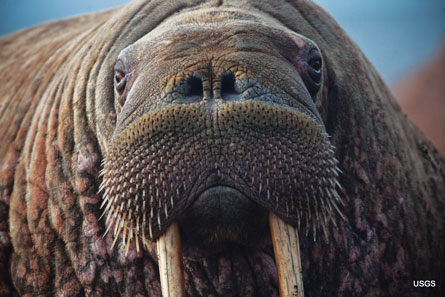
A new paper by polar bear biologists (Rode et al. 2015) argues that terrestrial (land-based) foods are not important to polar bears now and will not be in the future – a conclusion I totally agree with – but they miss the point entirely regarding the importance of this issue.

Fat bears on land in the Southern Beaufort, Sue Miller photo, well-prepared for a brief summer fast.

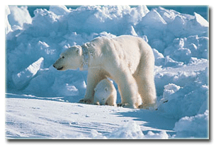
Whatever food polar bears consume in the summer – whether they are on land or on the ice – doesn’t really matter. What matters is how many fat-rich seals they can consume between March and June each year. The fat put on in late winter/spring from gorging on baby seals carries polar bears over the summer, no matter where they spend it.

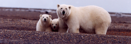
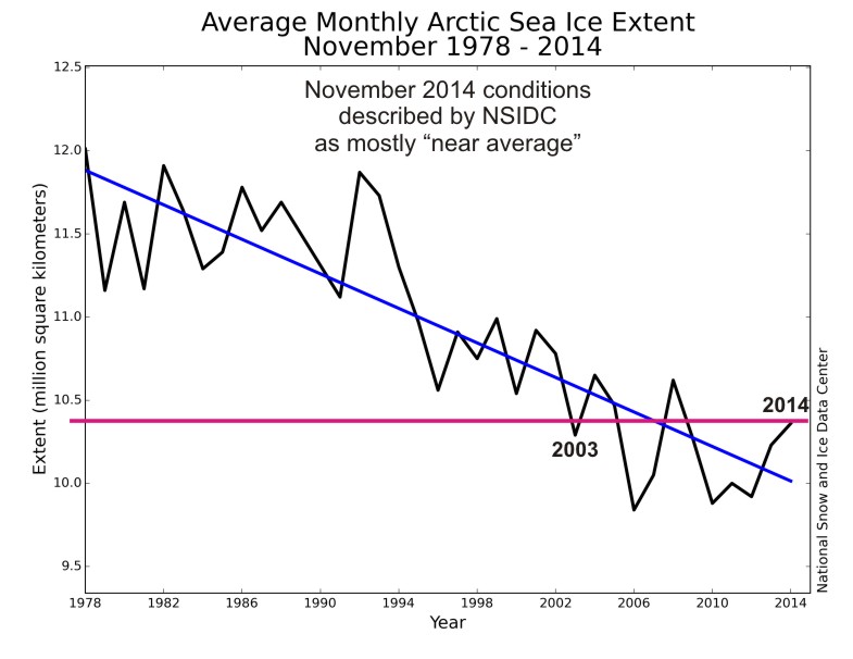
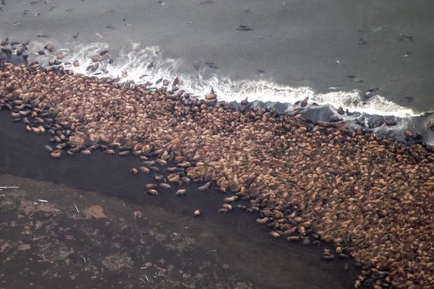
USGS polar bear biologist Karyn Rode and colleagues (press release here) have tried to frame this issue as one about future survival of polar bears in the face of declining sea ice. However, the fact that polar bears in the Chukchi Sea and Southern Davis Strait are thriving despite dramatic declines in summer sea ice (aka an extended open-water season), proves my point and disproves their premise. Bears in these regions are doing extremely well – contrary to all predictions – because they have had abundant baby seals to eat during the spring (see here and here).

Continue reading

Tracking polar bears in the Beaufort Sea – February 2015 map

Here is the February 2015 follow-up to my post on the July 2013 track map for female polar bears being followed by satellite in the Beaufort Sea by the US Geological Survey (USGS) – “Ten out of ten polar bears being tracked this summer in the Beaufort Sea are on the ice.”

polar_bear with collar_USGS

See that post for methods and other background on this topic, and some track maps from 2012 (also available at the USGS website here). The USGS track map for February 2015 is copied below.

There were 7 bears in February, up from 6 in January, because one of the bears has re-entered the area from elsewhere. However, many bears from the original sample have either had their collars fail, moved out of the area and stayed out, or they have died. We can’t tell from which of those options, or combinations of them, explain the reduced number still being followed.
Continue reading

Tracking polar bears in the Beaufort Sea – January 2015 map

Here is the January 2015 follow-up to my post on the July 2013 track map for female polar bears being followed by satellite in the Beaufort Sea by the US Geological Survey (USGS) – “Ten out of ten polar bears being tracked this summer in the Beaufort Sea are on the ice.”

Tranquilized_pb570_S Beaufort March 2014_USGS

See that post for methods and other background on this topic, and some track maps from 2012 (also available at the USGS website here). The USGS track map for January is copied below.

There are only 6 bears being followed now, which means a few more collars have failed, or the bears have moved out of the area or died.
Continue reading

‘Threatened’ status for Arctic ringed seals under ESA makes no sense

Recent research (Crawford and Quakenbush 203; Rode et al. 2014) has shown that sea ice declines in the Chukchi and Beaufort Seas have made life better for ringed seals, not worse (as predicted) – ringed seals are in better condition and reproducing better than they were in the 1970s. Why? Ringed seals do most of their feeding in the open-water period (Young and Ferguson 2013), so a longer open-water season means fatter, healthier seals and more fat pups for polar bears to hunt the following spring.

Ringed_seal_2_NOAA

However, Arctic ringed seals (as well as bearded seals) were designated as ‘threatened’ by the USA in 2012 under the Endangered Species Act, based on predicted ice and snow declines due to prophesied global warming. These listings are all about future threats, with no pretense of on-going harm.

Virtually no other Arctic nation has taken this step for Arctic seals — see previous discussion here. There are lots of ringed seals — an estimated 3-4 million world-wide and about 1.7 million within the critical habitat proposed by NOAA (see below).

As weak as the case for listing polar bears as ‘threatened’ has proven to be, the case for listing ringed and bearded seals is even more feeble (a judge has already sent the bearded seal listing back to the drawing board).
Continue reading

Tracking polar bears in the Beaufort Sea – December 2014 map

Here is the December 2014 follow-up to my post on the July 2013 track map for female polar bears being followed by satellite in the Beaufort Sea by the US Geological Survey (USGS) – “Ten out of ten polar bears being tracked this summer in the Beaufort Sea are on the ice.”

Tranquilized_pb570_S Beaufort March 2014_USGS

See that post for methods and other background on this topic, and some track maps from 2012 (also available at the USGS website here). The USGS track map for December is copied below.

There are only 10 bears being followed now, which means a few more collars have failed, or the bears have moved out of the area or died.
Continue reading

Tracking polar bears in the Beaufort Sea – November 2014 map

Here is the November 2014 follow-up to my post on the July 2013 track map for female polar bears being followed by satellite in the Beaufort Sea by the US Geological Survey (USGS) – “Ten out of ten polar bears being tracked this summer in the Beaufort Sea are on the ice.”

See that post for methods and other background on this topic, and some track maps from 2012 (also available at the USGS website here). The USGS track map for November 2014 is copied below.

 Figure 1. Original caption: "Movements of 12 satellite-tagged polar bears for the month of November, 2014. Polar bears were tagged in 2014 on the spring-time sea ice of the southern Beaufort Sea. All twelve of these bears have satellite collar transmitters. Polar bear satellite telemetry data are shown with AMSR2 remotely-sensed ice coverage for 30 November, 2014." Click to enlarge, original here.


Original caption: “Movements of 12 satellite-tagged polar bears for the month of November, 2014. Polar bears were tagged in 2014 on the spring-time sea ice of the southern Beaufort Sea. All twelve of these bears have satellite collar transmitters. Polar bear satellite telemetry data are shown with AMSR2 remotely-sensed ice coverage for 30 November, 2014.” Click to enlarge, original here.

All twelve bears (all females) are finally visible on this map, confirming my suspicion that two were so close together they overlapped. Three out of the twelve “Southern Beaufort” bears were in the Chukchi Sea at the end of November (west of Point Lay, see discussion here). If you missed it, my October 2014 post on the progress of these bears has some maps from previous years that are worth reviewing.

Polar bear habitat update – November 2014 average sea ice levels higher than 2003

Average polar bear habitat for November 2014 was well within two standard deviations1 and higher than 2003, according to the November report from the National Snow and Ice Data Center (line and labels added, below).

Arctic ice Nov aver_NSIDC_sm_PolarBearScience

Notice that the lowest average November level occurred in 2006not 2007 (after the second lowest September extent since 1978) and not 2012 (after the lowest September extent since 1978). Take note that the scale on the graph above does not go to zero but to a whopping ~9.5 million square km!

Quotes from the NSIDC monthy report and sea ice maps for November 2014 and 2 December 2014 below.

UPDATE 3 December 2014: CIS has issued a new ice map corrected for ice level on Hudson Bay – new map below.
Continue reading

Tracking polar bears in the Beaufort Sea – October 2014 map shows most ice since 2010

Here is the October 2014 follow-up to my post on the July 2013 track map for female polar bears being followed by satellite in the Beaufort Sea by the US Geological Survey (USGS) – “Ten out of ten polar bears being tracked this summer in the Beaufort Sea are on the ice.”

See that post for methods and other background on this topic, and some track maps from 2012 (also available at the USGS website here). The USGS track map for October 2014 is copied below (Fig. 1).

For the end of October, there was more ice in the Southern Beaufort this year than there has been since 2010.

Eight bears (all females) were on the ice and four were onshore. Only six of the eight on-ice bears were actually in the Southern Beaufort – the other two were in the Chukchi Sea (west of Point Lay, see discussion here).

Note that the recent boundary change between the Southern and Northern Beaufort subpopulations (the US/Canada boundary of the Southern Beaufort), reported here, has not addressed the fact that many western “Southern Beaufort” bears move into the Chukchi Sea. Continue reading

No proof walrus are “struggling from the loss of sea ice” as new Earthjustice lawsuit claims

A new day, a new lawsuit by environmentalists: this time, the species-on-a-pedestal is the same population of Chukchi Sea walrus that generated a news frenzy last month, which apparently still has legs.

Walrus puss_USGS_IMG_4763
Continue reading

Walrus and sea ice, a summary

I’ve written a briefing paper for the GWPF refuting claims that huge herds of Pacific walruses hauled out on land are a sign of global warming.

Here’s the GWPF press release:

London, 20 October: A briefing paper published today by the Global Warming Policy Foundation refutes claims that Arctic walruses are in distress and danger due to global warming.

The paper, written by Canadian zoologist Dr Susan Crockford, assesses the recent mass haulouts of walrus females and calves on the beaches of Alaska and Russia bordering the Chukchi Sea. The events have been blamed by US government biologists and WWF activists on lack of summer sea ice, amplified into alarming scare stories by news media around the world.

Such claims ignore previous haulouts that suggest a different cause. Scientific reports about large walrus haulouts that have occurred repeatedly over the last 45 years show that they are not new phenomena for this region.

At least two documented incidents of similar magnitude have occurred in the recent past: one in 1978, on eastern St. Lawrence Island and the other in 1972, on the western end of Wrangel Island. The 1978 event involved an estimated total of almost 150,000 walrus hauled out within in a small geographic area.

Moreover, sea ice maps for the months when known mass haulouts occurred, compared to years when they did not, suggest no strong correlation with low sea ice levels.

“The WWF and American walrus biologists have categorically linked the Point Lay mass haulout event to global warming, but available evidence suggests that’s alarmist nonsense,” Dr Crockford said.

“Blaming lack of sea ice for recent events ignores the documented factor – large population size – that drove walruses onto beaches en masse in the past, when plenty of ice was available. Conservation measures have almost certainly led to a spectacular recovery of walrus numbers over the last few years. This suggests that recent mass haulouts are more an indicator that Chukchi walrus are nearing maximum capacity than a sign of impending global warming catastrophe,” Dr Crockford added.

Here’s the paper. [Link fixed, h/t HO]

Save