Category Archives: Life History

Hudson Bay breakup progressing slowly, still lots of polar bear habitat

Not much change in sea ice coverage since last week – most of Hudson Bay is still covered with concentrated ice, which is good news for Western and Southern Hudson Bay polar bears. They are still free to roam and hunt over most of the ice-covered bay.

Hudson Bay breakup 8 June 2015 vs 1 June_PolarBearScience

There may be slightly less ice than average for this time of year (Fig. 1, below) but coverage is still >70% with concentrated ice and does not appear to be melting quickly (see charts above and Fig. 2, below).

The dates for three previous earliest breakups according to Lunn and colleagues (Fig. 3) have come and gone, as all were in the first week of June (more on that in an upcoming post) – no records broken. More graphs and maps below, see previous posts here and here.
Continue reading

Hudson Bay sea ice coverage is atypical this year but what does that mean for polar bears?

Churchill_Polar_Bear_2004-11-15 Wikipedia

There is a rather large patch of open water in the northwest sector but what’s also unusual about breakup this year is the virtual lack of open water in eastern Hudson Bay – that almost never happens (compare to 2013 here). In addition, there’s still very little open water in Hudson Strait, which connects Hudson Bay to Davis Strait in the east – that’s also unusual.

Figure 1.  Sea ice extent over Hudson Bay and Hudson Strait at 26 May 2015. Canadian Ice Service.

Figure 1. Sea ice extent over Hudson Bay and Hudson Strait at 26 May 2015. Canadian Ice Service. Click to enlarge.

The question is: does the somewhat unusual pattern of ice cover at this date – which developed rapidly over the last few weeks – suggest we can predict whether polar bears will have a shorter-than-average hunting season?

To answer that, you have to look at maps generated by the same source over several years. The result, in my opinion, is inconclusive – while so far, this year looks a bit more like 2009 (which was a very late sea ice breakup year) than it does 2011 (which was an early breakup year), it’s really too early to tell.

I suggest we simply won’t know for another month or so which pattern will prevail. However, that hasn’t stopped IUCN Polar Bear Specialist Group member Andrew Derocher (via Twitter, e.g., here and here, among many others) from suggesting that this year’s pattern is likely a portend of doom for Hudson Bay polar bears. See what you think.
Continue reading

Arctic polynyas and sea ice extent in Canada at 20 May 2015

The map of sea ice extent in Canada at 20 May 2015 is an almost-perfect example of the placement of recurring patches of open water polynyas that were present in the Canadian Arctic at this time of year in 1975-1979. Notes from field work on shore leads in Hudson Bay ice at May, 1948 offer further insight into the current pattern of sea ice cover on the bay.

Polynyas and shore leads vs sea ice at 20 May 2015_PolarBearScience

May is traditionally the time when recurring polynyas in the Canadian Arctic become more prominent and persistent shore leads (cracks in the ice near shore, also called “flaw leads”) become wider. Polar bears hunt around these polynyas because ringed and bearded seals congregate around them in the spring (Stirling et al. 1981; Stirling 1997). These polynyas are often not truly “open water” but covered by thin ice that’s easy for seals to break through.

Slight differences in location and size of polynyas and shore leads from year to year (especially in spring) are governed primarily by prevailing winds (Dunbar 1981:29) and to a lesser extent, currents. See my previous discussion on Beaufort Sea polynyas, with references: Beaufort Sea polynyas open two weeks before 1975 – open water is good news for polar bears.

This suggests that while sea ice cover over Hudson Bay and the Beaufort Sea is now a bit below average for this time of year (as the maps for this week show), it does not necessarily portend an earlier breakup or longer open-water period later in the year.

Continue reading

Beaufort Sea polynyas open two weeks before 1975 – open water is good news for polar bears

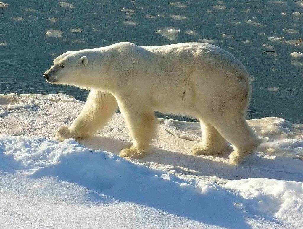
With masses of very thick, multiyear ice off Alaska this spring, the developing polynyas (open water) at either end of the Beaufort Sea are providing essential polar bear hunting habitat.

SB polynyas on ice thickness map 14 May 2015_PolarBearScience

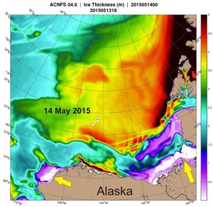
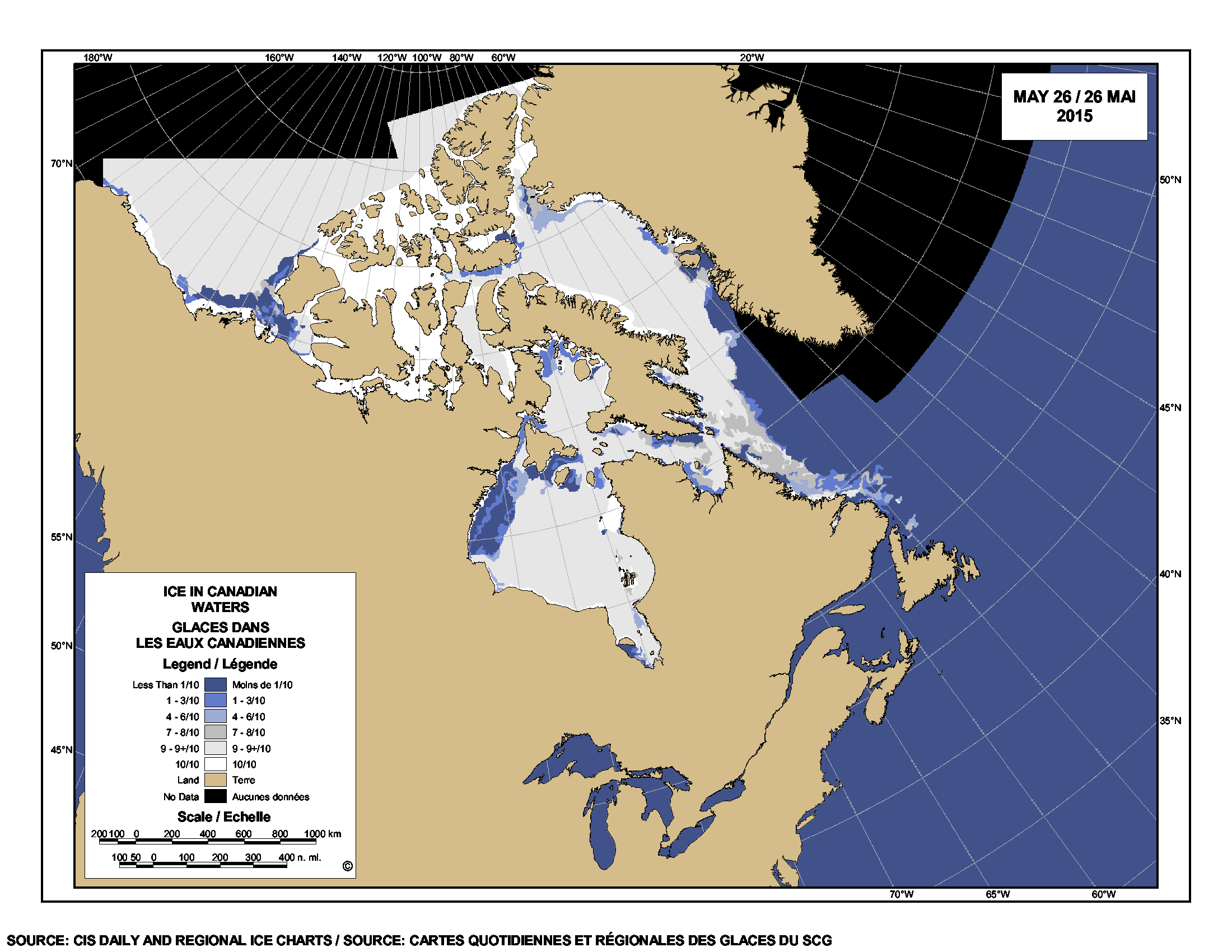
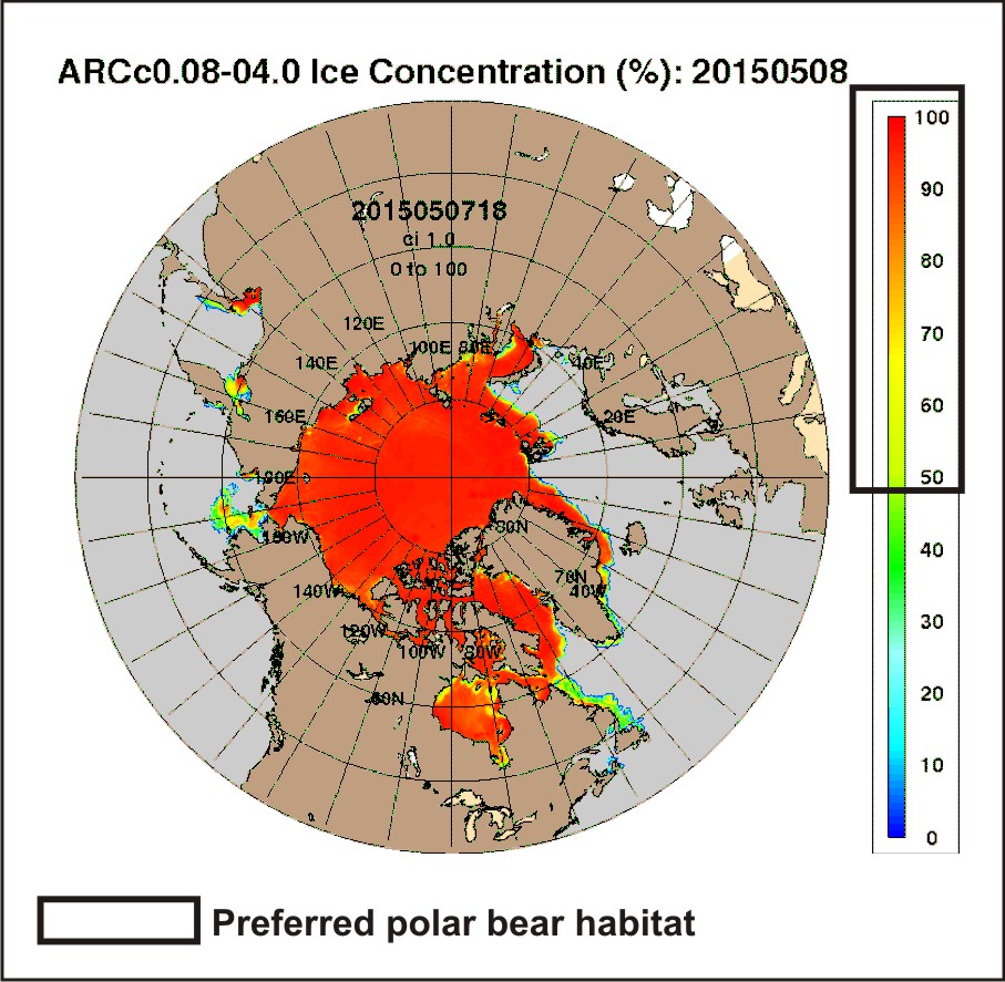
Patches of open water in the Beaufort Sea are naturally recurring phenomena. This year we have two excellent examples, shown by the yellow arrows in the sea ice thickness map above (from the Naval Research Laboratory).

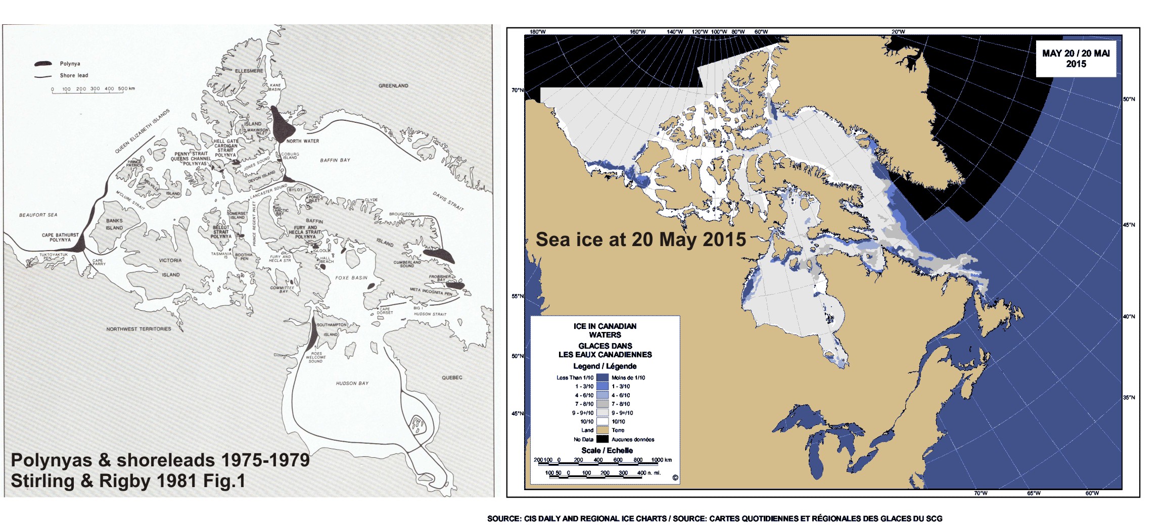
The eastern-most polynya forms in the Canadian portion of the Beaufort most years in the spring. This open water feature is so common it has a name – the Cape Bathurst polynya. Last year, there wasn’t an obvious polynya there until sometime in June, but in 1975, a patch of open water almost as large (or larger) as this year’s had developed by the end of May (Fig. 1).

Figure 1. Cape Bathurst polynya at 28 May 1975 (Smith and Rigby 1981: Fig. 14h), with the extent probably underestimated, and the polynya this year at 14 May (Canadian Ice Service). Click to enlarge.

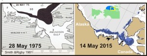
Figure 1. Cape Bathurst polynya at 28 May 1975 (Smith and Rigby 1981:Fig. 14h) and the polynya this year at 14 May (Canadian Ice Service). See discussion in the text below about the relative sizes. Click to enlarge.

According to the experts that study them, the timing and extent of the polynya formation depends on wind (Dunbar 1981:29), not temperature. This means that this spring’s polynya formation in the eastern Beaufort isn’t a symptom of global warming, it isn’t missing polar bear habitat,” and it isn’t a sign of early sea ice breakup.

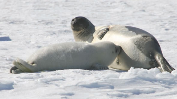
In fact, the Cape Bathurst polynya is a critical place for ringed seals and bearded seals to congregate in spring. Therefore, this is where many Southern Beaufort polar bears go to hunt. The presence of the polynya is especially crucial in years like this one, when very thick sea ice covers most of the Beaufort Sea.  Continue reading

Snow depth over spring sea ice affects polar bear feeding success and ringed seal survival

Snow depth over sea ice in spring affects the hunting success of polar bears on ringed seal (Phoca hispida) pups, but the relationship is more complicated than you might think and there is less data on this phenomenon than you would believe.

Ringed seal lair_snow and ice thickness_PolarBearScience_sm

Regional snow depth in spring (April-May) varies naturally from year to year due to weather patterns driven in part by long-term climate cycles (like the Atlantic Multidecadal Oscillation, Pacific Decadal Oscillation, and the Arctic Oscillation).

This year, it was very cold in Eastern North America, with record-breaking snow fall in some areas. Snow depth was apparently greater than average over Hudson Bay sea ice this spring but was it deep enough to have impaired polar bear hunting success?

Continue reading

Labrador polar bear not lost or in danger – just running down a rural highway

An interesting report from Labrador this morning: video footage of a fat polar bear running down an isolated 2-lane highway in southern Labrador.

Cartright Junction_Labrador pb_Chelsea Morris photo from video

Yet another reminder that there is still a lot of sea ice off that coast, which is home to the Davis Strait polar bear subpopulation.
Continue reading

Polar bear habitat update – sea ice for hunting plentiful in all subpopulation regions

Preferred polar bear habitat is said to be 50% concentration or higher over continental shelves, which describes all but the fringes of sea ice extent today, including Hudson Bay, the Southern Beaufort, and the Barents Sea.

Preferred polar bear habitat 50pc concentration_May 8 2015_PolarBearScience

However, polar bears – excellent swimmers that they are – are quite capable of utilizing areas with 15-50% sea ice concentration if necessary (Durner et al. 2004; Rode et al. 2014:79), especially when prey are plentiful.  This would account for the fact that there are still sightings of polar bears in and around northern Newfoundland (see previous post here and photo below1), where ice concentration is in the 30-50% range.

Photo with this news story (7 May 2015): "(Update) Polar bear sighting in Croque"

Photo with this news story (7 May 2015): “(Update) Polar bear sighting in Croque”

Continue reading

Tracking polar bears in the Southern Beaufort, with a sea ice surprise – April 2015 map

USGS biologists were clearly busy this spring putting more satellite radio collars and glue-on tags on Southern Beaufort Sea polar bears but there’s some surprising information in their April 2015 tracking map about current sea ice conditions.

From the 2013-2014 issue of  “Polar Bear News” (USFWS).

From the 2013-2014 issue of “Polar Bear News” (USFWS).

What’s interesting is that the sea ice maps they use show less dark spots that might be open water this year than were present last year in late April. Oddly, this phenomenon has one prominent biologist worried about “challenging” polar bear habitat developing this year – without mentioning last year at all.

The USGS track map for April 2015 is copied below.1
Continue reading

Polar bear season for Newfoundland residents still going strong, recent sightings confirm

Two recent sightings of polar bears along the north shore of Newfoundland are a reminder that sea ice is still a prominent feature of the Davis Strait polar bear subpopulation landscape at this time of year.

LaScie_Newfoundland_April 27 2015_ColleenGray label

A polar bear was sighted in the community of La Scie, northern Newfoundland Monday, 27 April (pictured above, swimming in the harbour), while another landed in the town of Fogo, on Fogo Island, last week (see maps below).
Continue reading

Spring ice alarm deflated – 2015 ice now as high as 2014 & Davis Strait highest since 1971

Arctic ice extent (at 14.1mkm2) on 15 April, was virtually identical to 2014 on that date, and higher than 2006. But the record goes to Davis Strait, which recorded the highest ice extent since 1971 for the week of April 16, while the waters of Eastern Newfoundland to the south (where most harp seals have their pups) had the third highest ice extent since 1969. Lots of fat baby seals are just what polar bears need at this time of year.

Harp seal pup_DFO Newfoundland

Continue reading