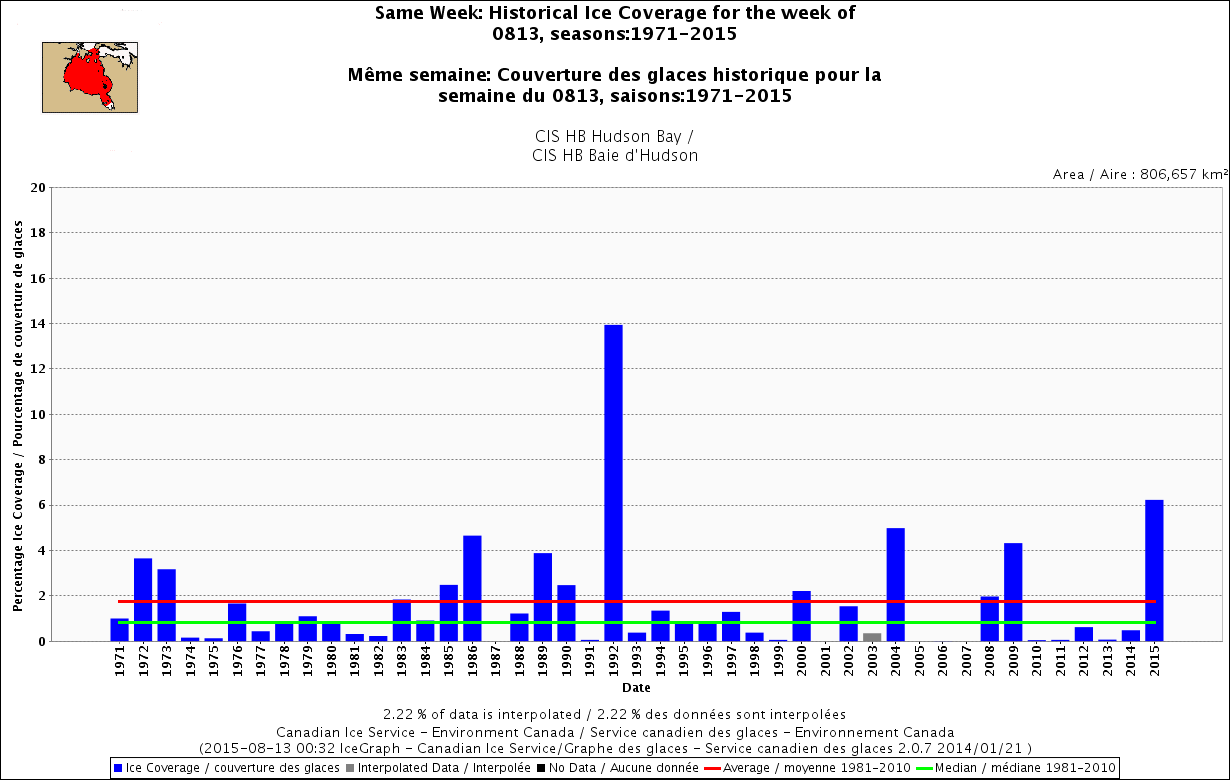
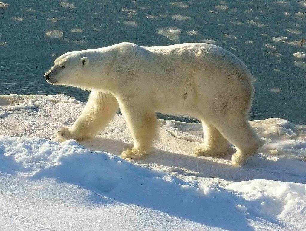
Tag Archives: Davis Strait

Polar bear habit update – day 333 Arctic sea ice hits 11.1 mkm2

It’s just past the height of fall in the Arctic (Oct-Dec) and polar bear habitat is expanding day by day: according to NSIDC Masie ice charts, the ice has now surpassed 11 mkm2 in extent. Fall is the second most important feeding period for polar bears after spring.

masie_all_zoom_4km 2015 day 333_Nov 29

Only the Barents and Kara Seas (north of Norway and western Russia) are short of ice right now, similar to conditions seen in the fall of 2013. Last fall (2014), conditions were much better and as a consequence, researchers saw a lot of females with healthy cubs in the spring of 2015.

Continue reading

Polar bear habitat update – Arctic sea ice today covers same area as it did on June 30

Arctic refreeze is well underway. Less than half way through the Arctic autumn (Oct-Dec), polar bear habitat on 11 November 2015 covered the same total area as it did on the last day of Arctic spring (April-June); it’s just distributed differently.

polar_bear_usfws_no date_sm

Yesterday, courtesy NSIDC Masie

masie_all_zoom_4km_2015 Nov 11

Here is what 30 June 2015 ice extent looked like, with the same amount of ice coverage:

masie_all_zoom_v01_2015181_4km

For the week of 12 November, Hudson Bay sea ice development is well underway, with more ice in the north than there has been in many years; Davis Strait ice is the highest this week since 1999 and Baffin Bay ice coverage is above average. Foxe Basin and the Beaufort Sea are both approaching maximum coverage, which means bears there will be back out on the ice hunting. Chukchi Sea ice has finally surrounded Wrangel Island but the Svalbard Archipelago in the Barents Sea is still ice-free. More ice maps and charts below.
Continue reading

2nd highest ice coverage for Hudson Bay since 1971 at mid-August – only 1992 higher

Since 1971, there has been no year when there was as much ice left on Hudson Bay as there is this year at August 13th, except 1992 – the year when Mt. Pinatubo seemingly affected Hudson Bay ice levels but not any other region in Eastern Canada or the Beaufort Sea. Odd, that – see the graphs below.

Hudson Bay same week 13 Aug 1971-2015

Doesn’t mean that much to polar bears, since they will mostly be fasting whether they are onshore for the summer or riding the ice – they primarily live off their fat this time of year. Still, the relative ice levels are interesting because it could impact freeze-up dates later this fall, which will influence the bears’ ability to hunt before the winter fast sets in.

Continue reading

Polar bear habitat update: Eastern Canada well above normal, lots of sea ice worldwide

Sea ice in at least three Eastern Canadian polar bear subpopulations is well above normal for this time of year, which means many bears are likely not ashore yet. The same is true in the Beaufort and Barents Seas – ice is melting but there is still a fair amount of sea ice close to popular shores. Cause for cheering, not raising alarms.

Stirling 01 no date_sm

Southern Hudson Bay, Foxe Basin, and Davis Strait, all have above average sea ice coverage, according to the Canadian Ice Service (see charts below).

Sea ice concentration in Canadian waters at 23 July 2015. Canadian Ice Service. Click to enlarge.

Sea ice concentration in Canadian waters at 23 July 2015. Canadian Ice Service. Click to enlarge.

Hudson Bay ice levels are particularly striking: the anomaly map below (“departure from normal”) is almost entirely blue (positive), showing how far it is above average. No wonder supply ships needed icebreaker help yesterday to get into Inukjuak on the eastern shore. Most of the ice is technically in the Southern Hudson Bay polar bear subpopulation region, which has a stable population.

Continue reading

Heavy ice in Hudson Bay derails ArcticNet global warming research plans: irony bites

Heavy ice in Hudson Bay derails CCGS Amundsen’s research plans” – just in from the CBC (22 July 2015, via Twitchy). Worst ice in 20 years.

ccgs-pierre-radisson-in-sea-ice_to_Iqaluit_july 17_2015

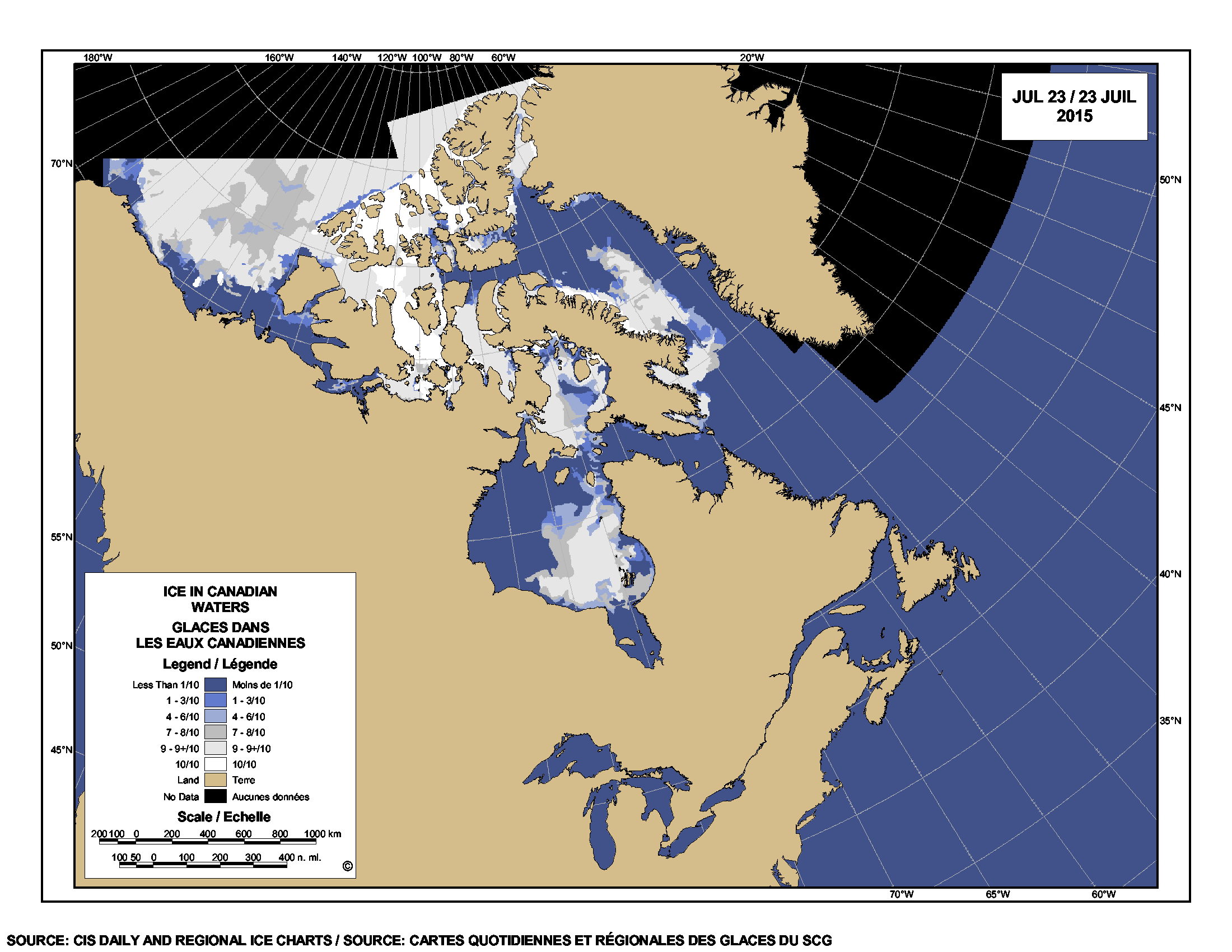
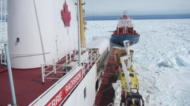
[original caption for the above photo: “The CCGS Pierre Radisson escorts the oil tanker Havelstern to Iqaluit July 17. Tough ice conditions in area have delayed this summer’s annual resupply, and have now derailed the CCGS Amundsen from its carefully planned summer research program.”]

Worst ice conditions in 20 years force change of plans to icebreaker research program

That would be 1992 they’re talking about, the cold year that everyone blamed on the eruption of Mt. Pinatubo. Unfortunately, there are no good detailed ice maps from 1992 (see previous post here). What’s the excuse this year?

CCGS Amundsen is an icebreaker that is usually released from duty to serve as an Arctic research vessel in the summer. And who’s on board? GEOTRACES 2015 Arctic Expedition out of the University of British Columbia with a plan to study (in part) global warming caused “ocean acidification.” Their short blog post shows a map without ice and not a hint they see the irony of the situation.

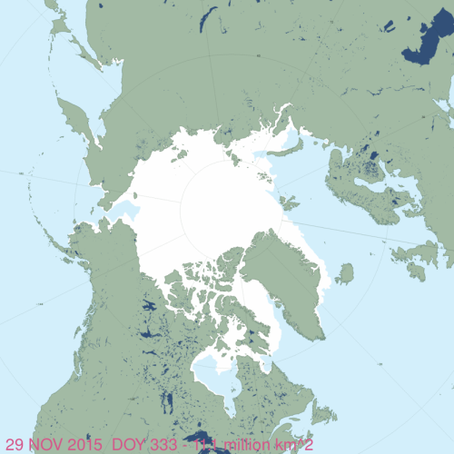
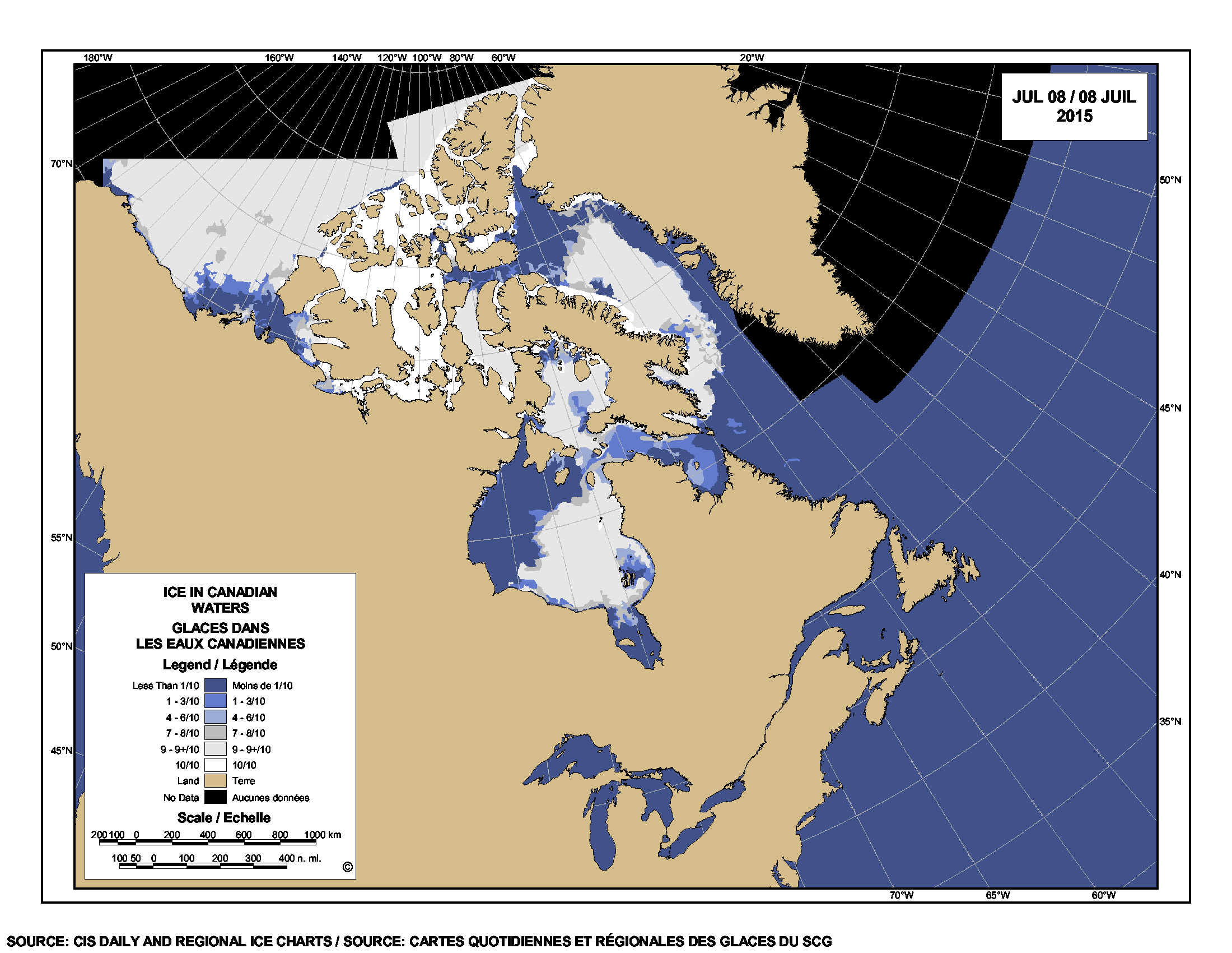
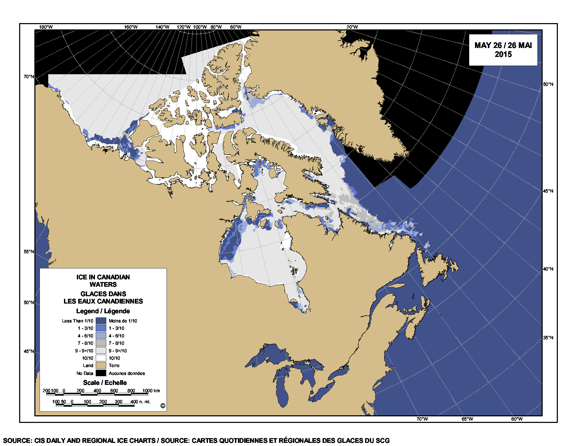
Here’s the ice they’re talking about (from the Canadian Ice Service), with the communities mentioned in the study marked:

Sea ice at 22 July 2015, with Inukjuak (EHB) and Iqaliuk, Baffin Island marked. Click to enlarge.

Sea ice at 22 July 2015, with Inukjuak, Eastern Hudson Bay, and Iqaliuk, Baffin Island, marked. CIS map. Click to enlarge.

Continue reading

Polar bear habitat looking good for early summer – last days before the fast

Some polar bears may already be living mostly off the fat put on over the spring but others may catch a seal or two on the sea ice before the summer fast begins – since the ice hasn’t left the coast in most regions quite yet. Polar bears eat little in summer, whether they spend their time on land or on the sea ice.

PolarBearCV1LG_USGS

Sea ice is still high over Hudson Bay – for this time of year, it hasn’t had this much polar bear habitat since 2009. Davis Strait and Foxe Basin are also above average – Davis Strait hasn’t had this much ice since 1992 (the Mt. Pinatubo cold year). Polar bear subpopulation refresher map below.

PB map-all-populations PBSG original plus Okhotsk
Continue reading

Sea ice breakup update: high ice coverage just about everywhere, even Hudson Bay

There is still a lot of sea ice in Hudson Bay, Foxe Basin, Davis Strait and Baffin Bay this week – more than average for this date – with slightly less than average in the Beaufort Sea. Past behaviour of Western and Southern Hudson Bay polar bears suggests the mean date that bears come ashore for the summer this year will be later than average due to the plentiful ice available, regardless of when polar bear biologists decide that “breakup” has occurred.

Hudson Bay breakup July 8 2015_CIS

Hudson Bay, with almost 50% of the bay still covered in ice, has the third highest coverage this week since 1992 (after 2009 and 2004); Davis Strait has the highest coverage since 1992; and Foxe Basin and Baffin Bay have the highest coverage since 1998. For this week, the Beaufort Sea has the second highest coverage since 2006 (after 2013), and more ice than was present in 1971, 1982, 1987, 1988 and 1998 – among others.

Published data shows that most polar bears of Western Hudson Bay traditionally come ashore in July, but this year it might be late July or even August. Have a look at the charts below.
Continue reading

Hudson Bay sea ice coverage is atypical this year but what does that mean for polar bears?

Churchill_Polar_Bear_2004-11-15 Wikipedia

There is a rather large patch of open water in the northwest sector but what’s also unusual about breakup this year is the virtual lack of open water in eastern Hudson Bay – that almost never happens (compare to 2013 here). In addition, there’s still very little open water in Hudson Strait, which connects Hudson Bay to Davis Strait in the east – that’s also unusual.

Figure 1.  Sea ice extent over Hudson Bay and Hudson Strait at 26 May 2015. Canadian Ice Service.

Figure 1. Sea ice extent over Hudson Bay and Hudson Strait at 26 May 2015. Canadian Ice Service. Click to enlarge.

The question is: does the somewhat unusual pattern of ice cover at this date – which developed rapidly over the last few weeks – suggest we can predict whether polar bears will have a shorter-than-average hunting season?

To answer that, you have to look at maps generated by the same source over several years. The result, in my opinion, is inconclusive – while so far, this year looks a bit more like 2009 (which was a very late sea ice breakup year) than it does 2011 (which was an early breakup year), it’s really too early to tell.

I suggest we simply won’t know for another month or so which pattern will prevail. However, that hasn’t stopped IUCN Polar Bear Specialist Group member Andrew Derocher (via Twitter, e.g., here and here, among many others) from suggesting that this year’s pattern is likely a portend of doom for Hudson Bay polar bears. See what you think.
Continue reading

Labrador polar bear not lost or in danger – just running down a rural highway

An interesting report from Labrador this morning: video footage of a fat polar bear running down an isolated 2-lane highway in southern Labrador.

Cartright Junction_Labrador pb_Chelsea Morris photo from video

Yet another reminder that there is still a lot of sea ice off that coast, which is home to the Davis Strait polar bear subpopulation.
Continue reading

Polar bear habitat update – sea ice for hunting plentiful in all subpopulation regions

Preferred polar bear habitat is said to be 50% concentration or higher over continental shelves, which describes all but the fringes of sea ice extent today, including Hudson Bay, the Southern Beaufort, and the Barents Sea.

Preferred polar bear habitat 50pc concentration_May 8 2015_PolarBearScience

However, polar bears – excellent swimmers that they are – are quite capable of utilizing areas with 15-50% sea ice concentration if necessary (Durner et al. 2004; Rode et al. 2014:79), especially when prey are plentiful.  This would account for the fact that there are still sightings of polar bears in and around northern Newfoundland (see previous post here and photo below1), where ice concentration is in the 30-50% range.

Photo with this news story (7 May 2015): "(Update) Polar bear sighting in Croque"

Photo with this news story (7 May 2015): “(Update) Polar bear sighting in Croque”

Continue reading