Tag Archives: habitat

Alarm over future summer polar bear habitat disguises how good conditions are right now

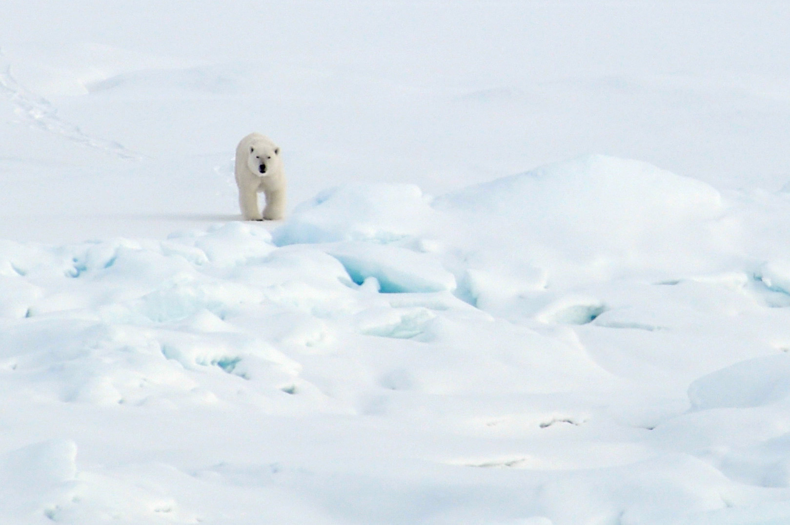
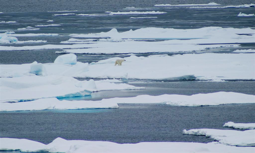
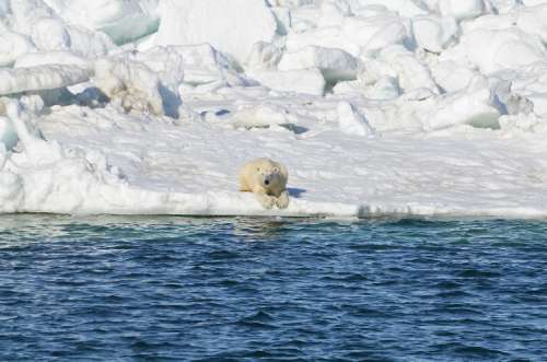
Despite the public outcry last week over future polar bear survival, the polar-bears-are-doomed crowd can’t hide the fact that this year, spring sea ice habitat for polar bears worldwide has been excellent.

A polar bear walks on the Arctic Ocean ice Aug. 21, 2009.

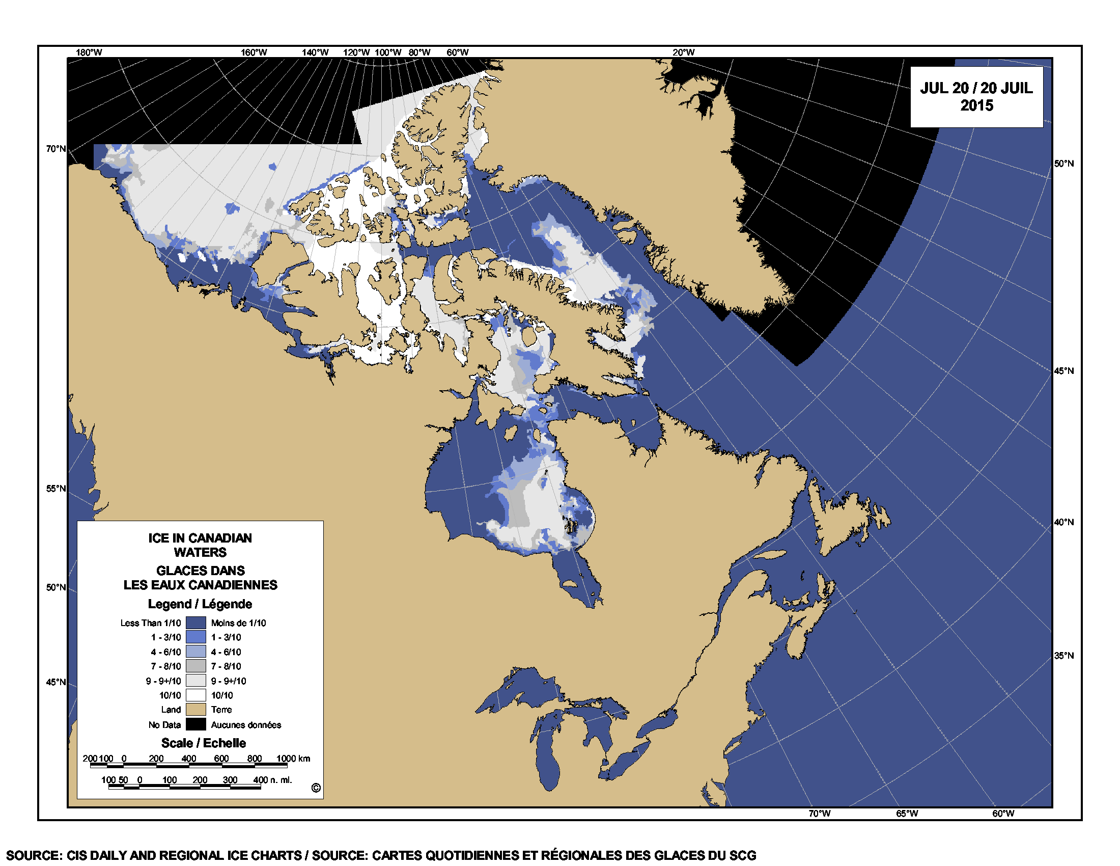
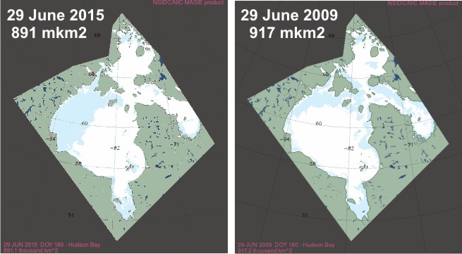
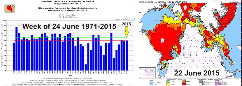
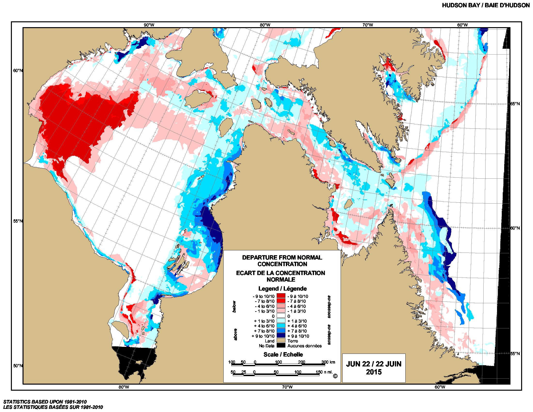
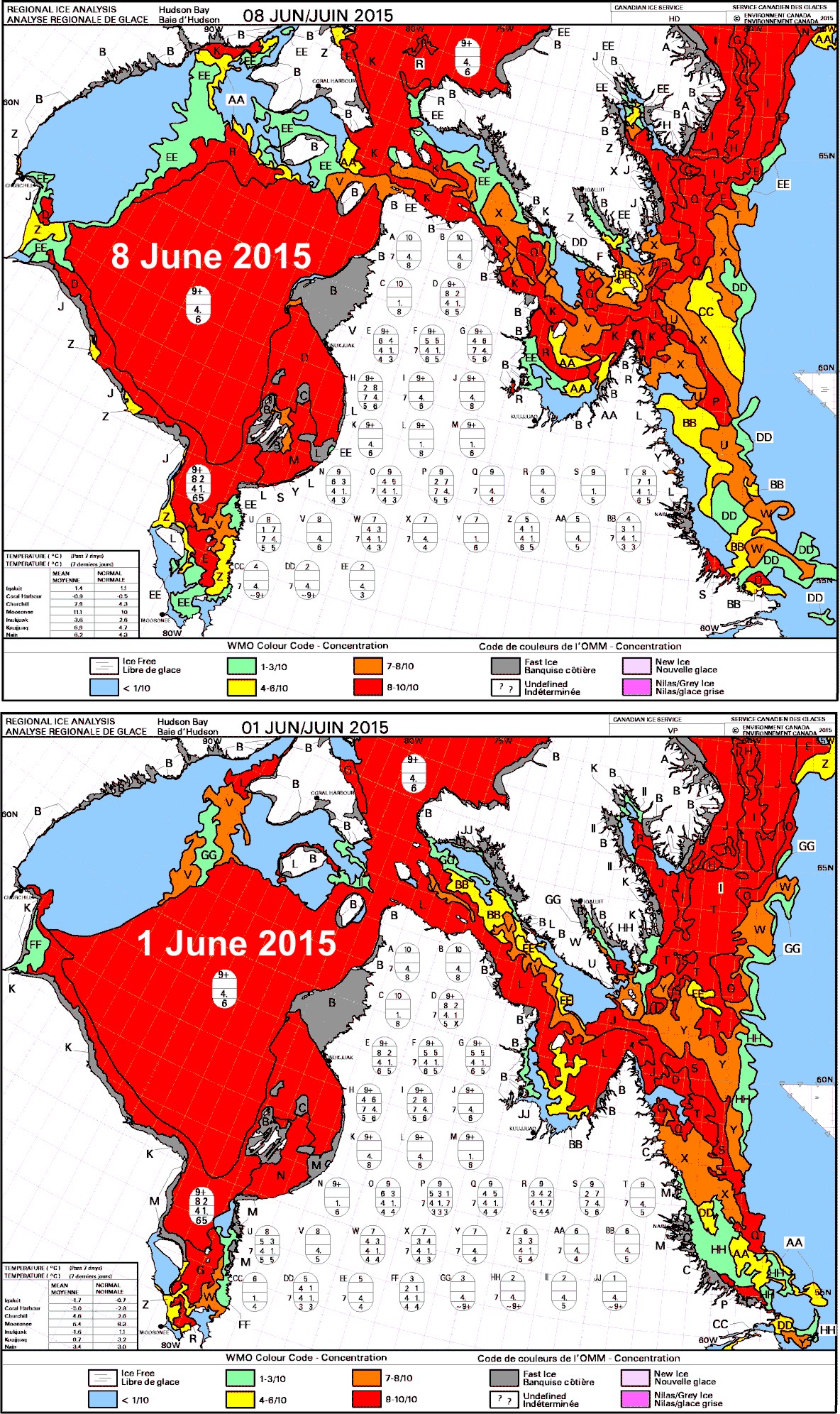
This year on 19 July, for example, Hudson Bay had greater than 150,000 square km more sea ice than there was in 2009 on that date (526.2 vs. 368.5 mkm2)(1992 was a particularly cold year and most bears left the ice as late in 2009 as they did in 1992).1 Conditions have also been excellent for pregnant females around Svalbard – Norwegian polar bear researchers recently reported a good crop of cubs this spring.

Hudson Bay breakup July 20 2015_CIS

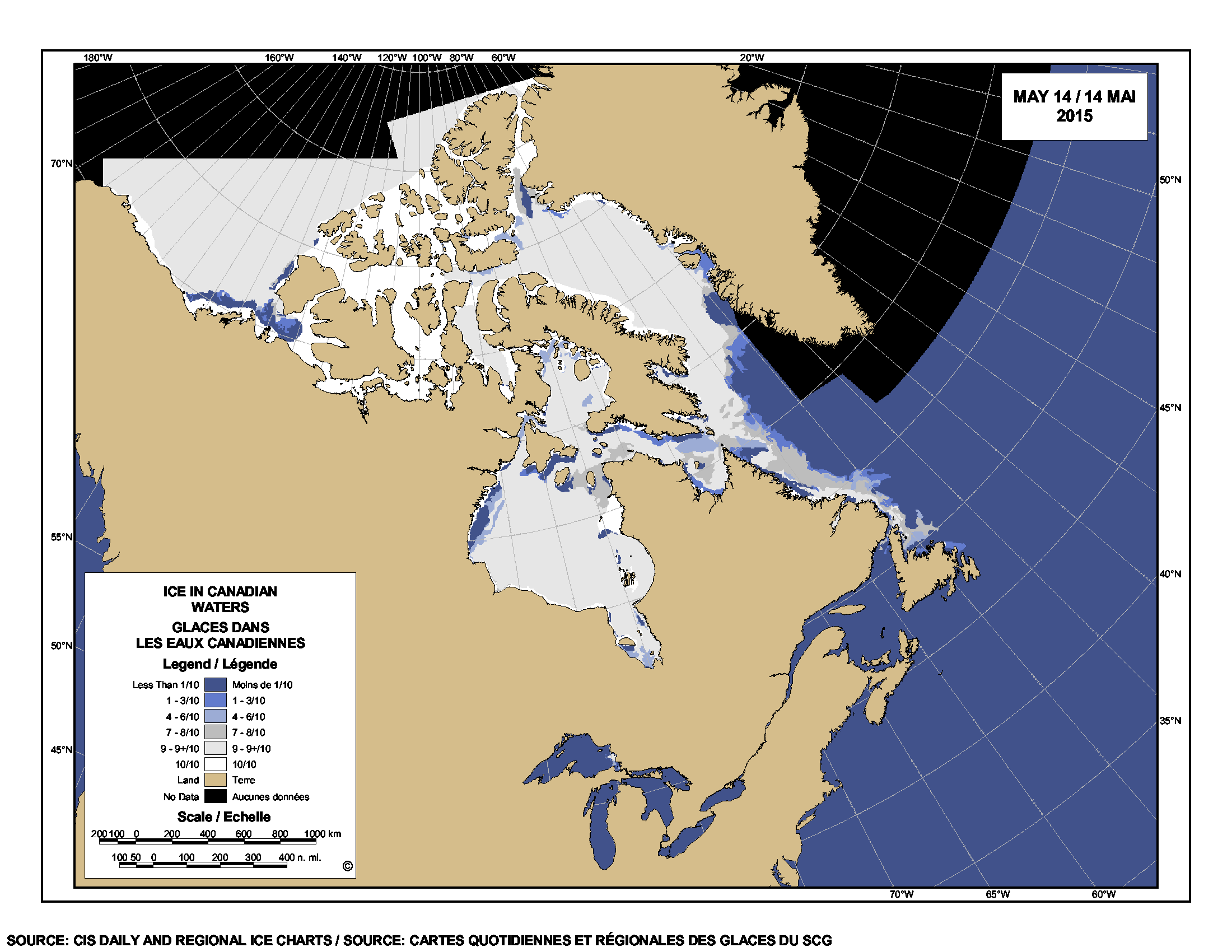
Worldwide, there was exactly the same amount of Arctic sea ice present on 18 July 2015 as there was back in 2006 (Day 199) – 8.4 mkm2. By 19 July (day 200), 2015 had more ice than 2006 (8.4 mkm2 vs. 8.3).

All this means that recent summer ice melt has not impinged on the spring feeding period that is so critically important for polar bears. So much ice left in early summer means there was lots of sea ice in the spring (April-June), even in the Southern Beaufort Sea.

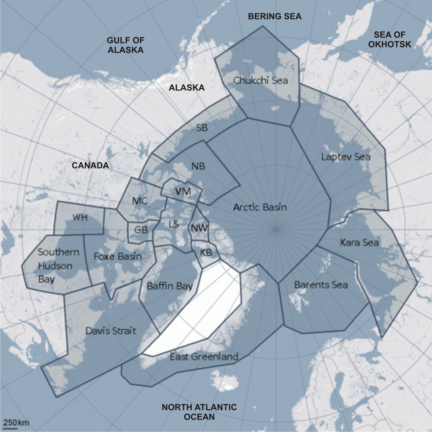
The only region with sea ice coverage well below the last five years is the Chukchi Sea (see plots below, click to enlarge). So why aren’t we hearing the-sky-is-falling stories about Chukchi bears? Because biologist have already demonstrated that polar bears in the Chukchi do very well even with no summer sea ice.
Continue reading

Polar bear habitat looking good for early summer – last days before the fast

Some polar bears may already be living mostly off the fat put on over the spring but others may catch a seal or two on the sea ice before the summer fast begins – since the ice hasn’t left the coast in most regions quite yet. Polar bears eat little in summer, whether they spend their time on land or on the sea ice.

PolarBearCV1LG_USGS

Sea ice is still high over Hudson Bay – for this time of year, it hasn’t had this much polar bear habitat since 2009. Davis Strait and Foxe Basin are also above average – Davis Strait hasn’t had this much ice since 1992 (the Mt. Pinatubo cold year). Polar bear subpopulation refresher map below.

PB map-all-populations PBSG original plus Okhotsk
Continue reading

Polar bears fine now but give us more money: US Fish & Wildlife Management Plan subtext

Between-the-lines message of the recently released (and hyped to death) Conservation Management Plan for polar bears by the US Fish & Wildlife Service is that the bears really have nothing to worry about except human-caused global warming but it will cost tens of millions of dollars over the next five years to study and manage them.

polar_bear_usfws_no date_sm

So filled with double-speak, misinformation, and obfuscation [including the newly-invented term, “quasi-extinction floor”] that it’s no wonder some news outlets got it wrong (nowhere in this document does it say that polar bears might go extinct within ten years“). The document does, however, lay out the FWS budget for polar bears over the next five years – and it’s a real eye-opener.

Continue reading

Hudson Bay breakup later than average, longer hunting season for polar bears

Due to the atypical pattern of sea ice melt on Hudson Bay this year, 2015 will definitely be a later than average breakup year – perhaps not as late as 1992 but maybe almost as late as 2009. Easing into the first days of Arctic summer, there is still a lot of polar bear habitat left on Hudson Bay, especially in the east.

Hudson Bay breakup 2015 vs 2009 at 29 June_MASIE

Although official breakup in 2009 was only a little later than usual (9 July), bears came ashore about the same time (after mid-August) as they did in 1992, when breakup was very late (30 July). With the pattern this year being so unusual (and the melt so slow over the last few weeks), who knows how late it could be before the last bears leave the ice in 2015?

There is definitely more sea ice this year on the bay than there was last year, when breakup was about average for the last 24 years.

UPDATE 2 July 2015: CIS weekly ice coverage graphs added to the end of this post. Hudson Bay ice highest since 2009 and Davis Strait highest since 1994! Have a look.
Continue reading

Polar bear habitat update: many bears on the ice in Hudson Bay, lots of sea ice globally

Polar bear habitat over Hudson Bay was average this week (at 60% coverage), despite the odd pattern of breakup – but the end of spring in the Arctic is only 5 days away and there is still plenty of polar bear habitat in all regions.

Hudson Bay breakup 2015 June 22 and 24_sm

According to the Canadian Ice Service (CIS), there is still more ice in the eastern portion of the bay than usual and much less in the northwest (Fig. 1 below). There is far more ice than average ice in Hudson Strait, the approach to southern Davis Strait.

Figure 1. Hudson Bay sea ice, difference from average at 22 June 2015. Blue is less than average, red is more than average. CIS.

Figure 1. Hudson Bay sea ice, difference from average at 22 June 2015. Blue is less than average, red is more than average. CIS. Click to enlarge.

Continue reading

Polar bear news: 1st fat bear ashore in WHB, trouble in S. Greenland, and more hybrid hype

Last week, among other events, the first fat polar bear of the season was photographed on shore in Western Hudson Bay, a fat bear was run out of town in South Greenland, and media outlets spread misinformation – apparently preferring global warming hype to rational facts.

1) First polar bears have been seen onshore in Western Hudson Bay in Wapusk National Park near Cape Churchill (map below) on 18 June this year, apparently fat and well prepared for the summer fast. My informants tell me a few bears usually come ashore in June near Churchill before ice conditions make this necessary; the bulk of the population will probably continue seal hunting for a few more weeks. Those bears will come ashore along the southwest coast (near Polar Bear Provincial Park, in Ontario, see Fig. 2 below). They’ll make their way north to the Churchill area in time for freeze-up in the fall. Watch one fat bear caught on camera on 18 June, below :

2) Fat polar bear spotted in Nanortalik, Southern Greenland 18 June 2015, a bit further south than usual. People from the community drove it away, but not before taking lots of pictures.

Greenland South_polar-bear-nanortalik-08_henrik-hansen_June_18_2015

Some very cool photos, including the one above (taken by Henrik Hansen), worth a look. This bear was in excellent condition, well prepared for the summer fast ahead, whether he ends up spending it on shore somewhere (but not near this community!) or on the sea ice further north in SE Greenland (Fig. 1 below). The ice in that areas is probably broken up (~15-30% concentration) but this is enough for the bear to swim from flow to flow to make it’s way up the northeast coast where most East Greenland bears spend the summer.
Continue reading

Hudson Bay breakup progressing slowly, still lots of polar bear habitat

Not much change in sea ice coverage since last week – most of Hudson Bay is still covered with concentrated ice, which is good news for Western and Southern Hudson Bay polar bears. They are still free to roam and hunt over most of the ice-covered bay.

Hudson Bay breakup 8 June 2015 vs 1 June_PolarBearScience

There may be slightly less ice than average for this time of year (Fig. 1, below) but coverage is still >70% with concentrated ice and does not appear to be melting quickly (see charts above and Fig. 2, below).

The dates for three previous earliest breakups according to Lunn and colleagues (Fig. 3) have come and gone, as all were in the first week of June (more on that in an upcoming post) – no records broken. More graphs and maps below, see previous posts here and here.
Continue reading

My new Arctic Fallacy paper- Sea ice stability and the polar bear

I have a new paper out that explains a fundamental problem with polar bear conservation.

Chukchi June 15 2014_USGS_Brian Battaile_after swim_sm

I’m convinced that a flawed and out-dated ecological concept — that sea ice, under natural conditions, provides a stable, predictable habitat — is what has allowed the present doom and gloom attitude of most polar bear specialists to develop.

Sea ice changes, of course, from season to season. However, the concept that sea ice is a stable habitat assumes that these seasonal changes are predictable and virtually the same from one year to the next – at least, similar enough that the differences are not responsible for causing marked declines in population size.

The assumption is that under natural, stable conditions populations of Arctic animals will either stay the same over time or increase. Biologists were taught at university that sea ice should be a stable habitat and as a result, they’ve glossed over evidence they collected to the contrary. [see recent posts here and here, for example]

Negative effects on populations of short-term natural variations in spring sea ice or spring snow cover on sea ice have been entirely ignored in modeled predictions of future conditions. The focus has been on summer ice extent.

I have summarized this evidence in a fully referenced, peer-reviewed essay that explores how the acceptance of this fallacy (“sea ice is a stable habitat”) has so skewed the conservation biology of polar bears that to outsiders it may look like a scientific integrity issue.

The summary and the essay are below (with embedded links and references). The Global Warming Policy Foundation (GWPF) has published the essay in their “Briefing Paper” series (#16, The Arctic Fallacy: Sea Ice Stability and the Polar Bear), which includes a must-read foreword by Dr. Matthew Cronin, Professor of Animal Genetics at the University of Alaska Fairbanks. Press release here, pdf here.

I think you’ll find it timely and thought-provoking.

Continue reading

Tracking polar bears in the Southern Beaufort May 2015 – thick ice and polynyas

Polar bear habitat in the Southern Beaufort for May 2015 was a contrast between the development of recurring polynyas (patches of open water) and tremendously thick sea ice. So it’s interesting to see where the polar bears tagged by USGS biologists chose to hang out.

Polar_Bear_Biologist_USFWS_working_with_a_Bear_Oct 24 2001 Amstrup photo

The total number of bears being tracked in May – 23 – is down markedly from the 30 bears USGS biologists started with in April.

Most of the collared bears were concentrated in May along the shore lead (crack of open water) that normally develops between the shorefast ice and the pack ice offshore. That’s especially understandable this year, since most of that pack ice is 3-5 m thick (10-16 ft) – see the maps below.
Continue reading

Polar bear habitat update: Hudson Bay sea ice breakup on track

Hudson Bay sea ice coverage is only slightly below average for this time of year (week of 14 May, below) but well above levels for 2006, when Western Hudson Bay breakup was relatively early).

Sea ice Canada 2015 May 14_CIS

Figure 1. Sea ice coverage over Hudson Bay for the week of 14 May, 1971-2015. Canadian Ice Service. Click to enlarge.

Figure 1. Sea ice coverage over Hudson Bay for the week of 14 May, 1971-2015. Canadian Ice Service. Click to enlarge.

Even at its highest extent in April, Hudson Bay is only 97-98% ice covered (due to persistent shoreleads and polynyas), which means ice levels are currently only 10% or so below maximum. In other words, there is still lots of polar bear hunting habitat over the bay.

That’s a bit lower than ice coverage was for the last two years at this date (2013-2014), which had average or above average ice cover. However, there is currently a bit more ice on Hudson Bay than there was in 2011 and 2012 – and much more than there was in 2010 and 2006.
Continue reading