Category Archives: Life History

Critical spring feeding for polar bears is over – sea ice levels are now irrelevant

Polar bears in virtually all regions will now have finished their intensive spring feeding, which means sea ice levels are no longer an issue. A few additional seals won’t make much difference to a bear’s condition at this point.

Relative importance of seasons polar bear graphic_PolarBearScience_June2016

The only seals available on the ice for polar bears to hunt in early July are predator-savvy adults and subadults but since the condition of the sea ice makes escape so much easier for the seals, most bears that continue to hunt are unsuccessful – and that’s been true since the 1970s. So much for the public hand-wringing over the loss of summer sea ice on behalf of polar bear survival! Continue reading

Polar bears and W. Hudson Bay sea ice breakup 2016

Breakup for Western Hudson Bay (WHB) is looking to be later than usual this year, given that the average breakup date since 1991 has been July 1 (using a 30% threshold) – only a few days from now – and the ice in WHB is nowhere near 50% coverage, let alone 30%.

Churchill_Polar_Bear_2004-11-15 Wikipedia

Note that few WHB bears come off the ice around Churchill – most come ashore along the southwest coast of Hudson Bay (almost into SHB) and make their way north over the course of the summer to meet the ice as it reforms in the fall north around Churchill – that’s why it’s called a “migration.”

map-WesternHudsonBay

There’s still a lot of ice left in Hudson Bay, as the Canadian Ice Service map for 29 June 2016 (below) shows: Sea ice extent Canada 2016 June 29 CIS

It seems to me that breakup for WHB this year is looking rather like 2014, which was something like a week later than the average since 1991, but time will tell. See below for comparison to 2009 (a late breakup year), 2015, and 2013 (lots of variability!), as well as a discussion of when bears come ashore in relation to this sea ice breakup benchmark.

Continue reading

Five years of polar bear habitat at June 20 around the Arctic

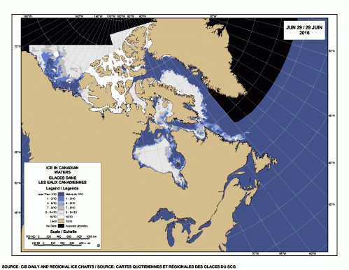
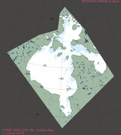
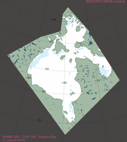
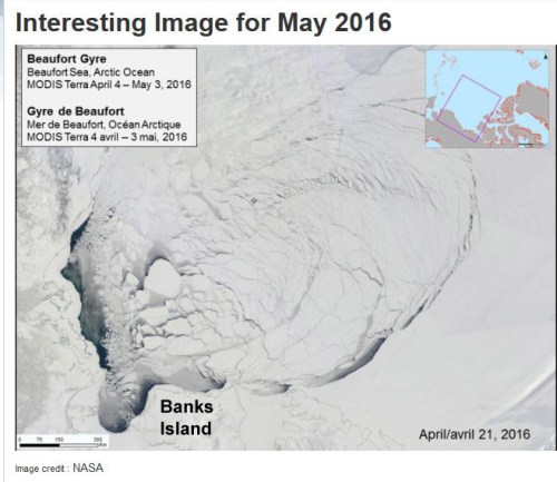
Five years worth of sea ice maps for the same date is hard to come by in this country, since the Canadian Ice Service does not archive their daily sea ice maps. However, due to some forethought, I have at hand ice maps going back to 2012 for the longest day of the year for Canada and archives for other regions provide similar perspective at the solstice.

Polar_Bear_male on sea ice_Regehr photo_March 21 2010_lg

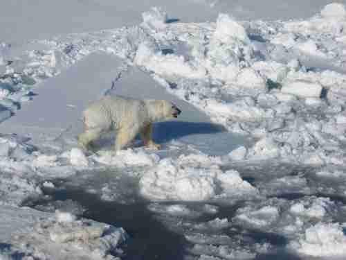
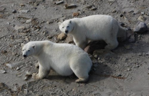
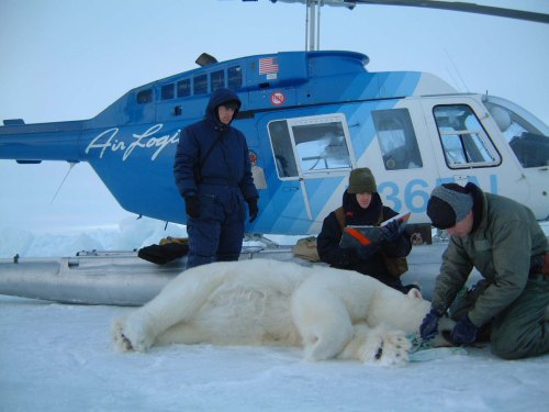
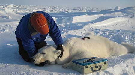
Few photos of polar bears in June likely exist – too early for most bears to come ashore and the ice too unstable for humans to be offshore [photo above is dated March].

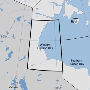
Compare the five maps for Canada and eastern Alaska below. Notice the differences for Hudson Bay: it may seem ironic, but 2012 (which had the lowest September minimum since 1979 due to an August storm) had the most typical Hudson Bay breakup/melt pattern compared to previous years. [Keep in mind this recent post about how much ice can remain even when almost none is visible on the ice maps]

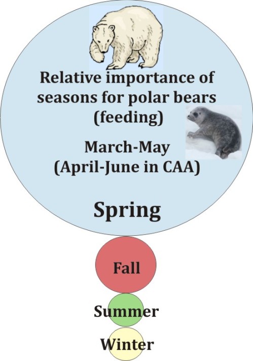
In many regions, polar bear hunting efforts are seldom successful after early June because young-of-the-year seal pups have taken to the water to feed, which means the only prey still on the ice are predator-savvy adults and subadults that have an easy time escaping in the rapidly breaking up ice fields. Bears that come ashore in June likely are not missing much – a little less ice than usual at this time of year is not going to make much difference.

Overall, despite doom and gloom predictions we heard in March 2016 (“wintertime extent hits another record low”), sea ice extent (courtesy NSIDC) at 20 June 2016 was the same at this date as it was in 2010 and 2012 at this time of year – which essentially marks the end of the primary feeding period for polar bears (except for those that live in the Canadian Arctic Archipelago, where seals give birth a bit later in the spring).

Sea ice at 20 June_2016 vs 2012 and 2010_NSIDC interactive

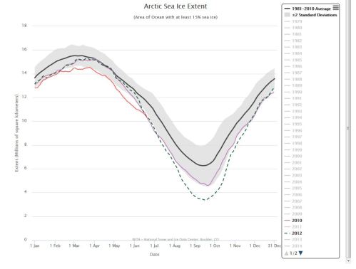
And did polar bears die in droves due to conditions in 2010 or 2012, in any subpopulation around the Arctic affected by low sea ice levels? No, they did not. In fact, the subpopulation that had the most recent survey done (Svalbard portion of the Barents Sea – 2015) was not only found to be thriving but numbers had increased markedly (42%) over 2004 levels. Now that’s resilience!

Continue reading

Terrestrial food fight amongst polar bear researchers reflects political differences

With a few big guns on one side and some fringe folk on the other, a dichotomy of opinion has developed amongst polar bear researchers regarding whether or not consumption of land-based foods is making a difference to polar bear survival (or is likely to in the future).

Polar bears eating terrest foods WHB_Rockwell press release

It’s been going on for a while now. Last year, two US Geological Survey members of the IUCN Polar Bear Specialist Group (PBSG) apparently got fed up with the scatter-shot of papers promoting terrestrial foods as a possible salvation for polar bears (e.g. Iles et al. 2013;  Iverson et al. 2014; Rockwell and Gormezano 2013a, 2013b). In April, they published a canon volley of a paper meant to blow all that ‘polar-bears-might-survive’ talk out of the water once and for all (Rode et al. 2015).

Note that although the PBSG didn’t bother to update their website with the IUCN Red List assessment when it came out last November, they had a link up to the USGS terrestrial feeding paper within 16 days (with an editorial summary in the “NEWS” section as well as a listing of the paper in the “RECOMMENDED READING” section). As I suggest below, this difference in treatment may not be a coincidence.

However, another group of non-PBSG researchers  haven’t given up just yet, as shown by the title chosen for the most recent news report (Alaska Dispatch News, 16 June 2016) on the just-finished International Bear Conference:

Want to know how a changing climate is affecting polar bears? Look at what they’re eating.

Apparently, Jeff Welker, a University of Alaska Anchorage researcher who is co-author on two recent papers on the subject of polar bear consumption of terrestrial foods (Tartu et al. 2016 and Rogers et al. 2015), gave a presentation at the conference that raised this topic yet again. His talk came on the heels of an earlier presentation by Todd Atwood, who suggested Southern Beaufort polar bears might benefit from staying onshore to eat left-over whale scraps instead of staying on the sea ice during the summer (even though he had no data to support that opinion – as I discussed in this post).

Here’s the question: is this dispute really about what polar bears eat or don’t eat when they’re on land – or is it symptomatic of the underlying politics of polar bears? [CBC documentary video by that name here]
Continue reading

New paper shows no harm from more time on land for S. Beaufort polar bears

polarbears-arcticnatlwildliferefuge-suzannemiller-usfws_labeled_smTake-home quote from a new polar bear paper by Todd Atwood and colleagues (2016):
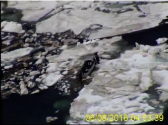
“…there is no causal link between the patterns in polar bear vital rates and increased use of terrestrial habitat…”

In other words, there was no information to link the increased time polar bears spent onshore with either an increase or a decrease in body condition, survival or cub production. The authors did find that polar bears were strongly attracted to the bone piles that accumulated in the fall from 2010-2013 after Inuit bowhead whale (Balaena mysticetus) hunting at Barrow, Cross Island, and Kaktovik. Isn’t that a surprise?

The results also appear to confirm previous work that showed terrestrial (land-based) foods are not important to polar bears – a conclusion I totally agree with and which I discussed last year here. No wonder there was no press release issued by USGS about this study. It’s only “news” because someone the Anchorage Daily News interviewed lead-author Atwood yesterday as a way of promoting the International Bear Conference (see previous post here, now updated with a link to the Talk of Alaska radio podcast). Atwood implied there could be advantages to bears from feeding on the bone piles but admitted he had no data to support that assumption.
Continue reading

Ice maps vs. observations in the W. Arctic – polar bear habitat reality check

Last Wednesday (8 June 2016), the US Coast Guard rescued walrus hunters from Shishmaref in the Bering Strait who got stuck in sea ice that is barely visible on sea ice maps. It’s a rare glimpse of what sea ice really looks like up close compared to what you see on the ice maps.

Watch the video here: https://www.dvidshub.net/video/embed/467959

[Unfortunately, the screencaps from the video, like the one below, are less impressive than the film. In the video, you can see the hunters walking on the ice around their trapped boat – the ice does not visibly move]

Shishmaref_ice_CoastGuard 02_8 June 2016

Have a look at the sea ice maps below for the day the incident took place. They show what appears to be hardly any ice in the area.

This is a good lesson for assessing what’s been going on in the Beaufort Sea a bit further east, where winds and currents have opened up a rather large patch of open water surrounded by considerable expanses of sea ice – at issue is the possible impact on polar bear spring feeding for April and May.
Continue reading

Tracking polar bears in the Beaufort Sea and the issue of open water in May

A map posted by USGS shows that the 13 polar bears with tags or collars tracked during April 2016 in the Beaufort Sea were down to 9 in May (7 females with collars, 2 subadult or adult males with tags). As two rather large patches of open water formed last month in the Beaufort – mostly due to winds and currents, rather than melt (see animation below, original post here) – a reasonable question is this: how have polar bears dealt with this somewhat unusual condition?

Polar_Bear_Biologist_USFWS_working_with_a_Bear_Oct 24 2001 Amstrup photo

Beaufort Sea breakup in April due to the effects of the Beaufort Gyre (NASA video):

There is also fairly extensive open water in Hudson Bay, so the same question can be asked for that region as well – but fortunately, we have data on tagged bears from both regions to give us a clue as to how the bears are faring.
Continue reading

More polar bear habitat in Hudson Bay region at mid-May than in 2006 & 2011

What a difference a bit of historical perspective can make to one’s attitude on the annual Arctic sea ice breakup.

masie_all_r10_v01_2016137_4km

The usual recent pattern (since 1979) has been for breakup to begin on the east side. However, this year and last (below), it has begun in the NW (as it did in 1990 and a few other years).

Not all of the open water is due to melt, of course. As I discussed last week in relation to the Southern Beaufort Sea, winds and prevailing currents at this time of year start to fracture the ice and move it around well before much significant melt has begun.

Compare 2016 (above) to 2006 (below), when there was 0.1 mkm2 less overall – with much less ice in Hudson Strait and in the east of Hudson Bay than this year:
masie_all_r10_v01_2006136_4km

Compare to 2011, when there was also 0.1 mkm2 less overall than this year:
masie_all_r10_v01_2011136_4km

It’s important to keep in mind that the intensive feeding season for polar bears is drawing to a close – within another two weeks, most young-of-the-year seals will be in the water feeding and inaccessible to bears.

The only seals on the ice during June and July are predator-savvy adults and subadults that have hauled out to moult and for these seals the rapidly disintegrating ice creates many escape routes. That means that as long as the ice breakup sequence allows polar bears to get their fill of young seals before the end of May, even during early breakup years most bears should be fat enough to survive the coming summer and winter fasts (see more here). So we should expect to see some bears coming ashore within the next two weeks.

Continue reading

Beaufort Sea fractured ice due to strong Beaufort Gyre action – not early melt

The Canadian Ice Service has a cool NASA animated video showing the Beaufort Gyre in action – you can actually see the solid mass of ice crack and swirl west and north under the pressure of the massive corkscrew current – see original here (tips on getting yourself oriented in the video below the screencap) and view below, for Apri 4- May 3, 2016:

Beaufort Gyre video screencap_21 April 2016_labelled

Note that the video is oriented with Banks Island on the bottom and the shore of Alaska along the left-hand side, as if the locator map provided was rotated as below:

Beaufort Gyre video screencap_locator map_rotated

The big ‘bite” of ice being torn out to the south of Banks Island is the Amundsen Gulf.

The caption for the NASA video says this (my bold):

“MODIS Terra imagery taken between April 4 and May 3, 2016 of the Beaufort Sea. The animation highlights the gradual ice breakup due to the Beaufort gyre.

So, early breakup here is due to Beaufort Gyre action – not early seasonal melt.
Continue reading

Tracking polar bears in the Beaufort Sea in April 2016 and early polynya formation

putting_collar_on_polar_bear_slider_USGS

Here’s the update on the polar bears fitted with satellite collars or ear tags in the Beaufort by USGS biologists over the last two years. Five new bears were added last month, which means there are now thirteen bears being tracked. Ice conditions are somewhat different than they have been in the past but concluding that such a situation means trouble is premature, I think (see here). Continue reading